
LOUISVILLE, Ky. — Another round of severe weather is expected to make its way through Kentucky and southern Indiana on Wednesday.
Much of the WHAS11 viewing area, including Metro Louisville, is again under an enhanced risk for severe weather (a level three out of five). Portions of western Kentucky are under a moderate risk, or a level four out of five.
Tornadoes, strong winds up to 70 mph, heavy rainfall, flooding and ping pong-sized hail are all likely.
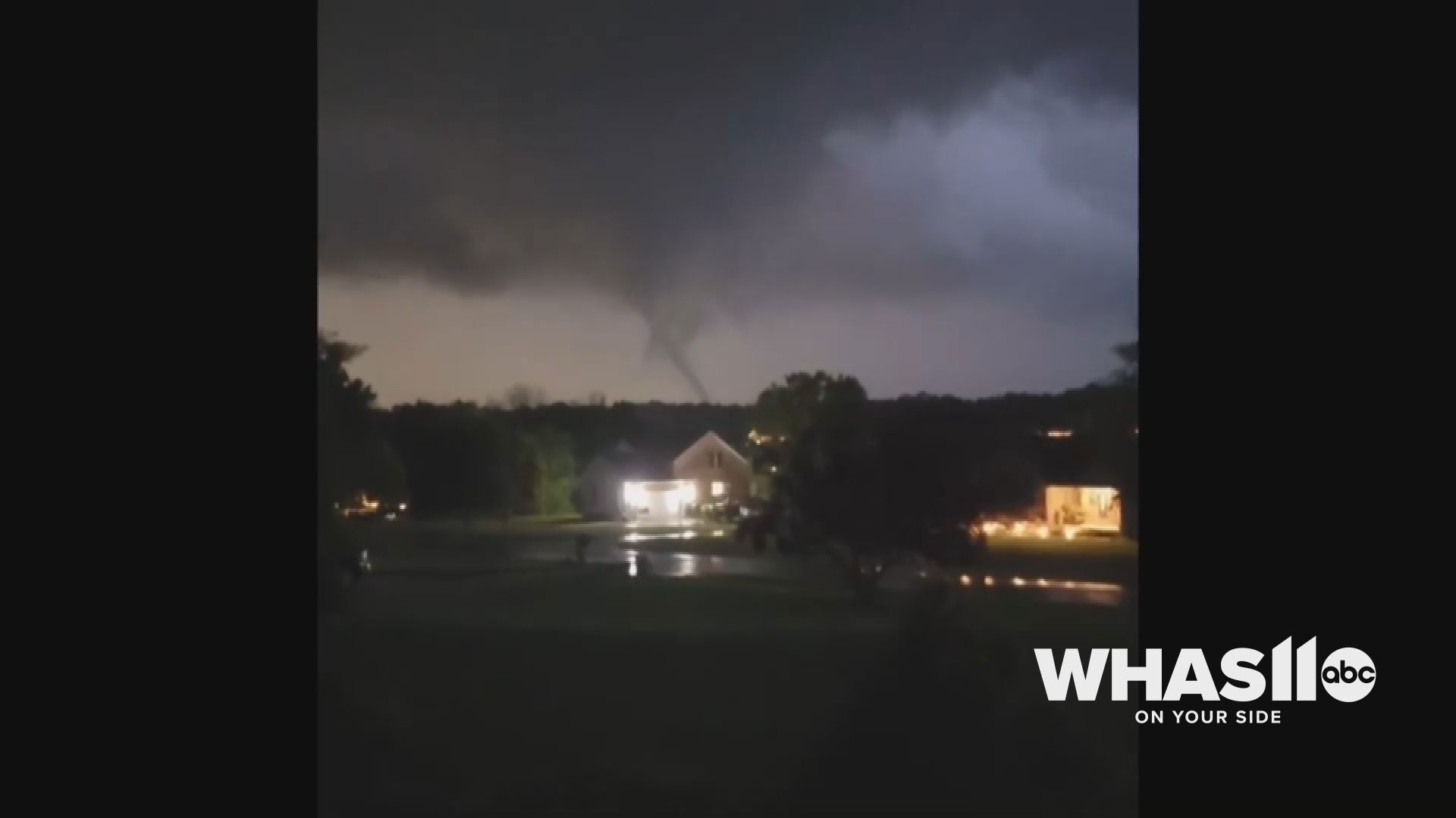
Severe storms produced multiple tornado warnings Tuesday night in southern Indiana, including a confirmed EF-0 tornado near Perry Crossing, Indiana. Video of the tornado showed a rope-like twister move over the area.
Current severe weather alerts in Kentucky, Indiana:
- Flood Watch has been issued for Adair, Bullitt, Breckinridge, Franklin, Grayson, Green, Hardin, Hart, Jefferson, LaRue, Marion, Meade, Nelson, Shelby, Spencer, Taylor and Washington Counties in Kentucky until 8 a.m. Thursday.
- Flood Watch has been issued for Harrison County, Indiana until 8 a.m. Thursday.
This story will be updated frequently as alerts are issued and canceled.
Download the free WHAS11 app to watch live coverage during severe weather and get real-time weather alerts, even if your power goes out. For Apple or Android users.
Have a news tip? Email assign@whas11.com, visit our Facebook page or Twitter feed.