
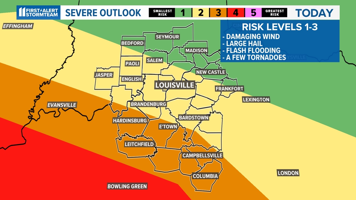
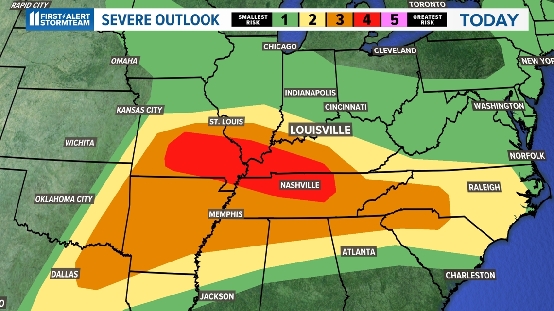
LOUISVILLE, Ky. — The Storm Prediction Center has parts of Kentucky and southern Indiana in either a risk level 2 or a 3 for thunderstorms to become severe Wednesday evening.
This means that tornadoes, wind gusts up to 70 mph, flooding rainfall and ping-pong sized hail are all likely. In fact, the storms will be scattered to numerous in coverage later on this afternoon and evening. Make sure you have a safe and reliable way to receive severe weather alerts.
The farther to the southwest you live in Kentucky, the higher the likelihood of seeing severe storms.


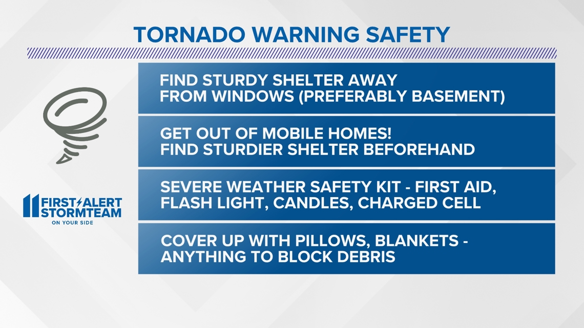
It is a good time to make sure you are prepared at home for storms to quickly turn severe. Please make sure you have a severe weather safety kit, plenty of water and a reliable way to receive severe weather alerts and updates.
Alerts
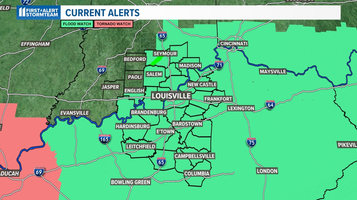
All of the Kentucky counties and the majority of southern Indiana counties in the WHAS11 viewing area are under a flood watch until 8 am Thursday morning.
Most areas will pick up 1-3 inches of rain with locally higher amounts possible, especially in southern and western Kentucky. The ground is already quite saturated due to heavy rain Monday and Tuesday, so it won't take much to experience flooding.

Please make sure you never drive through a flooded roadway. It is hard to tell how deep the water may be in a flooded road. Keep in mind, it only takes a few inches of moving water to move someone off of their feet or take control of a vehicle. Turn around, don't drown.


Areas shaded in pink are under a tornado watch until 10 PM Wednesday night. This is where the highest threat of a tornado will remain through this event.
Timing
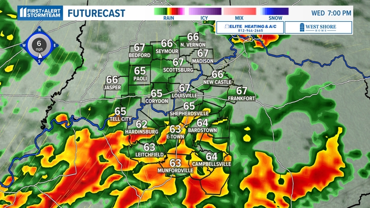
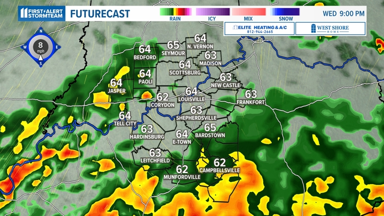
The timing of the the next batch of strong to severe storms is on tap for about 3 p.m. to 10 p.m. Wednesday. This will likely impact the rush hour commute and make for delays and issues with travel.
Strong to severe storms today

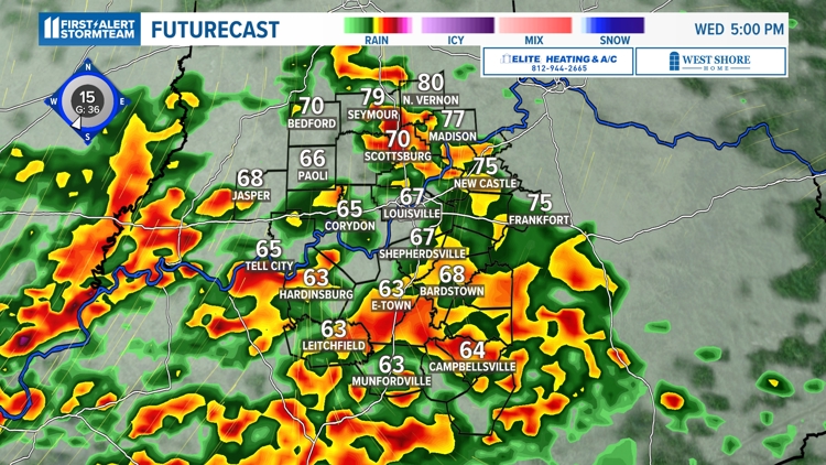


The risk for tornadoes is highest as the storm cells become a little more individual as opposed to clustered together in a line. But any storms that form may easily produce a tornado.
These storms will have an incredible amount of "fuel", meaning if they do pop-up, they could become very strong, very quickly. That's what we call an "explosive" atmosphere.

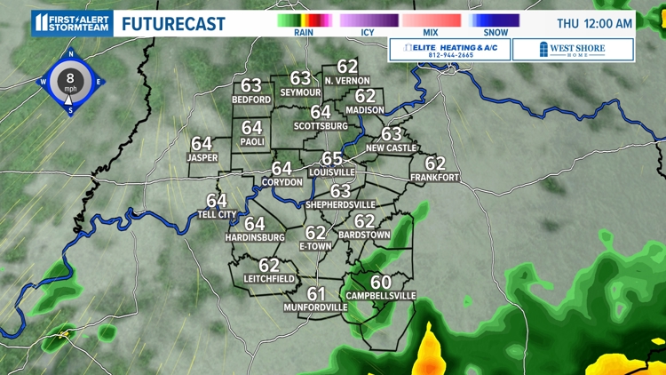
In summary, the main concern at this time is for the timing and intensity of the storms this afternoon and evening. The storms will look to form into a line from states to our west and will drift in bringing a straight line wind, tornado and very heavy rain threat. Conditions will quiet down overnight and into early morning hours Thursday.
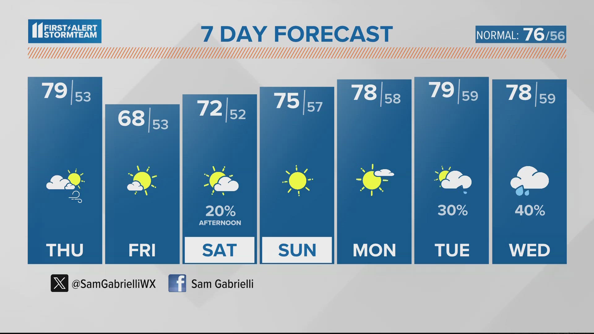
Cooler and drier air will replace this week's storm system as we near the end of the week and the weekend. Temperatures will fall back to the upper 60s and 70s with sunshine and a few clouds.
For now, it's most important to be prepared if any warnings are issued.
Make it easy to keep up-to-date with more stories like this. Download the WHAS11 News app now. For Apple or Android users.
Have a news tip? Email assign@whas11.com, visit our Facebook page or Twitter feed.