
FRANKFORT, Ky. — Severe weather is expected to impact Kentucky, and portions of southern Indiana, over the next 48 hours.
Tuesday morning, Kentucky Gov. Andy Beshear urged residents across the commonwealth to stay weather aware ahead of the severe weather.
"This early forecast is worse than the forecast we received before [the April 2 storms]," the governor said. "Remember that, while we saw a lot of damage, we didn't have a lot of injuries during that because people were weather aware."
Early last month, powerful storms produced dozens of tornadoes across Kentucky, including an EF-2 tornado that hit Jeffersonville, Indiana and crossed the river into Prospect, Kentucky.
State offices will be closed on Tuesday and Wednesday at 2 p.m. to ensure more than 20,000 state employees' safety.
"The state government provides a lot of important services and we don't take this lightly," Beshear said. "I've governed through tornadoes, and floods, and polar plunges, and ice storms -- and just about anything else we've seen, and I care about every single one of our employees. I care about every single Kentuckian out there and I would rather be safe and careful than to lose even one life."
Kentucky Emergency Management Director Eric Gibson said the department has been activated and emergency crews are on "heightened" alert and prepared to act in the event of an emergency.
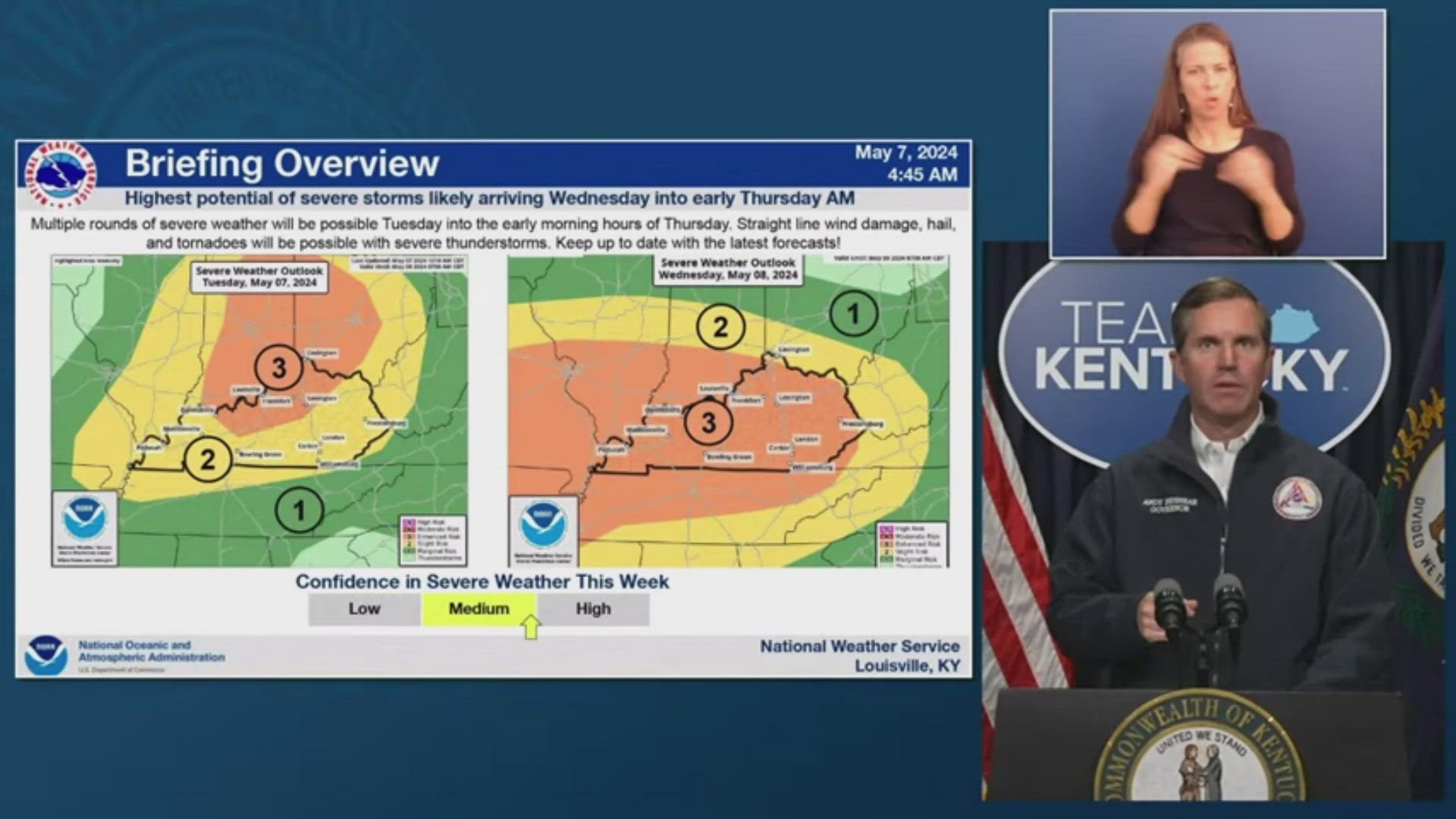
What to Expect
The Storm Prediction Center (SPC) has increased the risk for severe weather in Kentuckiana on Tuesday to a Level two and three out five. More severe weather is expected Wednesday afternoon, going into the evening hours, with much of Kentuckiana again under an enhanced (level three) severe weather risk.
Beshear said officials are "very concerned" about Wednesday's forecast since storms will be more scattered. He added that Wednesday's severe weather threat could be increased yet again to a moderate risk.
Tornadoes, strong winds up to 70 mph, heavy rainfall, flooding and ping pong-sized hail are all likely on both days.
The risk for tornadoes is highest as the storm cells become a little more individual as opposed to clustered together in a line. But any storms that form may easily produce a tornado.
The storms impacting our region on Tuesday and Wednesday will have an incredible amount of "fuel," meaning if they do pop-up, they could become very strong, very quickly. What we call an "explosive" atmosphere.
Please make sure you have a severe weather safety kit, plenty of water and a reliable way to receive severe weather alerts and updates. For additional storm preparedness tips, click here.
Download the free WHAS11 app to watch live coverage during severe weather and get real-time weather alerts, even if your power goes out. For Apple or Android users.
Have a news tip? Email assign@whas11.com, visit our Facebook page or Twitter feed.