LOUISVILLE, Ky. — Spring-like weather has returned and it's coming with a risk for severe weather through this afternoon.
Forecast at-a-glance
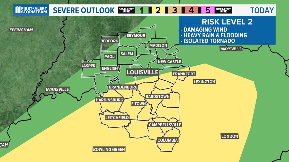
- Severe weather threat potential has decreased to levels 1 and 2 of 5
- Heavy rain and flooding have become main threats
- Damaging wind gusts will remain a possibility

Weather setup
Very heavy rain early this morning produced rain totals of over 3" in a few areas in Kentucky resulting in flash flooding. There will be a break in rain for the early afternoon which will help flooded areas "process" the water and see levels recede.
At the same time, we'll have to watch cloud cover. Any breaks in cloud coverage may allow sunshine to recharge the atmosphere and create more fuel for any later thunderstorms.
Download the free WHAS11 app (for Apple or Android) to stay tuned to the latest weather alerts from the First Alert StormTeam.
Rain and severe weather chances
Here's what to expect and when:
Rain early this afternoon is not as widespread as this morning, but downpours with very heavy rain will still be periodic. That said, a drier period should arrive for the mid afternoon around 2-4 p.m.

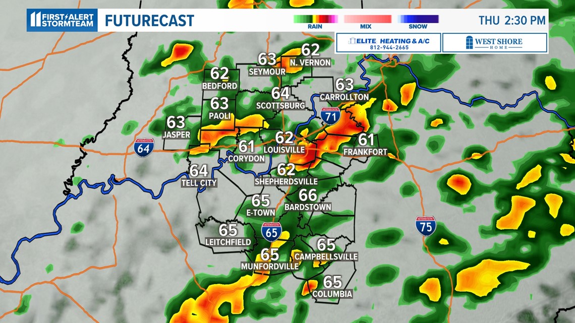
The heavy rain this morning was ambitious and resulted in many areas of flooding in central Kentucky. It's also zapped a lot of the energy away that afternoon thunderstorms would have had for their strength. As mentioned, the drier period in the mid-afternoon will need to be watched for any sky clearing as that may allow for more fuel for later afternoon thunderstorms.

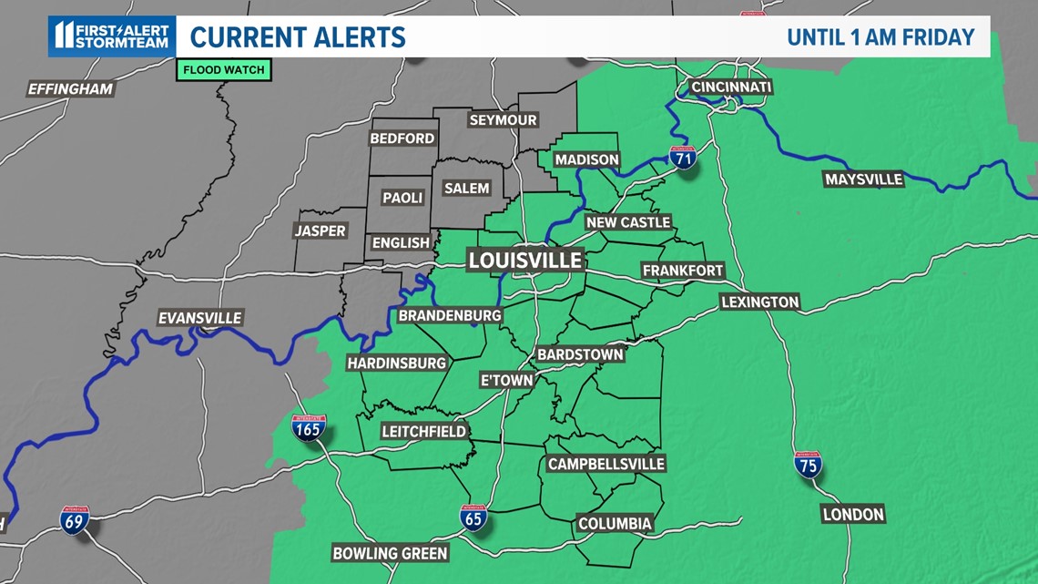
Flooding is now the biggest severe weather threat for the remainder of the afternoon. As of 12:30, over 3 inches of rain has fallen in a few locations with several other locations officially reporting over 2 inches since midnight. That's why a flood watch has been issued for much of the WHAS11 viewing area until 1 a.m. Friday.

Brief, but strong, cool-down
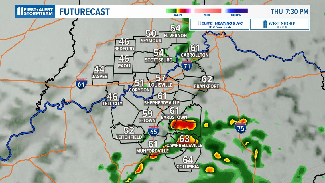
Rain will end Thursday evening after the cold front exits the area.
Temperatures will then fall rapidly. Highs Thursday afternoon should be in the 60s, but lows Friday morning dip below freezing.
Highs Friday likely only make it into the 30s. It won’t last long as another ridge makes an entrance this weekend and will once again push temperatures above normal into the middle and upper 50s by next Monday.
Latest forecast:
Meteorologist Alden German
Facebook: Facebook.com/AldenGermanWX | Twitter: @WXAlden
Make it easy to keep up-to-date with more stories like this. Download the WHAS11 News app now. For Apple or Android users.
Have a news tip? Email assign@whas11.com, visit our Facebook page or Twitter feed.