
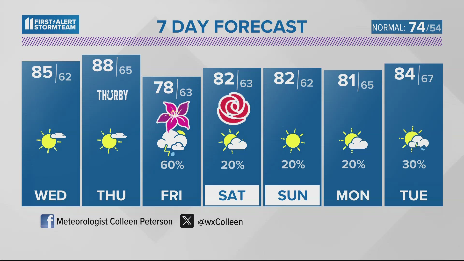
LOUISVILLE, Ky. — Tonight will remain dry and quiet. Low temperatures will fall just shy of 60 degrees.
Tomorrow and Thursday's high temperatures will march well into the upper 80s, if not looking to near 90° at times! Therefore one of the warmest days of the year so far may hit just in time for Thurby races at Churchill. Pack plenty of water! Daytime temperatures will consistently stay in the low 80s for Oaks and the Kentucky Derby but unfortunately we are tracking showers and storms any time between Thursday night and during Oaks races itself.

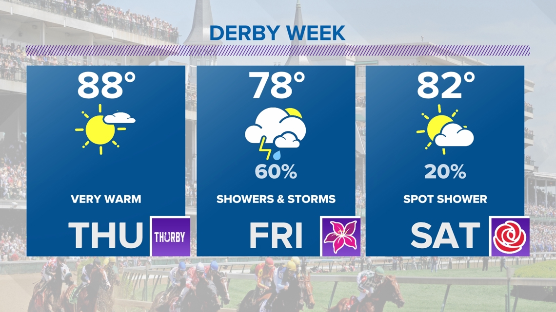
Details on the timing of the end of week storm system remain uncertain at this time. One thing we do know for certain is severe weather risk remains very low. This will likely be a wet race track for the fillies as they hit the track. As of now, rain chances will hold off for the 150th Kenucky Derby on Saturday! Plan on a mix of sun and clouds and high temperatures well into the lower to middle 80s all weekend long.
Download the free WHAS11 app for the latest weather alerts from the First Alert StormTeam. For Apple or Android users.
TONIGHT: Clear. Low: 59°. Wind: NW/S light.
TOMORROW: More sun! Warmer. High: 85°. Wind: SW 5-10 mph.
THURSDAY: Feeling like summer. High: 89°.
LIVE RADAR
Related video
More from the First Alert StormTeam

Follow the First Alert StormTeam on social media.
DOWNLOAD THE WHAS11 APP:
Download the free WHAS11 app for the latest weather alerts from the First Alert StormTeam. For Apple or Android users.
JOIN THE CLOUD WATCHERS FACEBOOK GROUP:
Interested in photography? Join nearly 8,000 residents from Kentucky and southern Indiana and share your weather photos. Click here to join the group!