
LOUISVILLE, Ky. — We are tracking light to moderate snow showers blossoming across Kentuckiana. Try to stay off the roads if possible! We are already getting reports of slick roads, mainly south on I-65 near Bardstown and E'Town.
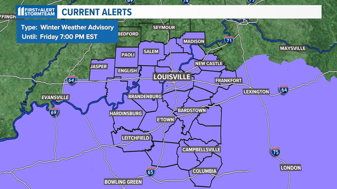
We are under a Winter Weather Advisory until tomorrow at 7 p.m. EST.
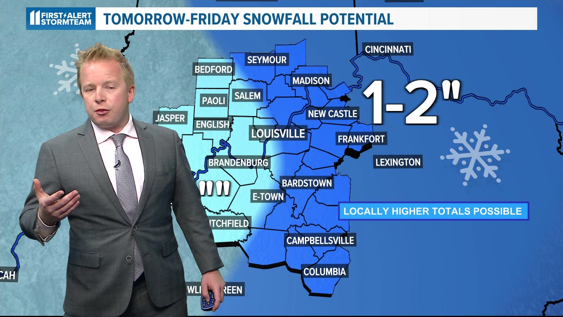
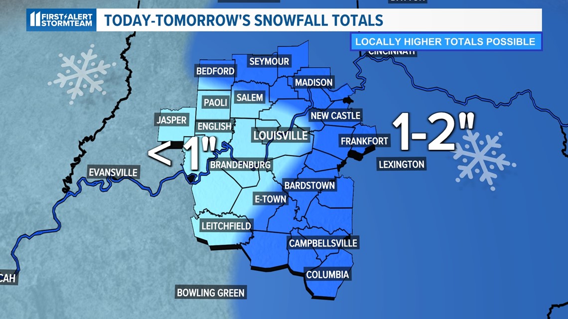
- 1-2 inches of snow accumulation with isolated 3-4 inch tallies along the Bluegrass Region.
- Areas of blowing snow and icy spots making for difficult travel with wind gusts up to 25-30 mph.
- Frigid cold temperatures and wind chills return Friday evening through the day Saturday. The feels like temperature will range from -5 to -15 degrees Saturday morning.
- A winter weather advisory has been issued for the viewing area until Friday at 7 p.m.

Timing out the snow
The snow is mainly going to target areas south and east of Louisville. We are expecting off and on snow showers through the morning tomorrow. We aren't anticipating white out conditions, but we could see a few pockets of moderate snowfall. For the most part, light snow showers.

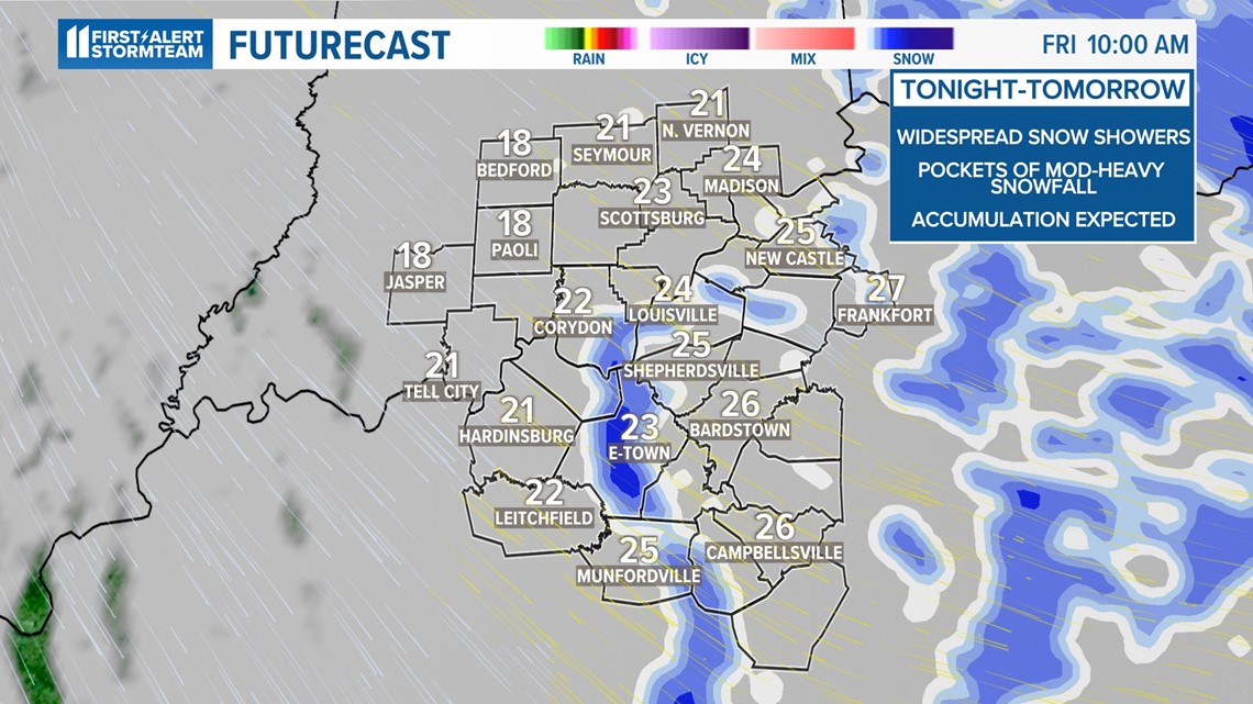

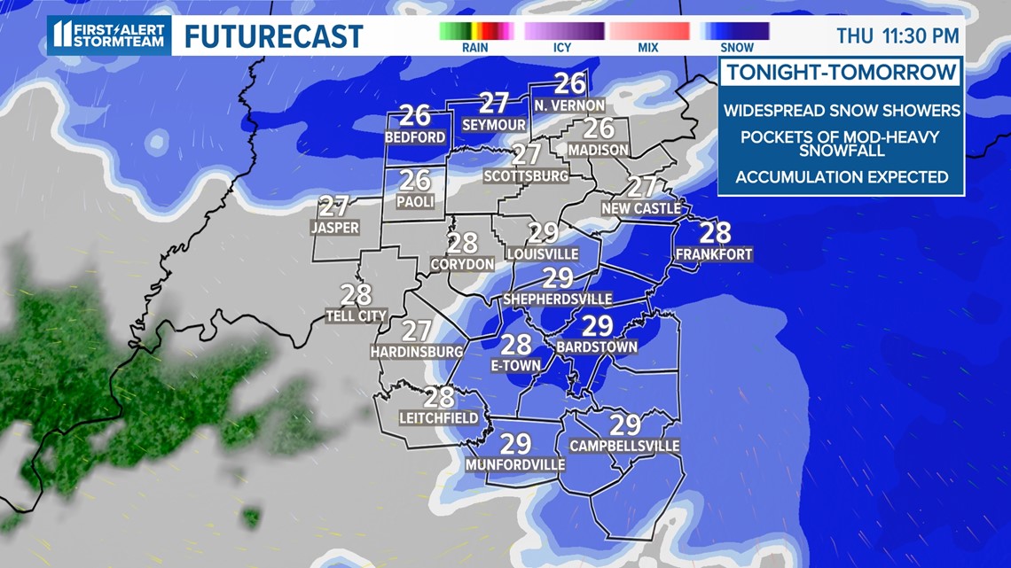
As our overnight temperatures hold steady in the lower 30s and upper 20s and a northwest breeze takes shape, blowing snow will become the main hazard into the morning commute on Friday. It is very important you dress in layers and pack plenty of blankets, non-perishable food and water in your vehicle in the event you are stuck or you drift off of the road.
Roadways and sidewalks will be slick/icy. The snow will come to a halt by noon Friday, but the next big thing we will be tracking is the cold.

More extreme cold
Wind chills will drift below 0 once again. Expect the worst wind chill to occur from Friday evening through midday Saturday.
As our sky clears and we see fresh snow cover, this will give way to plummeting temperatures. Low temperatures in Kentuckiana Friday into Saturday morning will dip into the single digits, but a northwest breeze will bring our feels like temperatures into the -5 to -15 range.
You can never wear too many layers. Make sure you never leave your pets outdoors without shelter, especially for a prolonged amount of time.
In these conditions, frostbite can happen in 15-30 minutes on exposed skin. Make sure you are wearing enough layers to keep warm in the incoming cold blast.
Temperatures will finally begin to rise back to normal next week, but both Saturday and Sunday will keep wind chill temperatures locked well into the subzero range at times, if not the single digits above 0 during the day.
RELATED VIDEO