LOUISVILLE, Ky. — One out of the two tropical storms moving through the Gulf of Mexico could impact our weather here in Kentuckiana later this week.
Let's take a look at where the storms are at now, and where they're heading.
Starting with Marco, it was a hurricane on Sunday, but has been weakening as it's been approaching the Louisiana coastline today. It is expected to bring heavy rain from the Florida Panhandle to Southeastern Texas over the next couple of days.
Here's the latest track from the National Hurricane Center. Marco is barely still a tropical storm with maximum sustained winds at 40 mph. Further weakening is expected. Marco is not expected to impact our local weather


Now, Tropical Storm Laura could bring heavy rain our way by Friday. The storm is not just south of Cuba, but currently forecast to make landfall near the Louisiana/Texas state line late Wednesday. Laura is expected to strengthen and become a Category 1 or 2 hurricane.


The remnants of Laura are then expected to move northeast, possibly over the Ohio and Tennessee Valleys.


Take a look at the path of potential heavy rain.

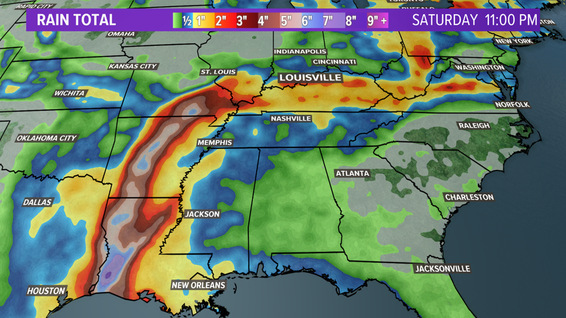
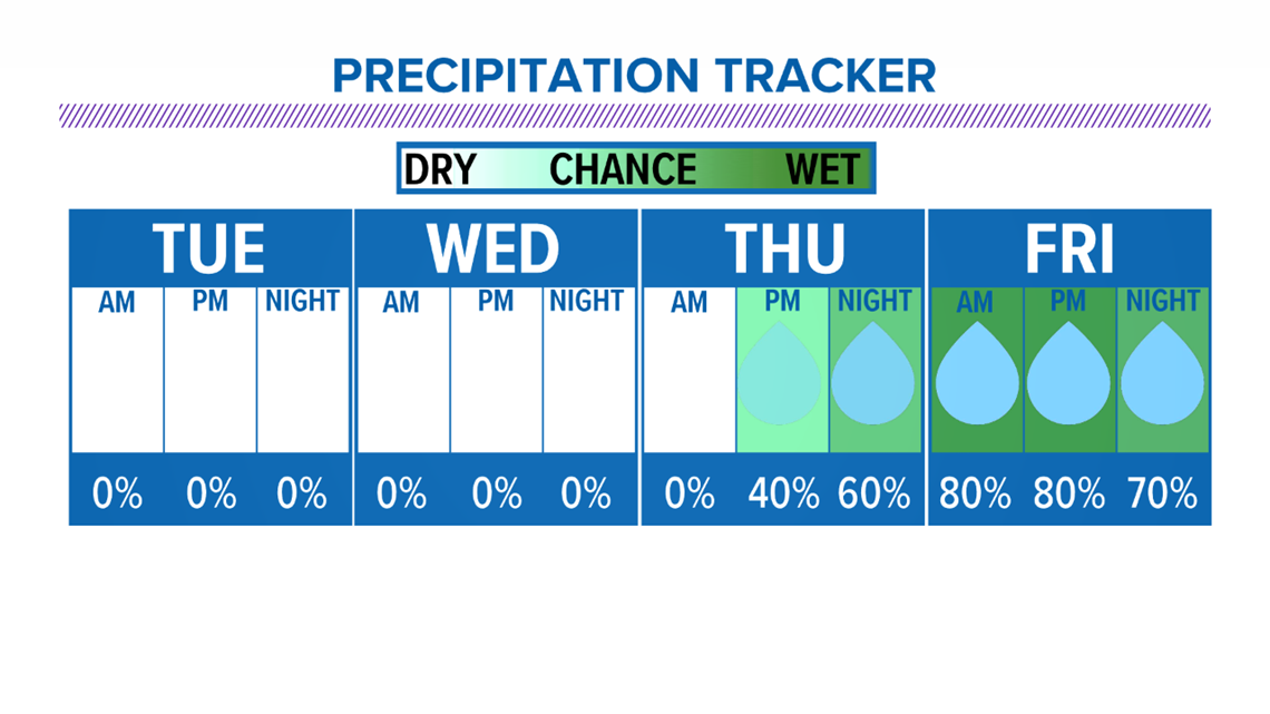
So, while our air is high in humidity now, the tropical moisture will likely be on the rise Thursday into Friday as the leftovers of Laura approach Kentuckiana. We may have some brief relief from the muggy weather Sunday.


Again, heavier rain is at this time expected on Friday, with localized flooding possible.


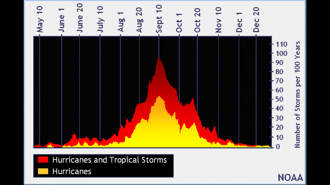
While the tropics are getting very busy, the peak of hurricane season isn't until mid-September. So far we have had fourteen named storms, setting a record named storm pace so far. Marco is the third hurricane.