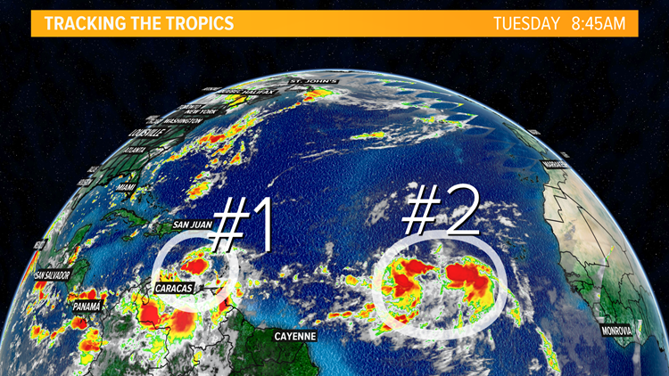
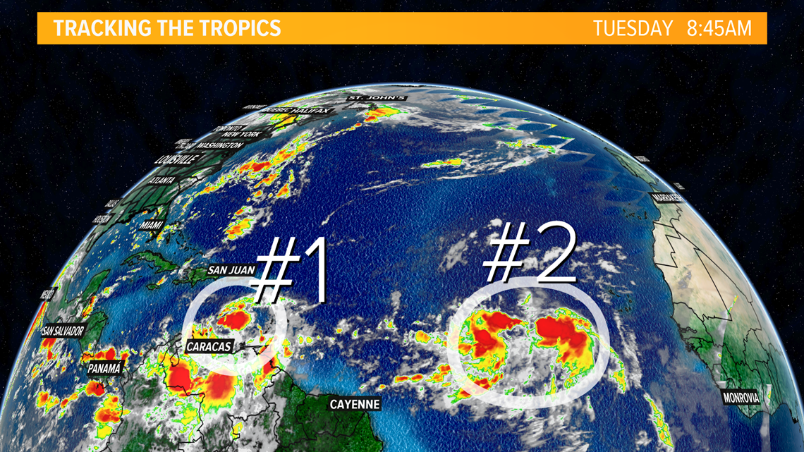
LOUISVILLE, Ky. — As we enter the busiest part of hurricane season, we are currently keeping an eye on a pair of tropical waves making their way across the Atlantic. Each of these clusters of storms has the potential to turn into a tropical system over the next few days and weeks. If these storms do strengthen to tropical storm status, they would be given the names Laura and Marco.

Tropical wave #1, also known as Invest 97L is just north of the South American continent and is currently a fairly unorganized system. Even though it isn't overly impressive, it still has about a 20% chance to gain strength over the next 48 hours according to the National Hurricane Center. Over the next 5 days, the wave has about a 60% chance for development. This system does lack rotation, but as it enters the warm waters of the Caribbean later this week, it could gain strength and organization. Invest 97L is moving westward towards Central America around 20 mph.


The second tropical wave we're watching is located just to the east of Invest 97L. This cluster of storms is larger than Invest 97L and does show a greater potential for organization and strengthening over the next 48 hours. The National Hurricane Center gives it a 70% chance for development in the next two days and a 90% chance for development over the next 5 days. The wave is moving WNW between 15-20 miles per hour. These higher chances for development mean the storm has favorable conditions to gain strength and possibly enter the Gulf of Mexico by next week.

This second wave is set to move into more favorable conditions for development over the next few days. Lower wind shear and less of an impact from drier air off the coast of Africa are helping it to gain strength. As of Tuesday morning it is difficult to determine where this system will exactly go, but because we're in historically active time frame for hurricane development it is worth keeping an eye on. Hurricane season tends to be most active in the months of August and September and these two systems are proving this year to be no different.

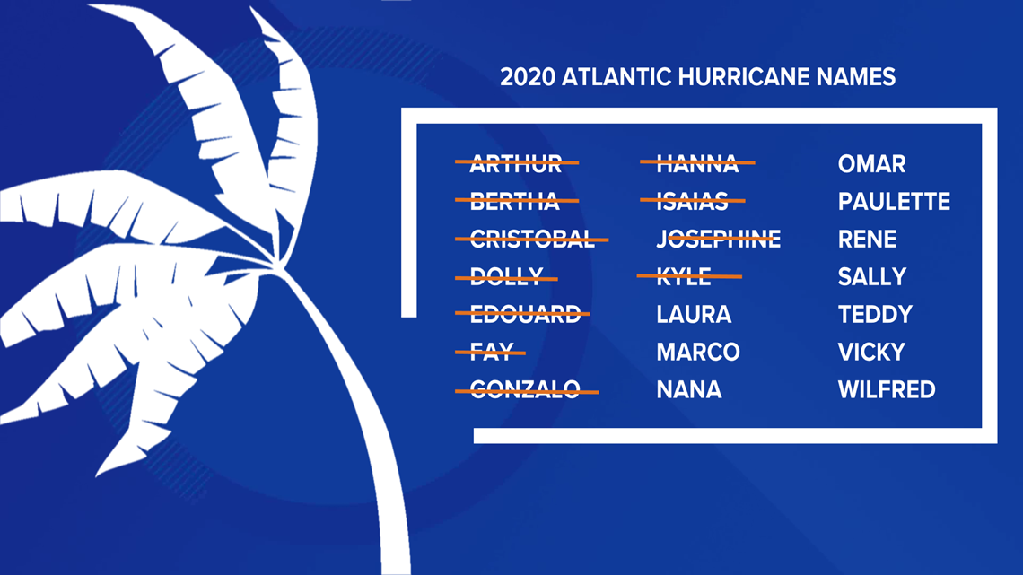
While the storms we've had this year have not reached major hurricane status (category 3 or higher), they have been historically early. If you look back to the graphic with the list of names, you'll see we've crossed plenty off already! This year we have seen the earliest named C, E, F, G, H, I, J and K storms of any year prior.

Make it easy to keep up-to-date with more stories like this. Download the WHAS11 News app now. For Apple or Android users.
Or, if you love weather photography, join our Kentucky/Indiana Cloud Watchers Facebook group.
--
Follow the WHAS11 First Alert Storm Team on Social Media:
Chief Meteorologist Ben Pine:
Facebook: Facebook.com/MeteorologistBenPine | Twitter: @WHAS11Ben | Instagram: @whas11pine
Meteorologist T.G. Shuck
Facebook: Facebook.com/tgshuck | Twitter: @TGweather
Meteorologist Kaitlynn Fish
Facebook: Facebook.com/WXkaitlynnfish | Twitter: @kaitlynnfish | Instagram: @kaitlynnfishwx
Meteorologist Reed Yadon
Facebook: Facebook.com/reedyadon | Twitter: @whas11reed
Meteorologist Alden German
Facebook: Facebook.com/AldenGermanWX | Twitter: @WXAlden