
LOUISVILLE, Ky. — A winter weather advisory for Metro Louisville and surrounding areas is in effect starting Friday afternoon until 1 a.m. Saturday.
Though this week started off warm and sunny, our attention shifts to light snow that may make a headache for this afternoon and evening commute.
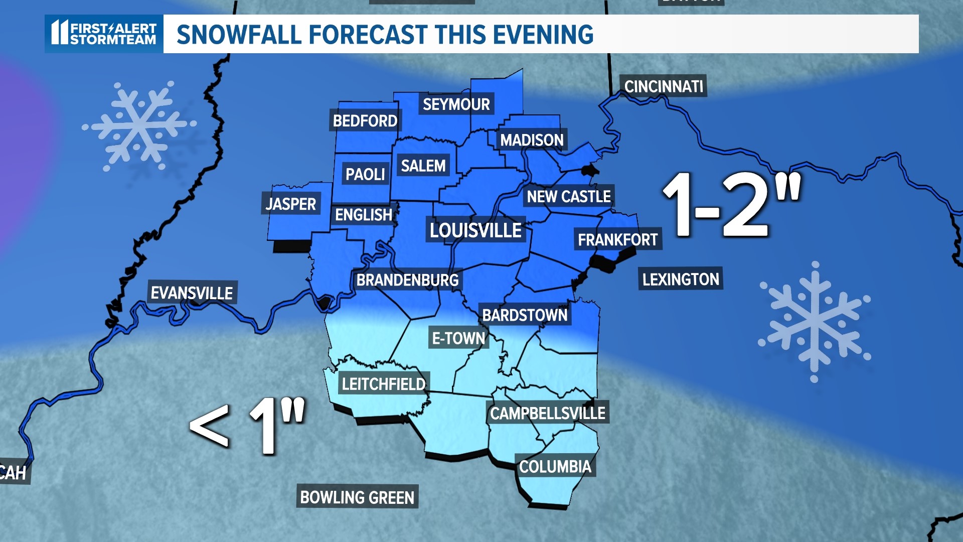
A dusting of two inches of snow is expected to impact much of southern Indiana and central Kentucky, including Louisville. Those of you south of the Parkways will likely only experience a dusting or at most an inch of snow. Southern Indiana, especially north of Highway 56, has the best potential of two inches or isolated areas of three.
Areas further south, such as, Leitchfield, Campbellsville and Columbia, will primarily see a chilly rain with a brief period of snow.


Timing
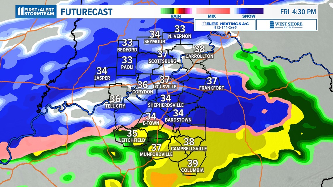
Starting this afternoon, the snow system and a brief period of rain will drift in from our northwest and move through from west to east.
Temperatures will rise into the middle 40s for afternoon highs. Any snow that falls during this transition time would be wet and heavy in nature and melting soon after contact with the ground.


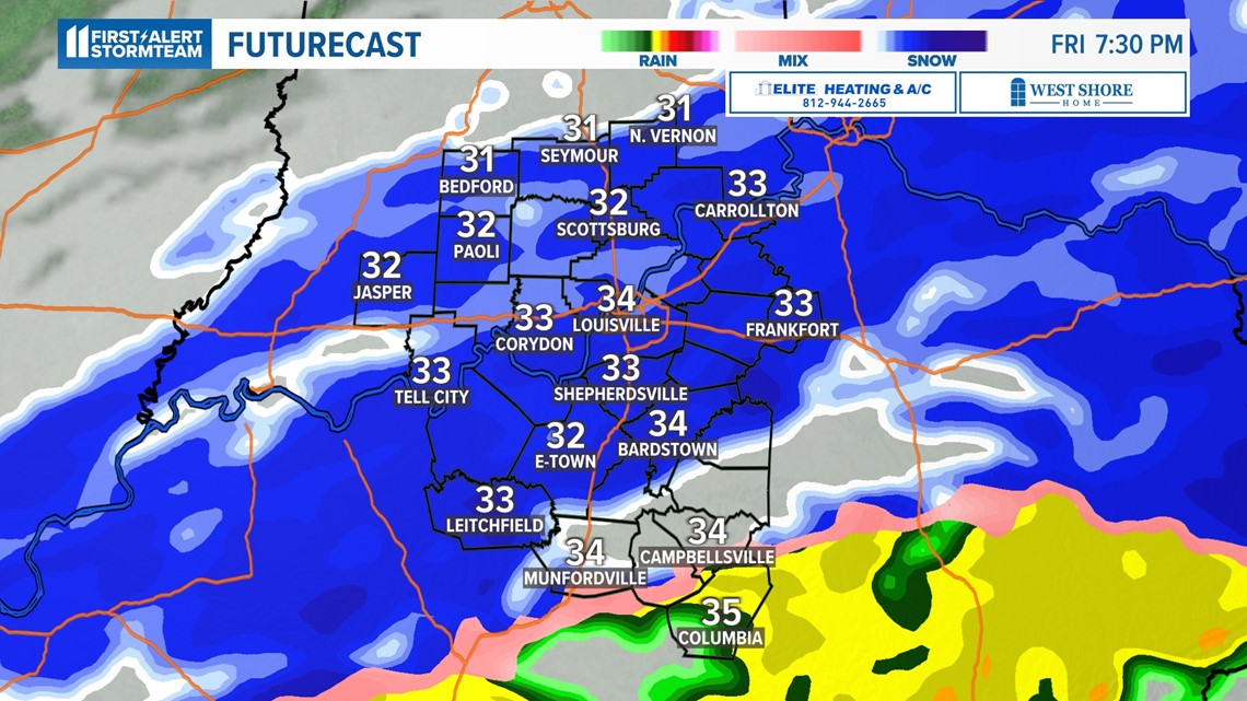
The snow is expected to come to an end by 10 p.m. and only a few light flurries are expected overnight.
Temperatures are going to be very important with this event. Since we'll start seeing the snow transition with numbers above freezing, roadways would likely just be wet. As the transition to all snow continues and temperatures drop to near freezing, then some slushy accumulation on roads will be possible. Given the early period of rain, it's unlikely roads would be treated with brine.
Much colder air to follow
Don't forget to bundle up, especially tonight and Saturday morning. Low temperatures on Saturday morning will dip into the 20s with wind chill into the teens. Any snowfall on the ground may result in temperatures cooling off a bit more than that.
Daytime temperatures on Saturday will only rise to the mid- to upper 30s, but the angle of the sun will encourage snow melt throughout the day.
Wind chill temperatures are expected to rebound to the 20s as we roll into Saturday afternoon. Temperatures will steadily return back to the 40s on Sunday, putting the bitter cold to an end by Sunday morning.
Make it easy to keep up-to-date with more stories like this. Download the WHAS11 News app now. For Apple or Android users.
Have a news tip? Email assign@whas11.com, visit our Facebook page or Twitter feed.