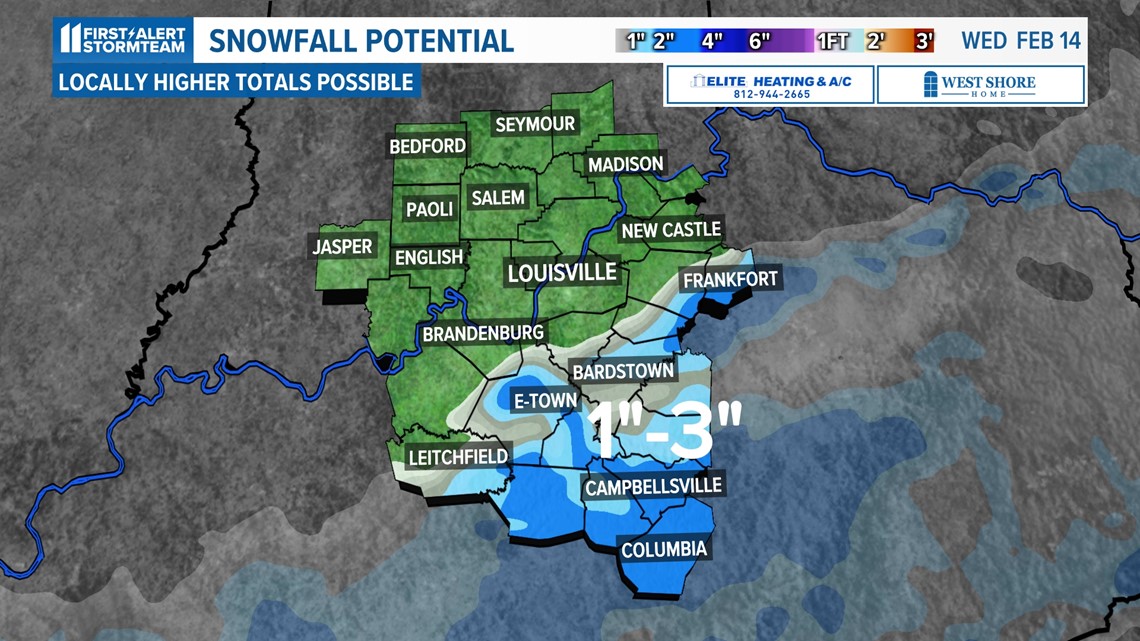
LOUISVILLE, Ky. — Some Kentucky counties may see 1-2" inches of snow as a quick-moving storm system moves through our area.
While Louisville and southern Indiana are barely expected to even see rain, counties south of the Metro will receive a light dusting of snow.

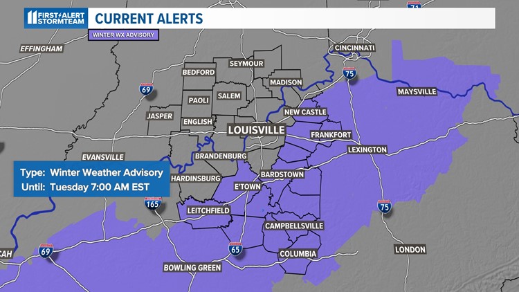
A Winter Weather Advisory is in place south and east of Louisville through 7 a.m. tomorrow.

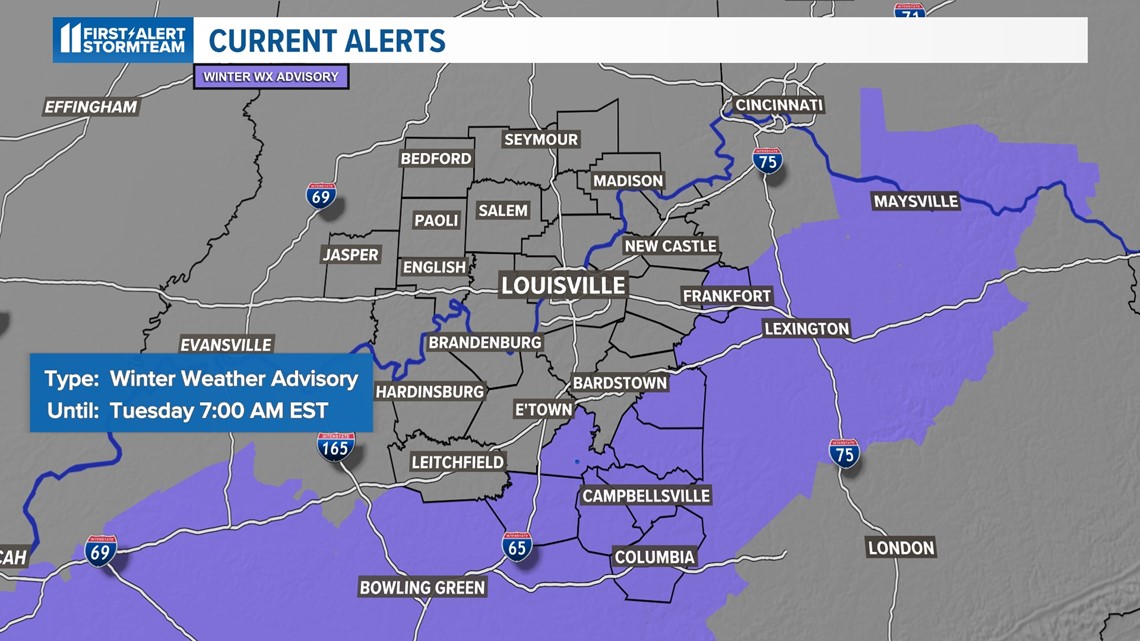
The majority of the rain will be missing Louisville to the south. It is possible to see a transition to snow in the counties highlighted above. As our temperatures cool down into the night, some light snow will develop across the central and southern portions of Kentuckiana (mainly south of I-64).
When the snow begins, it will come down heavy in isolated spots because it will be wet and heavy. The areas with the highest likelihood of accumulating snow will be anywhere along and southeast of the line from Frankfort, to Springfield, to Munfordville.
We also expect the snow to only stick to grassy surfaces because roads and sidewalks will be fairly warm and it will be likely that snow will melt on impact. Regardless, please make sure you slow down as you drive and watch for any slick spots during Tuesday morning's commute.
In conclusion, most measurable snowfall will accumulate south of I-64 and mainly south of the Parkways.
Make it easy to keep up-to-date with more stories like this. Download the WHAS11 News app now. For Apple or Android users.
Have a news tip? Email assign@whas11.com, visit our Facebook page or Twitter feed.