
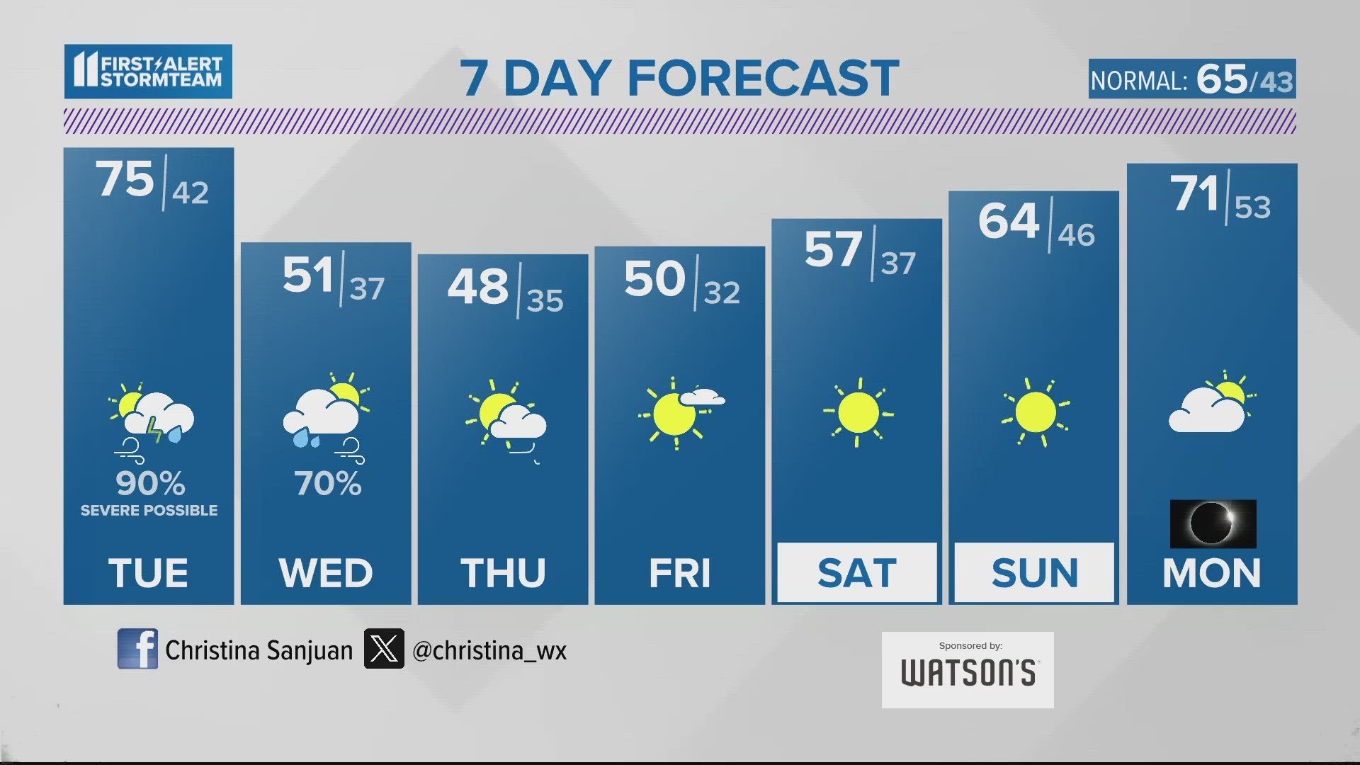
LOUISVILLE, Ky. — The month of April will likely be starting with active weather across the Ohio Valley, particularly in southern Indiana and central Kentucky on Monday and Tuesday. Below is the latest forecast from the First Alert StormTeam.
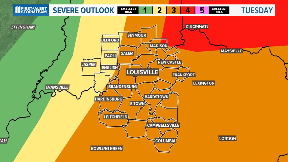
Severe weather possible the next few days
As low pressure centers and a strong cold front move into the Ohio Valley, showers and storms will develop both Monday and Tuesday bringing a risk of strong thunderstorms with them. Scattered strong to severe storms are anticipated starting late Monday into Tuesday morning, then again Tuesday afternoon into the early evening.
TIMING
MONDAY EVENING
The risk of seeing an isolated strong storm is low. This could be in southern Indiana with the main threat hail and damaging winds. These storms will likely trek into far western Kentucky and extreme western Indiana. The storms will form into a cluster and will affect southern Indiana and central Kentucky from west to east Monday evening and possibly overnight Monday.
ROUND 1 - MONDAY NIGHT TRHOUGH TUESDAY MORNING
A line of heavy rain will approach around 1 AM Tuesday morning. A Flood watch is in place for southern Indiana. All modes of severe weather are likely with this band of storms. Isolated tornadoes, locally heavy rain, strong damaging wind gusts (up to 65 mph) and hail up to quarter to half dollar and ping pong size are all possible with the severe storms on Monday and Tuesday. The biggest threat will be flash flooding, damaging winds and hail. There is a low/medium threat for seeing a spin-up tornado.


Rounds 2 - TUESDAY NOON UNTIL 7 PM
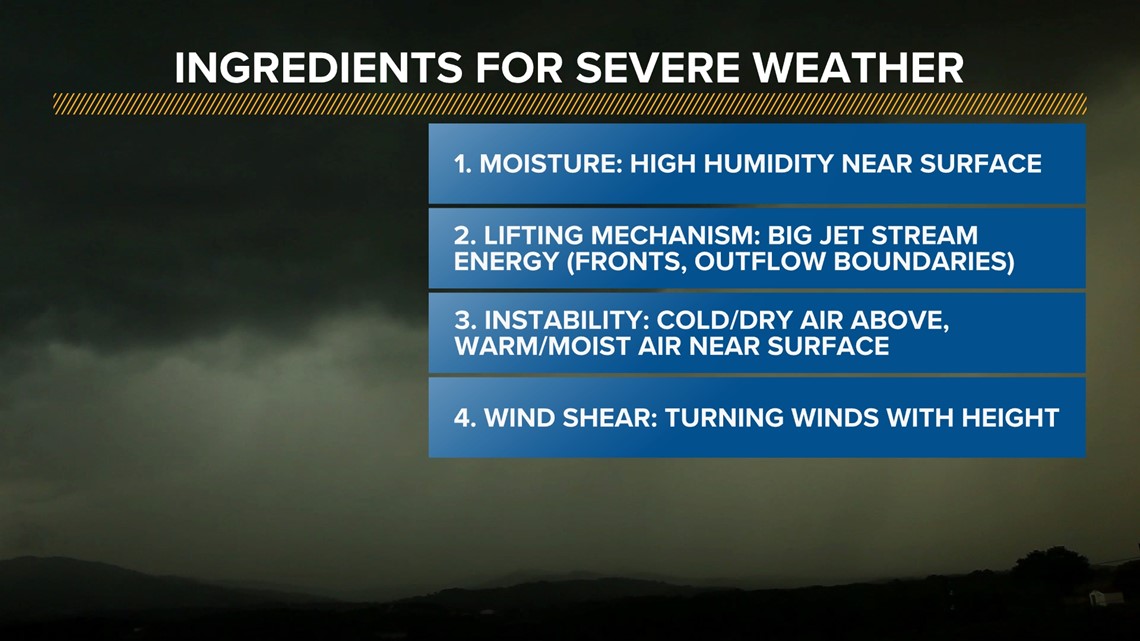
If we get sunshine around 10 am, that will provide the last ingredient to see supercells form in the afternoon. If we begin to notice that storms form into individual cells as opposed to a line, this is what we call a supercell. Supercells are known for producing the most intense severe weather, likely producing tornadoes so please be cautious and stick with us for updates.
The greatest threat of seeing a violent, long-lived tornado will be Tuesday midday into the afternoon. The threat will diminish by dinner time.

Calm after the storm
Model forecasts are also hinting at a cooler than normal pattern throughout the late stages of the week. Temperatures Wednesday through Friday will likely be in the lower to middle 50s. Overnight temperatures will come close to freezing, if not dipping slightly below freezing, in several locations. This may cause some harm to blooming plants.


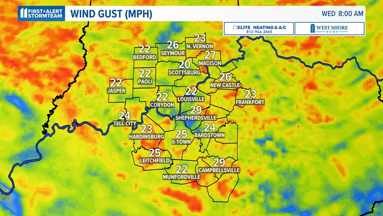
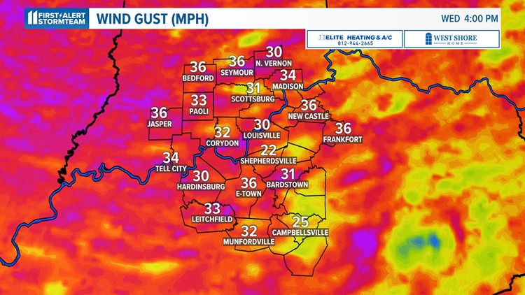
We are also tracking strong wind for a few days after the storm marches east of us. The strong cold front will bring in wind gusts out of the west to northwest howling around 25-35 mph, if not greater in some rural spots.
Please take note of this if you drive a high-profile vehicle or have some outdoor furniture that may easily blow around in the wind. The wind will finally begin to taper off during the nighttime hours Thursday.
Wind gusts midweek


Make it easy to keep up-to-date with more stories like this. Download the WHAS11 News app now. For Apple or Android users.
Have a news tip? Email assign@whas11.com, visit our Facebook page or Twitter feed.