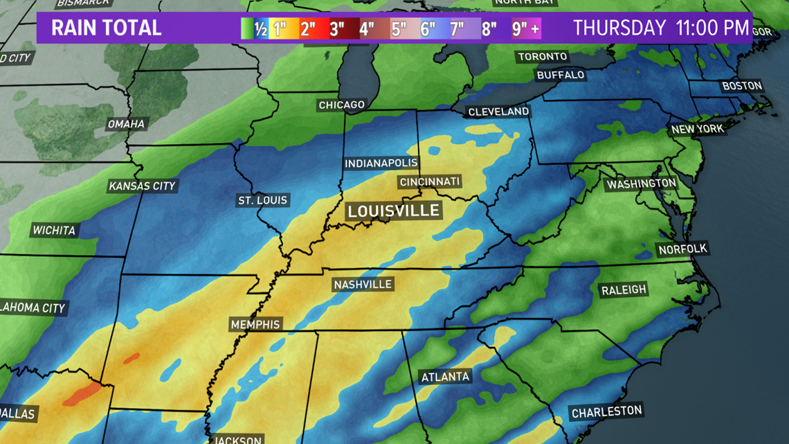
We're going to need to keep an eye on the mighty Ohio River this week, as more heavy rain is on the way. The latest river level forecast for the downtown McAlpine upper gauge heads to near flood stage by Friday. It is a similar forecast for the lower gauge as well.

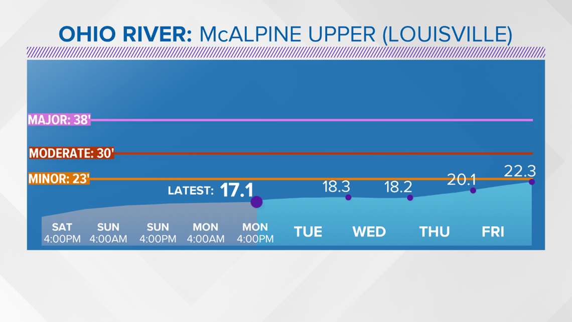

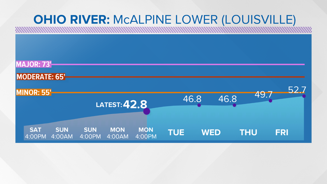
We've been stuck in a busy, unsettled weather pattern, and we don't see any changes. Storm systems will be moving through the Ohio Valley every two or three days. The ground will stay saturated, and river levels will continue to rise.
The Ohio River will not be the only spot to watch for flooding, other local rivers, creeks and streams will be on the rise Wednesday into Thursday. Areas around southeastern Kentucky into eastern Tennessee have already seen significant flooding, and again, more is likely. You can see the recent flooding below.
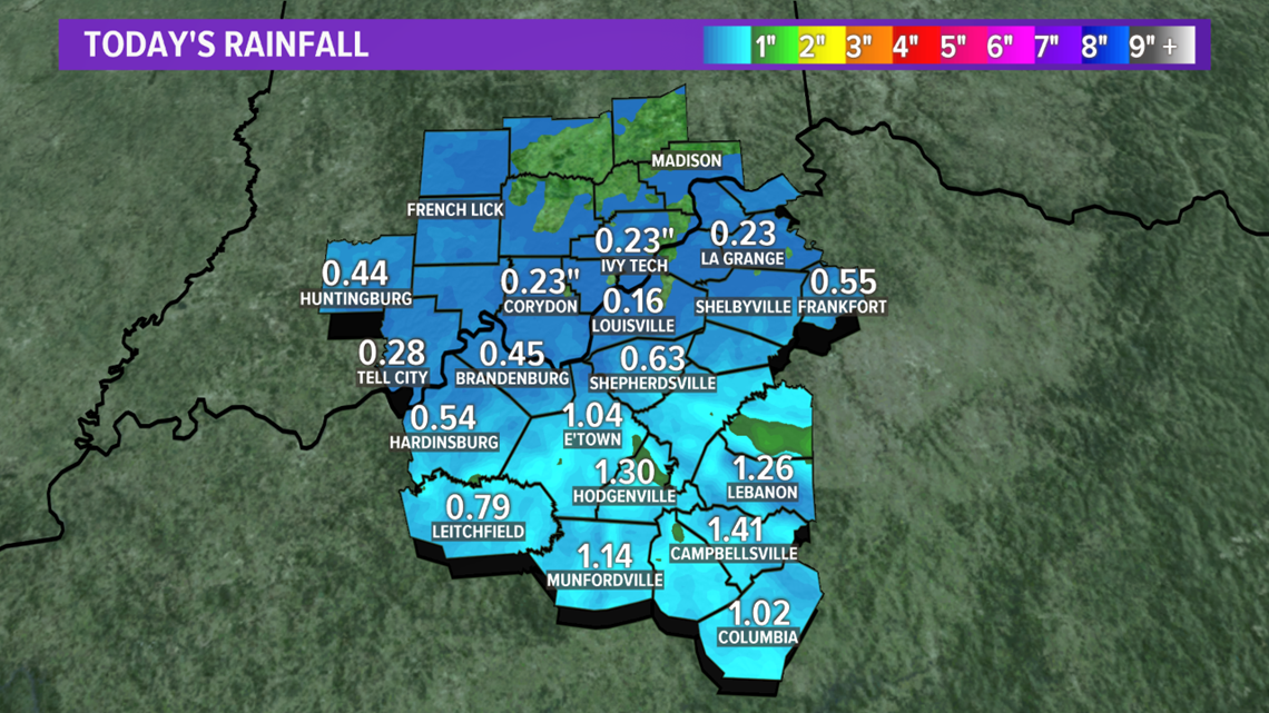
Here is a look at Monday's rainfall totals, with the heaviest amounts again south of Louisville.

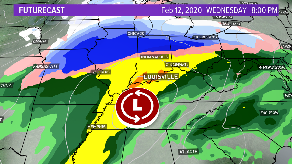
The next big rainmaker will arrive Wednesday. Another 1-2" rainfall total is expected by late Wednesday night. Colder air returns Thursday, with perhaps a few flurries.


This has been a familiar trend, with February flooding the last couple of years.