
LOUISVILLE, Ky. — Rain will impact your New Year's celebration plans, and snow could impact travel for some on Sunday.


A storm system will lift a warm front and bring heavy rain and storms Friday evening and overnight. Rain will move in during the early evening, with storms developing mainly after 10 pm.

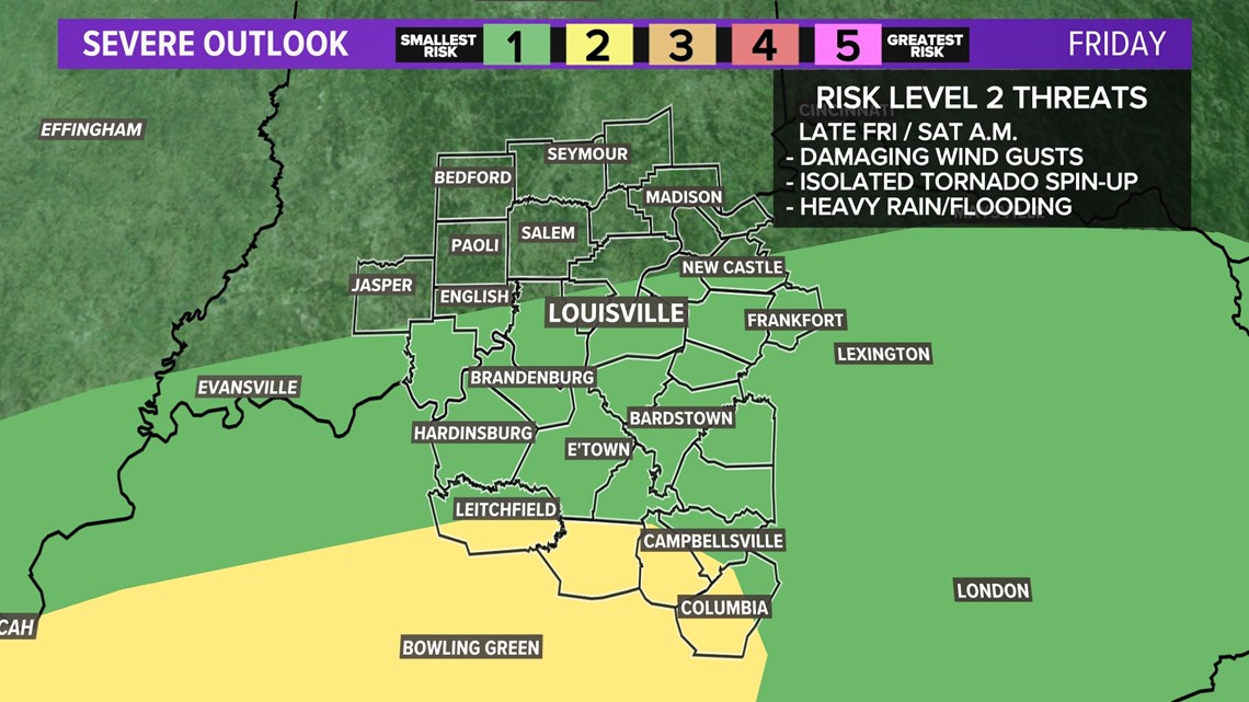
Overnight one or two storms could be on the strong to severe south of Louisville, but the bigger threat will be closer to the KY/TN border. If storms become strong to severe, damaging winds, hail, and an isolated tornado will be possible.

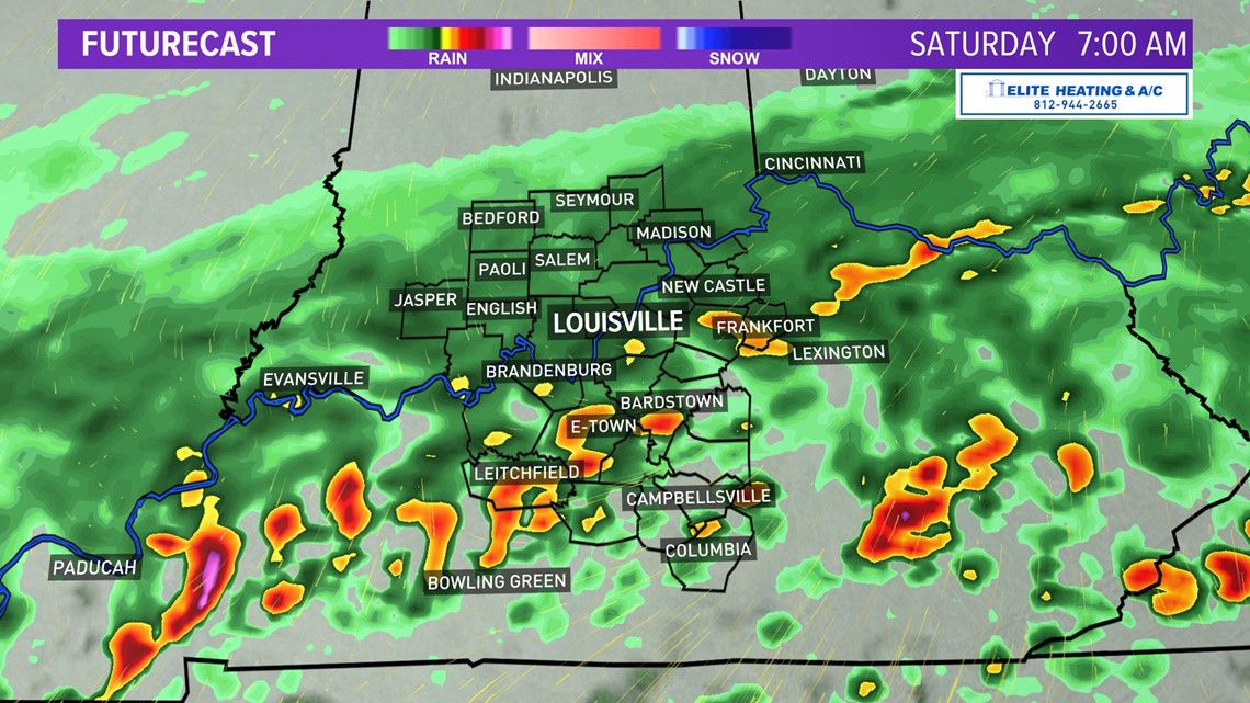
The chance for rain/thunderstorms continues through Saturday morning and into the afternoon. Thunderstorms and the threat of severe weather will be for areas in southern Kentucky during the morning.

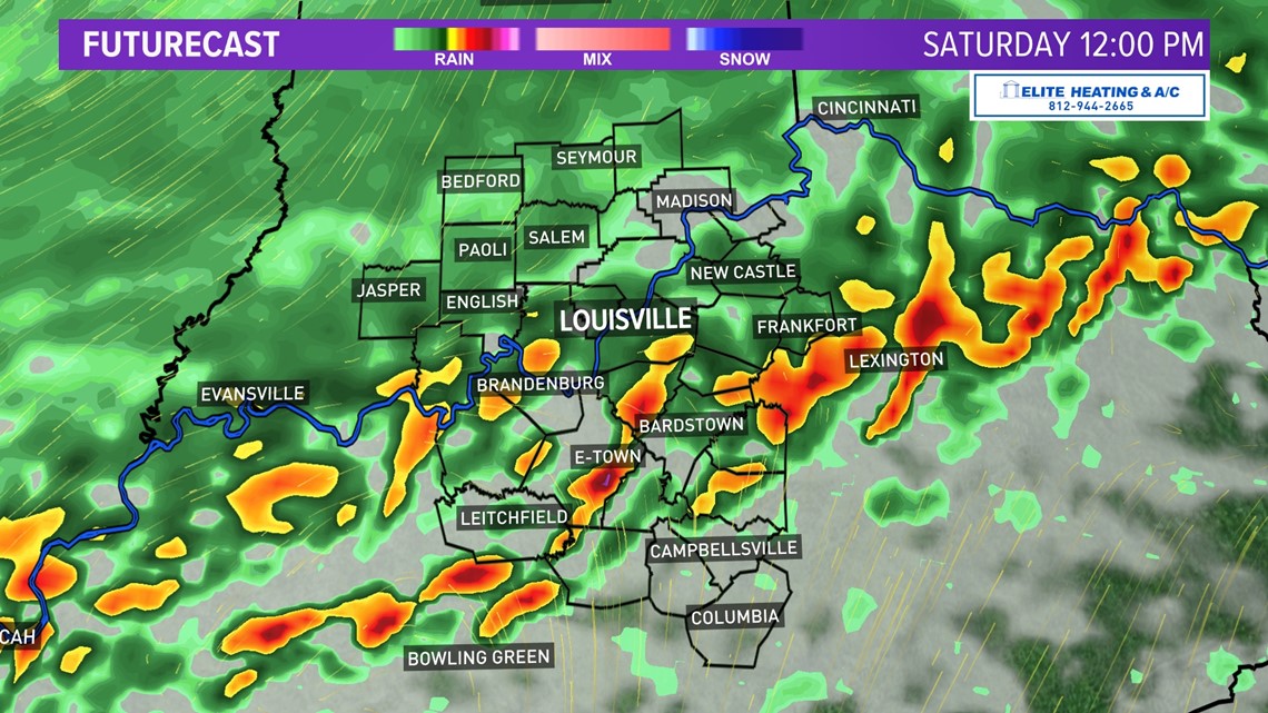
By the afternoon and early evening, the severe threat will spread north towards Louisville. Again, damaging wind gusts, hail, and an isolated tornado are possible with strong/severe storms.

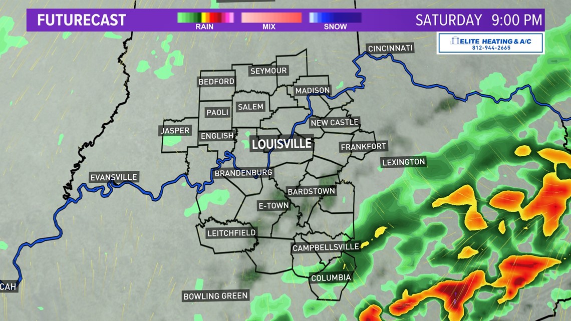
Storms will begin to slide east after sunset and wrap up for the entire area around 9 pm.

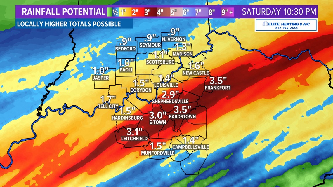
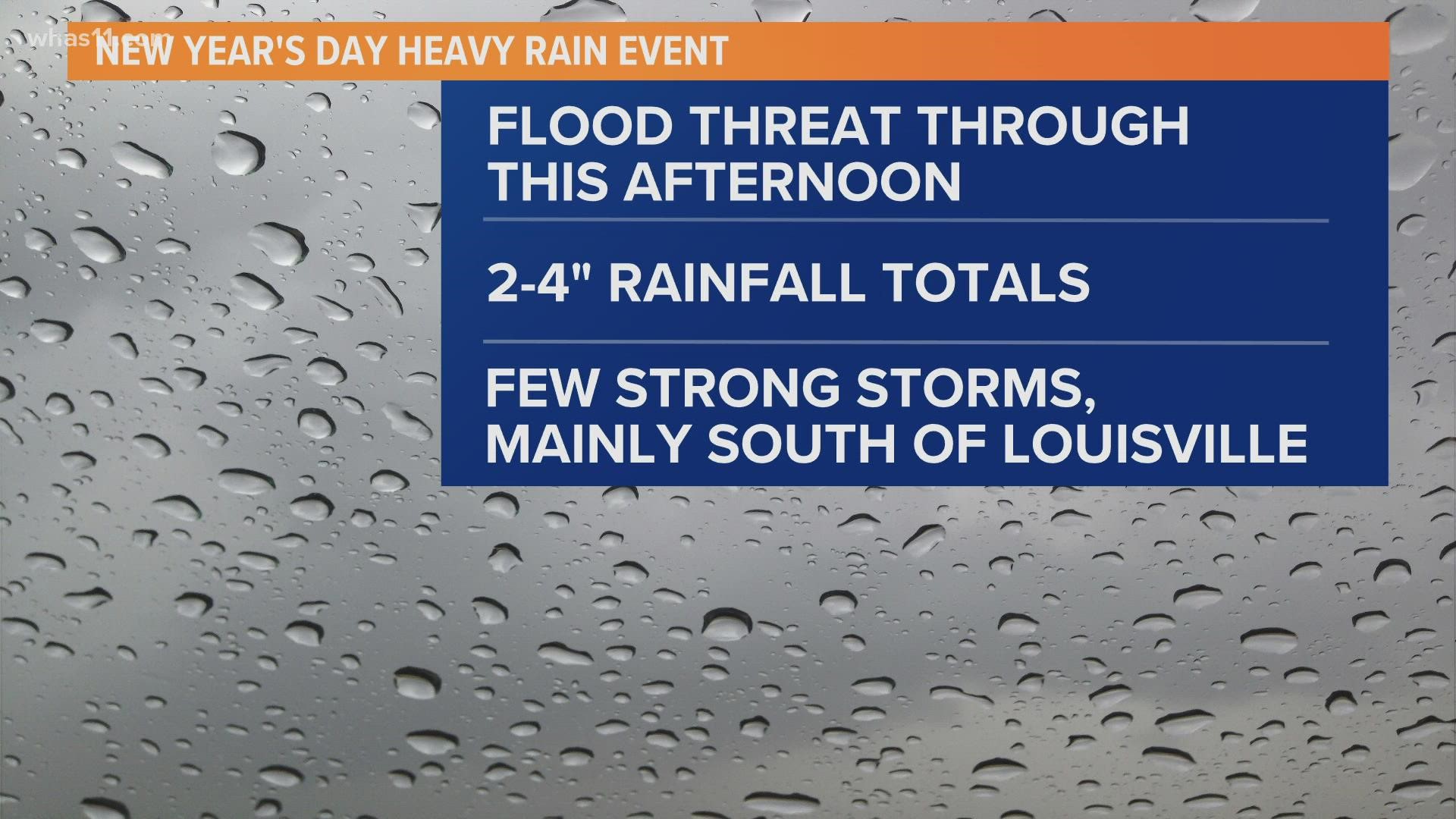
Flooding will be a concern for all Kentuckiana starting Friday night and through Saturday evening. During this time frame, areas could pick up 2"-4" of rainfall, which can lead to flash flooding.
Cold air will quickly rush in behind the front on Sunday, causing falling temperatures. Around midnight, temperatures will be in the 50s, and by the afternoon, temperatures will drop below freezing.


If there is any lingering precipitation, there would be a transition to flurries/snow on Sunday. However, dry air could cut into the chance for any snow.


Southcentral and southeastern Kentucky has a better chance to see snow. A developing low-pressure system out of the south could draw in enough moisture to bring snow during the afternoon and evening. A dusting up to a quarter inch is possible. Warm ground temperatures will cause melting, but snowfall rates could be great enough to overcome that.
With high confidence, Sunday is going to be a cold day. Wind gusts up to 25 mph out of the west will cause the wind chill (feels-like temperature) to be in the low to middle 20s most of the day.


It will be a bitterly cold start to Monday morning, with wind chills/feels-like temperatures in the teens.