
LOUISVILLE, Kentucky — A big weather pattern change is on the way after nearly perfect conditions for the Great American Eclipse. A front will stall out over the region providing rounds of rainfall starting Tuesday through Thursday night.
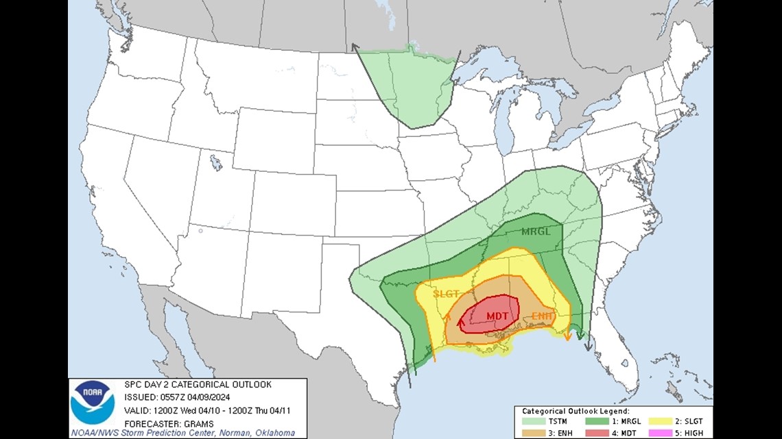
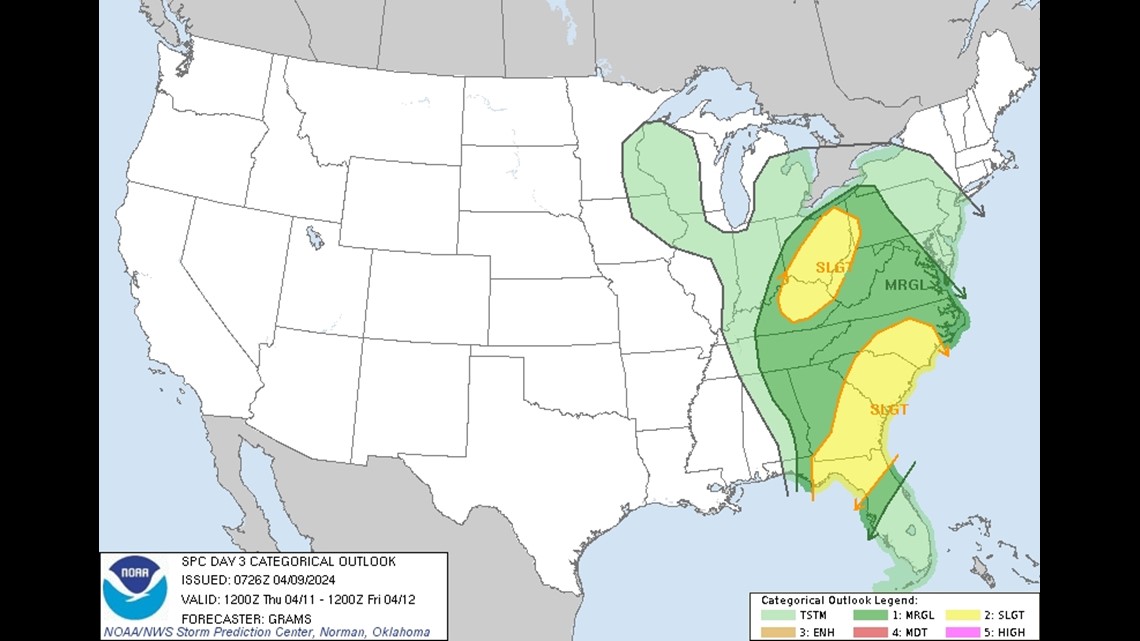
While we are expecting heavy downpours and a few thunderstorms from time to time, thankfully, severe weather is not expected at this time. Notice, the Storm Prediction Center places the severe weather threat to our south over the next couple of days, then just east on Thursday.


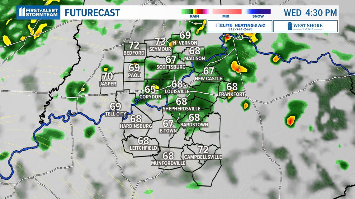
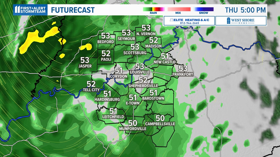
Timing:
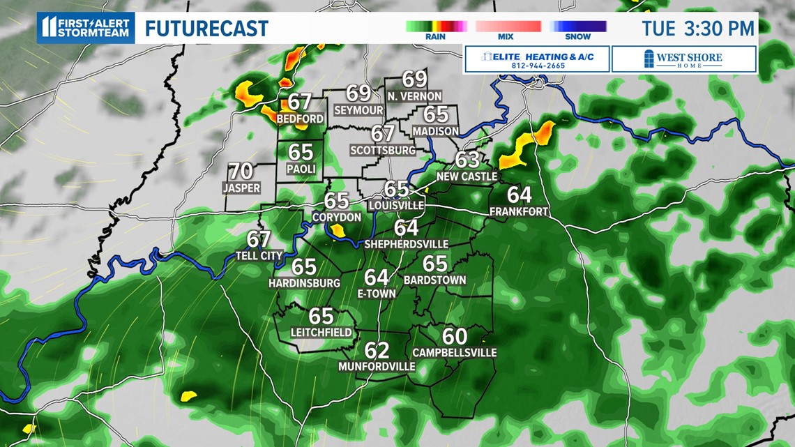
The first wave of rainfall is moving up from the south, and will be overspreading more of our area Tuesday afternoon and through the evening.
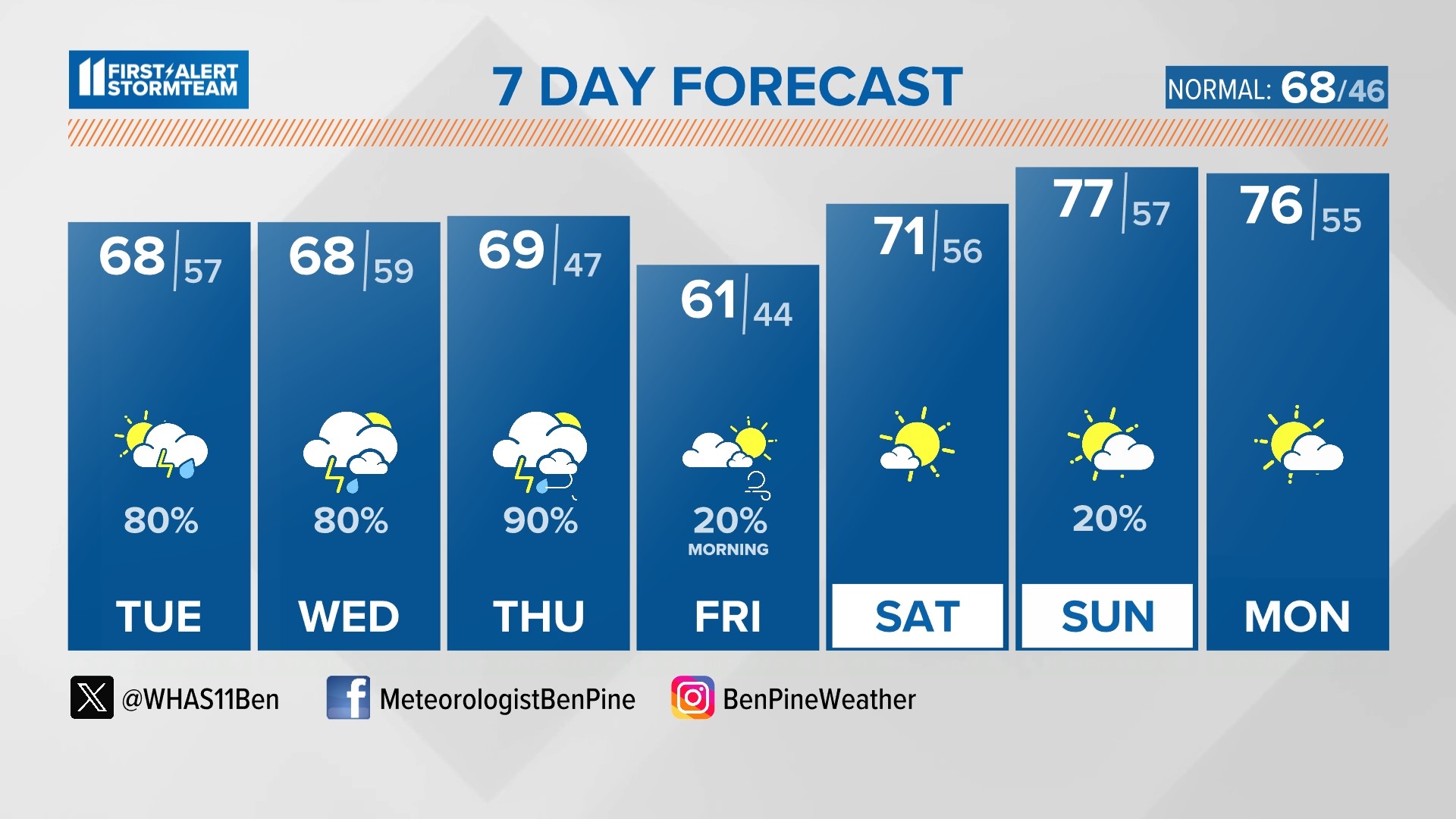
We don't expect a total wash-out any day, but it's nearly a 100% chance of rain Tuesday through Thursday. Temperatures will stay fairly mild in the 60s.


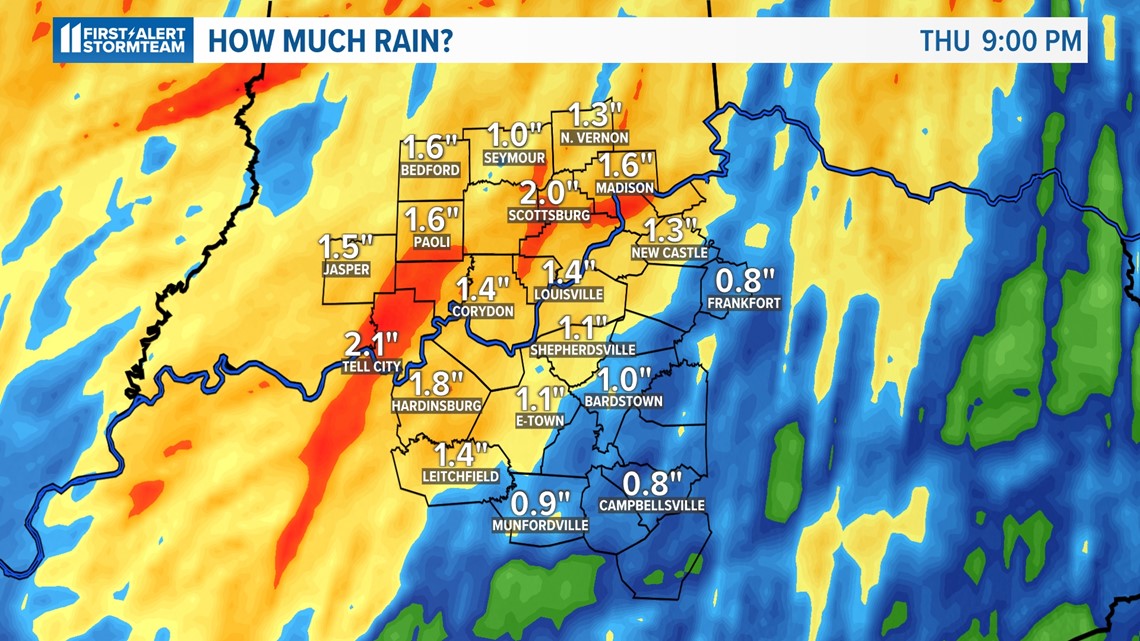
How much rain?
Rainfall totals will be around 1-3" by Thursday night. Since the rainfall is over a three-day period, we're not expecting significant flooding at this time.
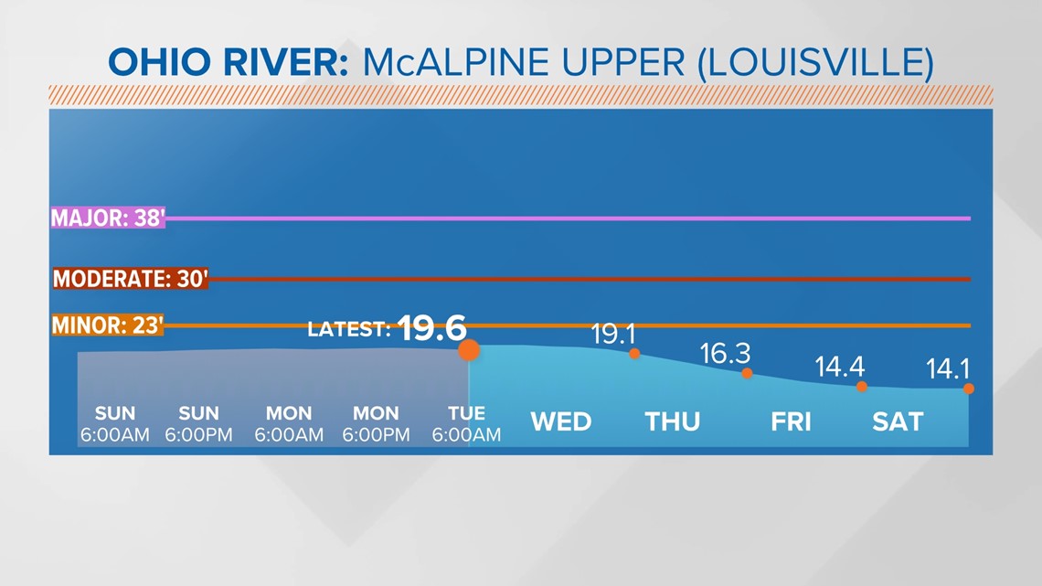
The Ohio River is currently above normal levels, but still several feet below flood stage, levels will need to be watched later this week.


So, keep the rain gear handy over the next several days. On the bright side, as they say, April showers bring May flowers.

Make it easy to keep up-to-date with more stories like this. Download the WHAS11 News app now. For Apple or Android users.
Have a news tip? Email assign@whas11.com, visit our Facebook page or Twitter feed.