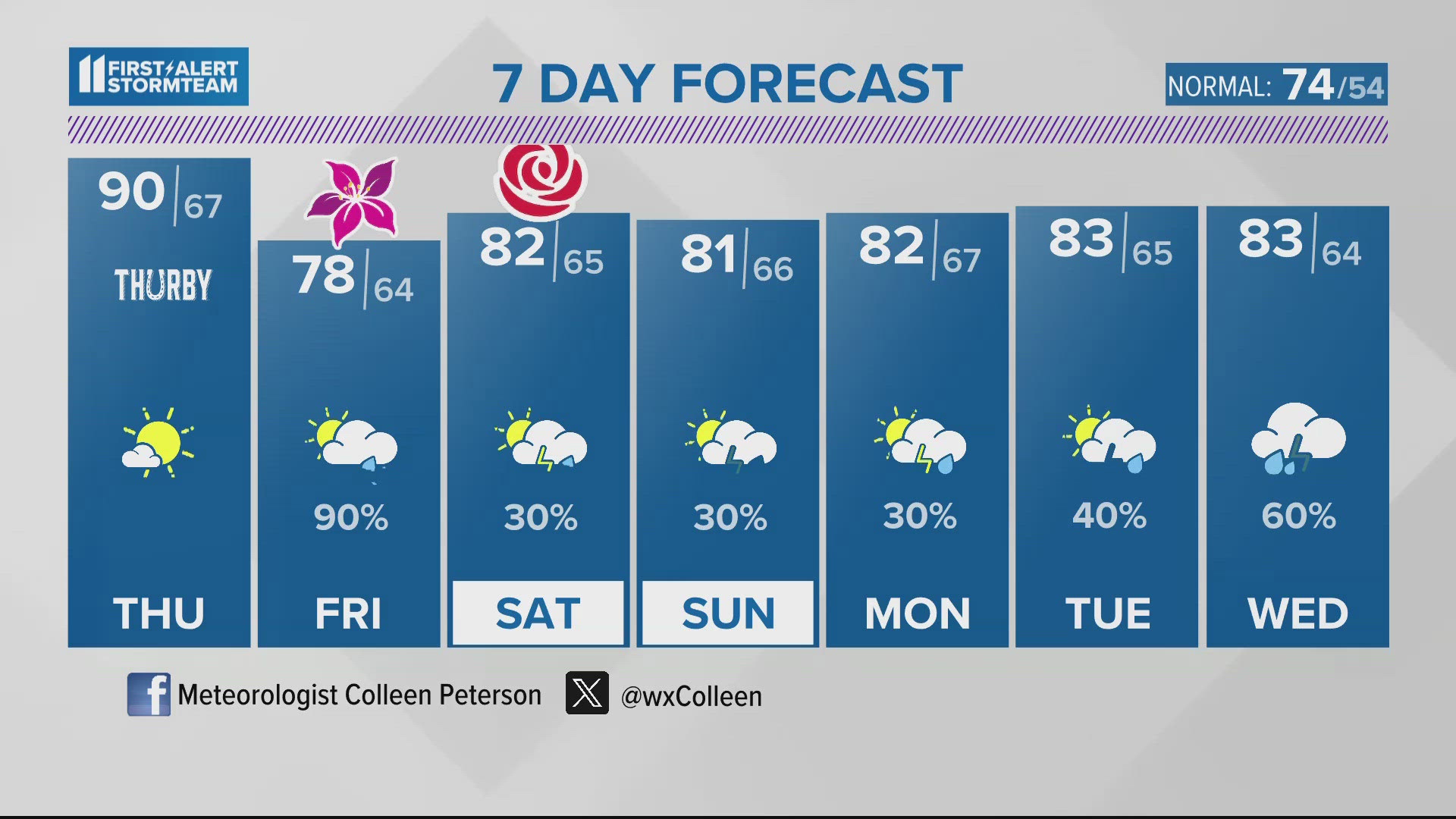
The chances of severe weather will be greatest over Kentucky this afternoon, with smaller chances north. A cold front will be interacting with very warm and humid air over the region firing up scattered storms. Mid-level energy and stronger winds will also help kick-up storms and potentially make them rather strong.
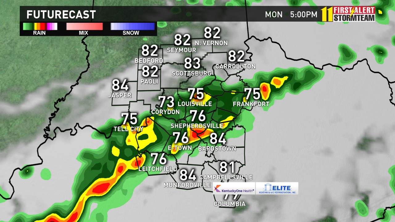
Take a look at the Futurecast maps below, as we time and map out the storms today. It won't be long after 2pm when the first storms fire up along and south of the Ohio River. (Note: The morning showers and thunderstorms we had could slow down the storms, and mess up the organization of our afternoon storms. We'll have to watch how quickly we heat up. The more clouds that linger, the less severe weather we will see.)
Storms could be strong to severe with damaging winds gusts, large hail, heavy rain, and lightning. An isolated weak spin-up tornado can't be ruled out, but is not likely.
The storms will likely be tracking in clusters gradually to the south, and most of the activity will be to the south of the Metro by 5-6pm. There is a good chance the skies clear in time for the 3rd UofL Super Regional baseball game at 7pm.
Storms will most likely be heading south of the Bluegrass Parkway toward Campbellsville by 7-8 pm.
The last three maps below are from the Storm Prediction Center. The first map shows the Slight Risk of Severe Storms today over Kentucky, the yellow shaded area. The next map shows the low 2-5% chance of a tornado, mainly over southern Kentucky. The last map shows the wind and hail threat at 15%.
This time of year is filled with outdoor activities, make sure to head inside anytime you hear thunder. If a warning is issued, seek shelter. If a tornado warning is issued seek shelter on the lowest level of your home, away from doors and windows - like an interior bathroom or closet. A Severe Thunderstorm or Tornado Watch means conditions are favorable for severe weather over the next several hours - be ready to seek shelter if a warning is issued.
Follow me on twitter for frequent weather updates @WHAS11Ben 'like' my weather facebook page