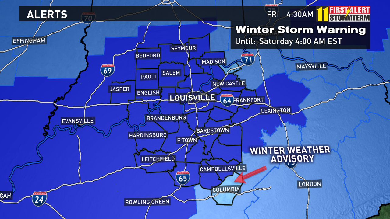
A Winter Storm Warning is now in effect for all of Kentuckiana today into Saturday morning. The cold front moved through Kentuckiana a little earlier than expected with temperatures crashing before dawn along the I-65 corridor. We saw a solid 15 degree drop in less than 1 hour in many locations as the front moved through. This system will create some hazardous travel with ice/sleet and snow accumulation with the colder air in place as the day wears on. Be prepared!
There are no major changes to the forecast as we head through the day with the cold front blasting out of Kentuckiana by late morning with rain eventually giving way to freezing rain/sleet and eventually snow from west to east. Even with the colder air arriving earlier and temperatures around freezing, it will take awhile for road surfaces to cool down given the recent warmth.
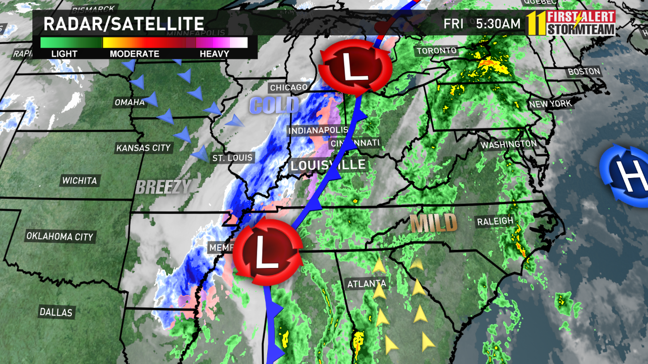
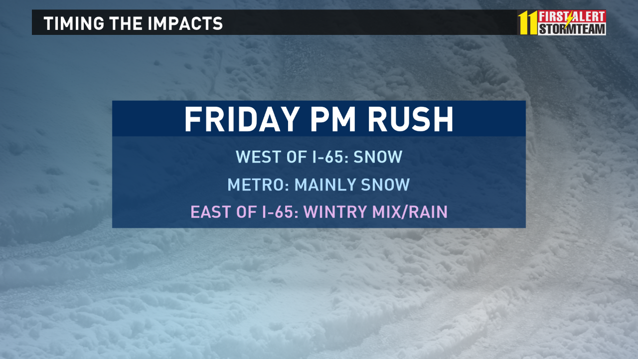
Of course TIMING is the biggest concern for folks into today with the changeover and going to be critical with how things play out. Snow will be moving in for the afternoon rush hour, with hazardous conditions expected across the board by late tonight.
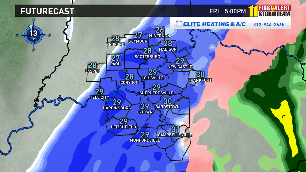
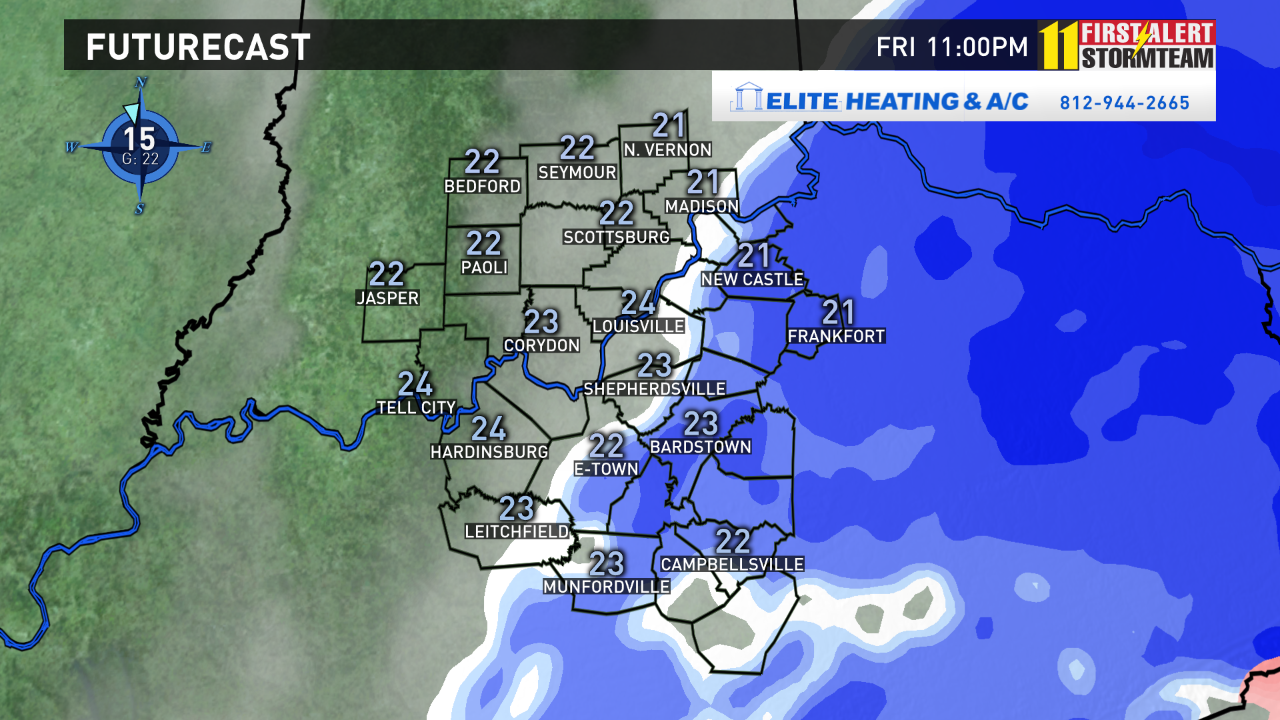
So we are pretty confident of a rain to freezing rain/wintry mix to snow transition through the day! Here is a breakdown (5pm, 11pm) of today as we see it currently on the models. Notice the change in precipitation type as the day goes on.
5PM
11PM
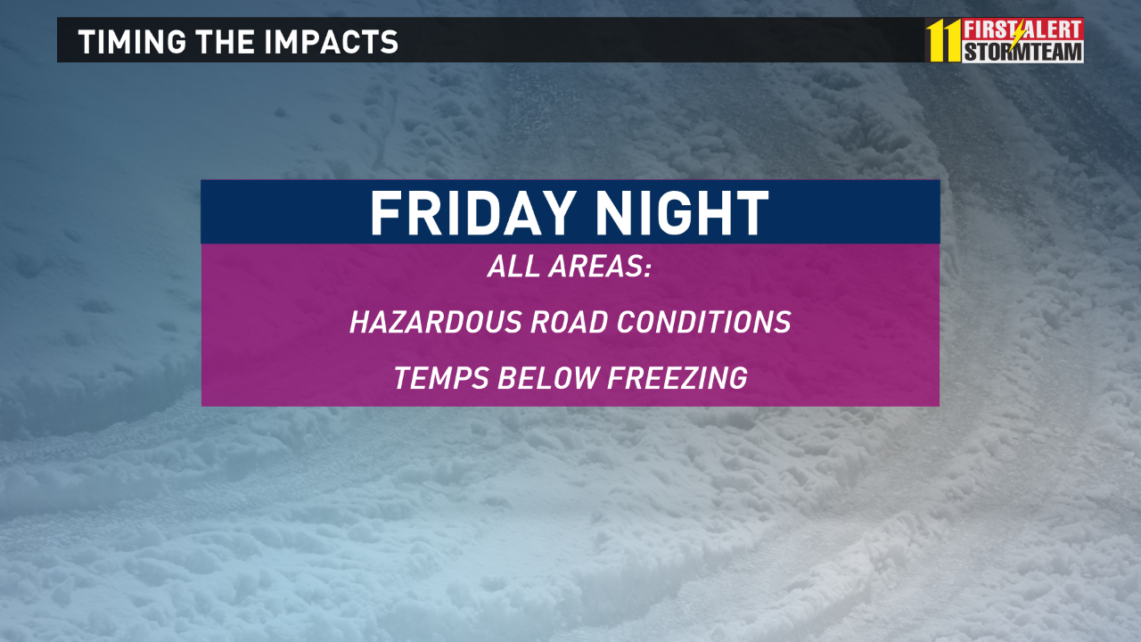
All areas will see freezing conditions by late on Friday, so whatever falls will become icy overnight and into Saturday morning. With a layer of ice under a bit of snow, travel could become quite treacherous, especially during the evening and overnight hours.
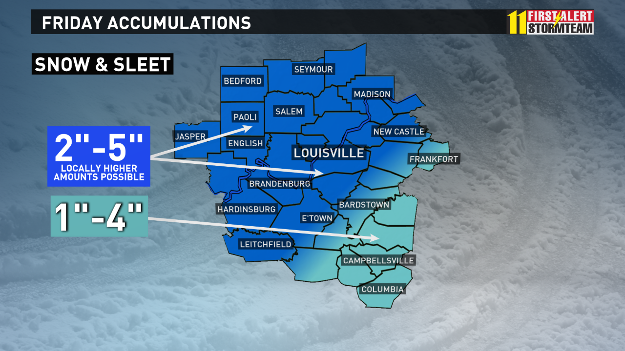
Here is what we believe the forecast holds for Kentuckiana with this event. We could see anywhere from 2-5" of snow across much of Kentuckiana. Lower amounts are anticipated over our southeastern areas.
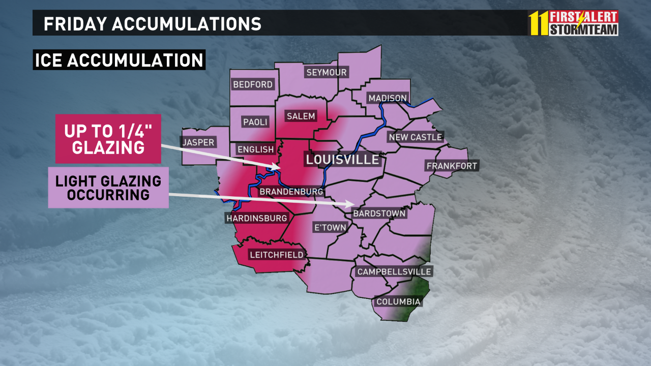
Light glazing has occurred on elevated objects and trees, and that will continue until snow moves into the area.
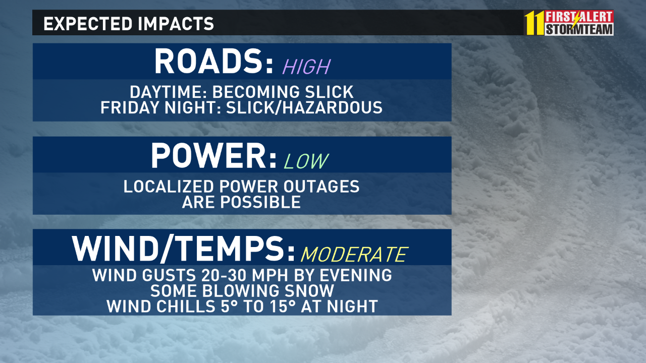
The bottom line is you need to be prepared for a rain/ice/snow event today and tonight. Make sure you take extra caution on roadways, especially untreated surfaces if you have to be out on Friday through early Saturday. We will continue to track this storm as it reaches Kentuckiana and have team coverage from the First Alert StormTeam into the upcoming weekend.
Meteorologist T.G. Shuck