

LOUISVILLE, Ky. — A wintry mix is looking more likely as chilly temperatures combine with next storm system on Wednesday.
Light precipitation is expected to begin during the predawn hours early Wednesday. At this time is looks like the best chance of snow will be along and north of I-64, where the temperature profile through the atmosphere will be a touch colder.

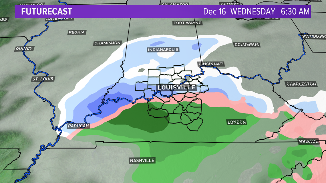

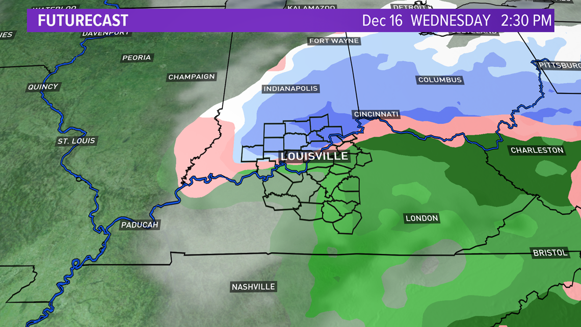
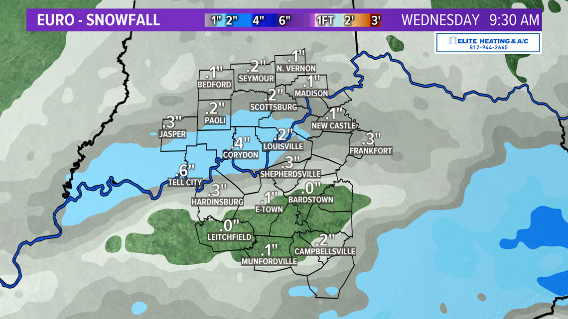
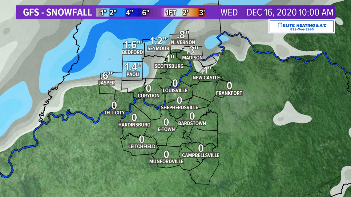
A minor, light, slushy snowfall accumulation will be possible over the northern half of the WHAS11 viewing area Wednesday. With temperatures staying just above freezing during the duration of this event, no major travel impacts are expected.
The EURO and GFS weather models are in pretty good agreement on the timing, precipitation type and amounts.

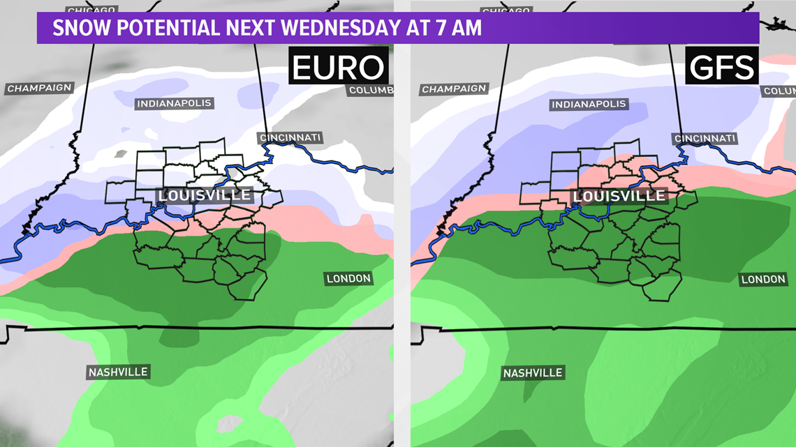


We'll continue to fine tune the forecast over the next couple of days. Again, so far, this isn't looking like a very significant winter system.