OVERVIEW:
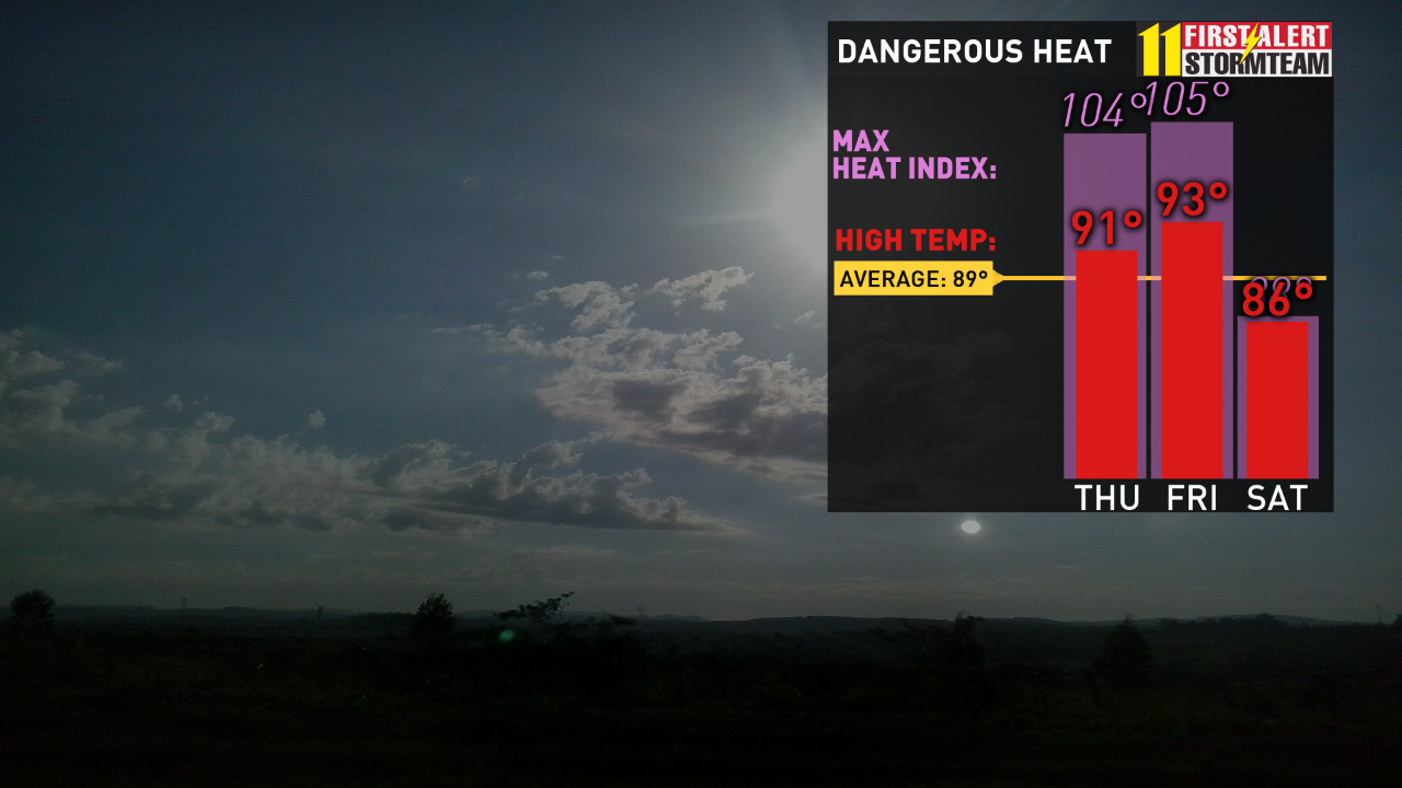
Not a comfortable rest of this July week here in Kentuckiana. We are very hot and muggy going into the next few days with heat index values in the 95-105 degree range. The main concerns from our weather will be excessive afternoon heating and thunderstorms that can produce gusty winds. A couple rounds of strong storms will be possible through Friday - be ready to go inside and seek shelter if a warning is issued.
TOMORROW:
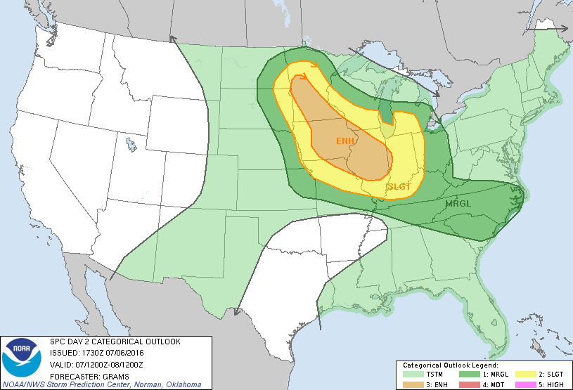
We might have some strongly desired dry time in the afternoon - although it will be warm and very humid. Storm chances increasing into the evening and overnight. The Storm Prediction Center has issued a slight risk of severe storms for the majority of our viewing area.
FRIDAY:
Friday will likely be the stickiest and hottest day of the week with heat index values getting up to 100-105. Scattered storms starting early morning and possible throughout the day into the late evening.
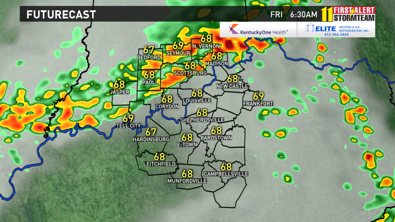
Here's a glimpse at FutureCast Friday morning 6:30AM:
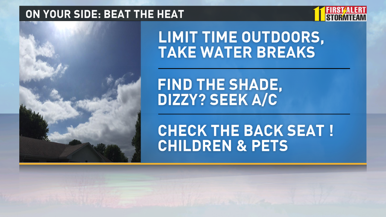
BEAT THE HEAT.......CHECK THE BACKSEAT
AT LAST.....RELIEF FOR THE WEEKEND! :)
If you've been wanting to spend time outside without sweating as soon as you walk out the front door, Saturday and Sunday are the days to do it!
We will get a break from the oppressive heat and humidity going into Saturday and Sunday. Partly sunny with highs in the upper 80's.
For lightning safety tips and procedures click here.
Christina Andress, WHAS11 Storm-Team Weather Intern