
LOUISVILLE, Ky. — A significant winter storm is making its way through the Ohio Valley. All precipitation types (rain, freezing rain, sleet, snow) are expected. This will likely be a high-impact storm.
Forecast at-a-glance:
- Temperatures will continue to drop Thursday afternoon
- Kentucky communities will see rain gradually transition to freezing rain and sleet
- Snow and sleet accumulations expected on top of any ice
- Snow showers Friday morning
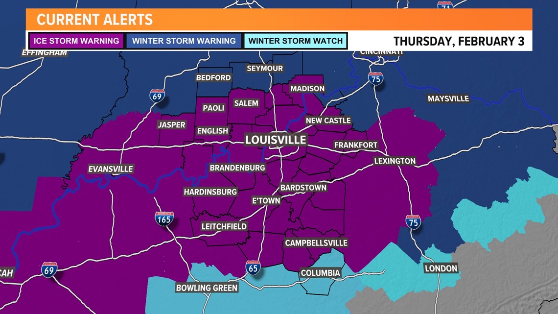
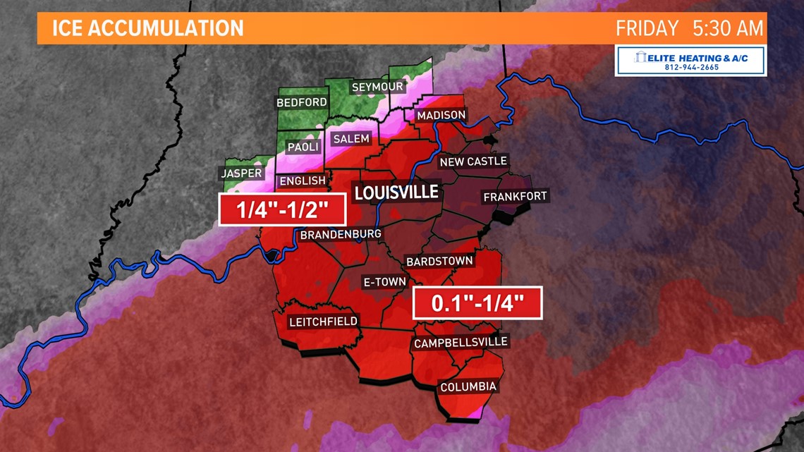
Most of the WHAS11 viewing area is under an ice storm warning starting early until Friday morning at 7AM EST (purple shaded counties).

Temperatures Thursday afternoon have been below freezing in southern Indiana, but have struggled to drop below freezing south of the river. As the afternoon progresses those temperatures will gradually fall and the transition from plain rain to freezing rain will begin.
There is still a lot of time left in the day for ice to accumulate, but with the slow fall to freezing, ice accumulations may thankfully be a bit less than initial forecast. That said, impactful ice accumulations of 1/4" to 1/2" are still anticipated from southern Indiana down to the Western Kentucky and Bluegrass Parkways.

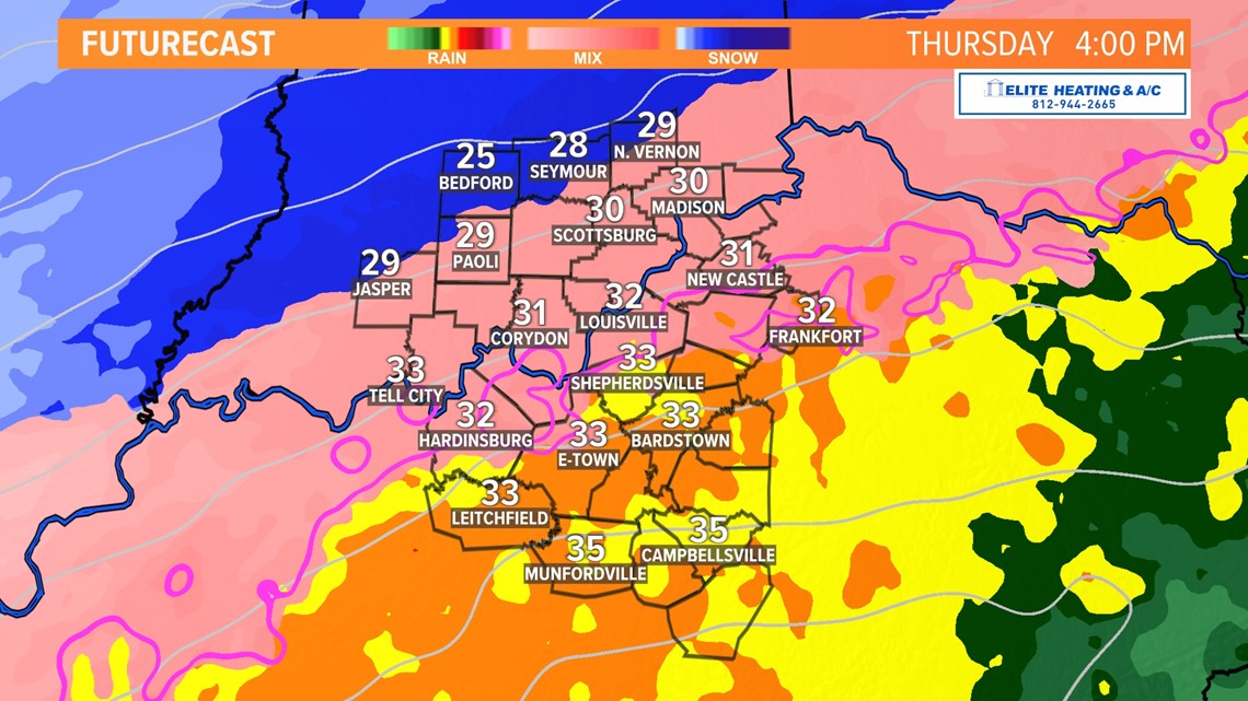

It’s important to note that freezing rain will NOT start accumulating into ice as soon as temperatures fall below freezing – there will be slight delay.
South of the Parkways, temperatures are unlikely to drop below freezing until early afternoon with ice accumulation beginning likely late afternoon.

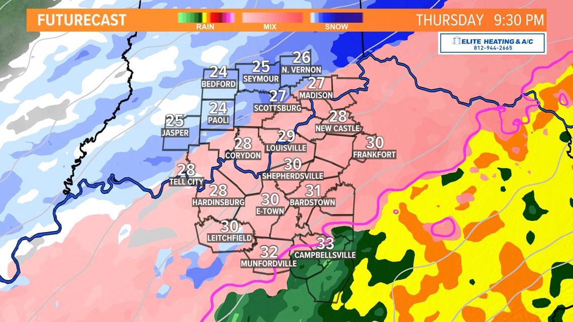
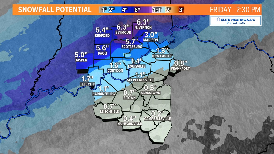
Transition to sleet/snow: As temperatures continue to fall below freezing Thursday afternoon and evening freezing rain will gradually see sleet mix in which will mean ice accumulation slowly tapers off. As we continue through the night light to moderate snow showers will move across the region.

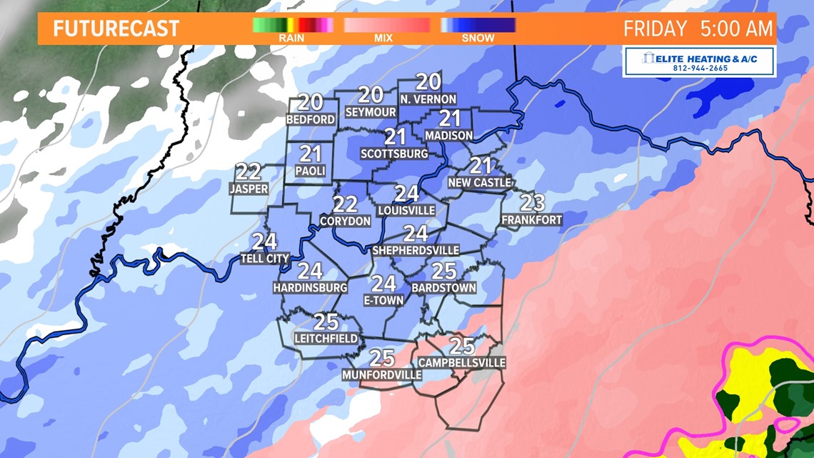
Snow accumulations will be greatest north of the river, but areas from the Parkways northward could expect 1-2" of sleet/snow on top of ice...

Impacts: Deteriorating conditions will likely continue Thursday afternoon, evening, and overnight in Kentucky as icing forms. Bridges/overpasses and country roads will likely become iced over first. Beware of tunnels for ice as well. Main roads should hold off longer especially because they’ll be treated.
The afternoon rush hour may be very hazardous with more cars on the road and ice likely having accumulated by then. Please have an emergency kit in your car that includes food, water, and extra clothing to stay warm.
RELATED: Are you ready for ice? It's in the forecast. Here's how Kentucky Electric Co-op is preparing
Stay up-to-date with the latest winter weather updates with the WHAS11 app.
Follow the WHAS11 First Alert Storm Team on social media:
Make it easy to keep up-to-date with more stories like this. Download the WHAS11 News app now. For Apple or Android users.
Have a news tip? Email assign@whas11.com, visit our Facebook page or Twitter feed.