Severe weather has been common across the Plains, Ohio Valley, and the Great Lakes much of this week and one thing that has become very obvious is that computer model forecasts have a long way to go.
There are two main long range models and a few shorter range models that have more detail.
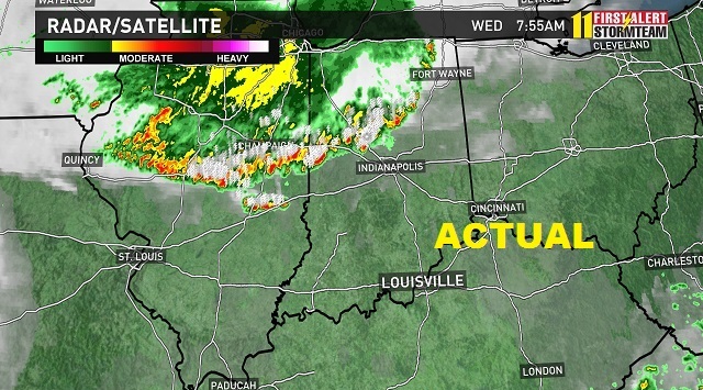
A large line of severe storms moved through Chicago, Indianapolis, and Louisville on Wednesday. These storms moved south toward air that was very humid. The problem is computer models were forecasting these storms to head toward Cleveland and fade out over drier air.
This made for a difficult forecasting day for broadcasters since there wasn't much to show as visual representation. We just had to say. See these storms? They will be here at ...
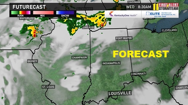
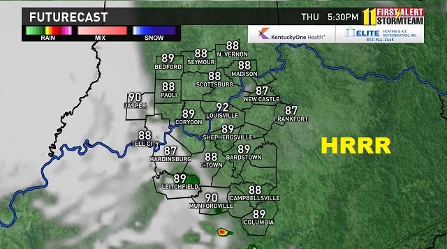
The same thing happened Thursday. This is a side by side of two computer models we use on air. One is the RPM, which updates every 4 hours and the HRRR, which updates every hour. In theory, as these models update, they are able to pick up on changes and adjust the forecast.
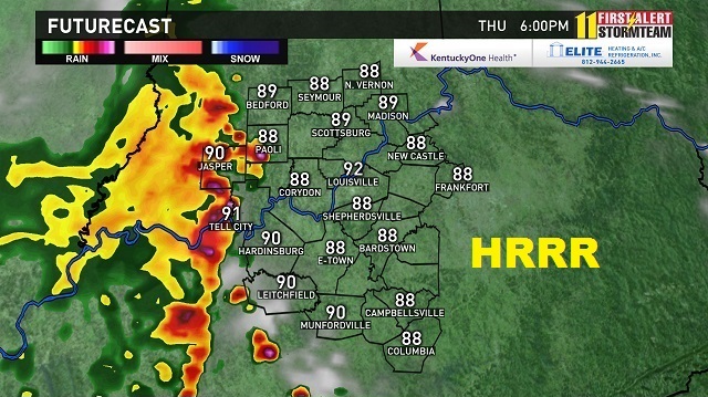
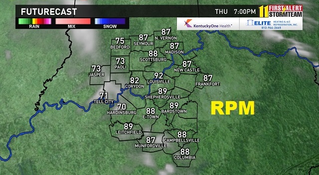
The HRRR did a good job of representing the line of significant storms moving through while the RPM had it sunny and 92 in the evening.
The next run for each produced this result.
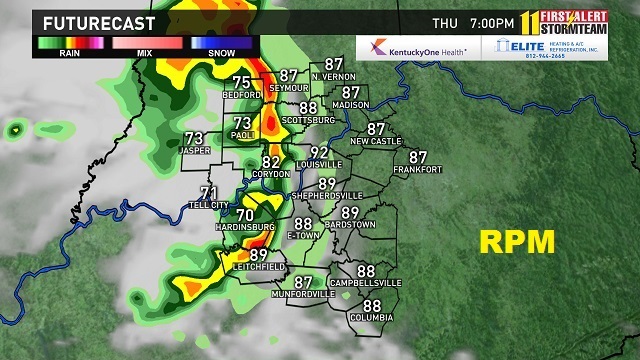
They flipped the forecast. The HRRR model had the storms fade out while the RPM did a better job of correcting the previous run's issues.
Why do you care? Because the stock weather app on your phone uses these models to give you a forecast. But you don't get a forecast. You get a temperature, an icon, and maybe a rain chance in percent.
If your phone used the RPM on this particular day, it would have told you to expect a sunny day in the 90s as opposed to the severe weather that moved through.
Without a human Meteorologist to interpret this data and these models for you, your forecast is garbage unless it is a picture perfect day. Which according to a run of each of these models, it was supposed to be.
Plus how much confidence in a forecast can you have if one version shows significant storms then the next version shows a sunny day?
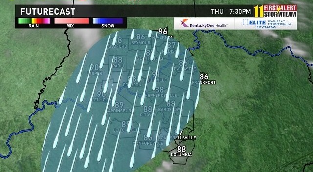
The model runs were so bad that day, that to give a visual of what would happen, we needed to go back to the days before these visual on air models and draw on a map.
Here was our written forecast for that Thursday.
"Rain showers will diminish through the morning and allow for a mainly dry afternoon with partly sunny skies. Hot and humid in the lower 90s with the heat index close to 100. More rain and storms are possible for late this afternoon and evening. They could be strong to severe with gusty wind and cause more flooding issues. "
That is a far better interpretation of what would happen over an icon and a temp. Severe storms moved in at around 3 PM, lasting until 6 PM, causing storm damage and more flooding for the areas. Admittedly they moved in a little sooner than expected.
Friday was another case of poor model forecasting.
Here are two screen shots from the stock weather app on my Android phone from Accuweather.
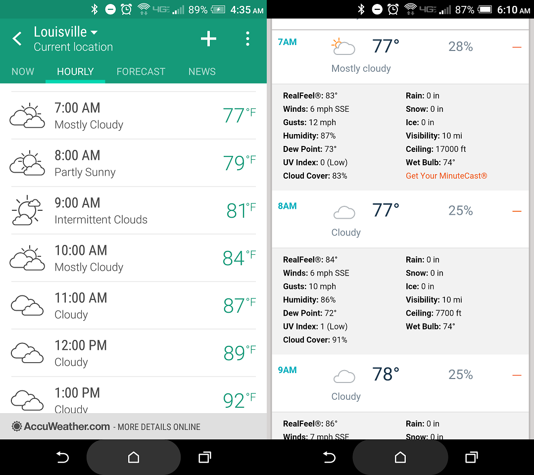
The first is the hourly forecast and the second is what you get if you click on one of the hours. A 25% chance for rain in the more detailed forecast but mostly cloudy to cloudy on the icons most of the day. The app didn't show an icon of "storms" until 4 PM.
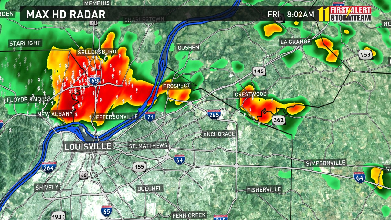
Here is what actually happened Friday. Louisville had storms hit the northern and eastern suburbs between 7:30 and 8:30 AM right when most people are heading to work. Would you have gotten any indication this was possible by the app? These storms didn't pop up, they moved in from the northwest and anyone watching the news in the morning would have known to expect them.
That morning's forecast also called for widespread rain and storms for the late morning and early afternoon that could be severe.
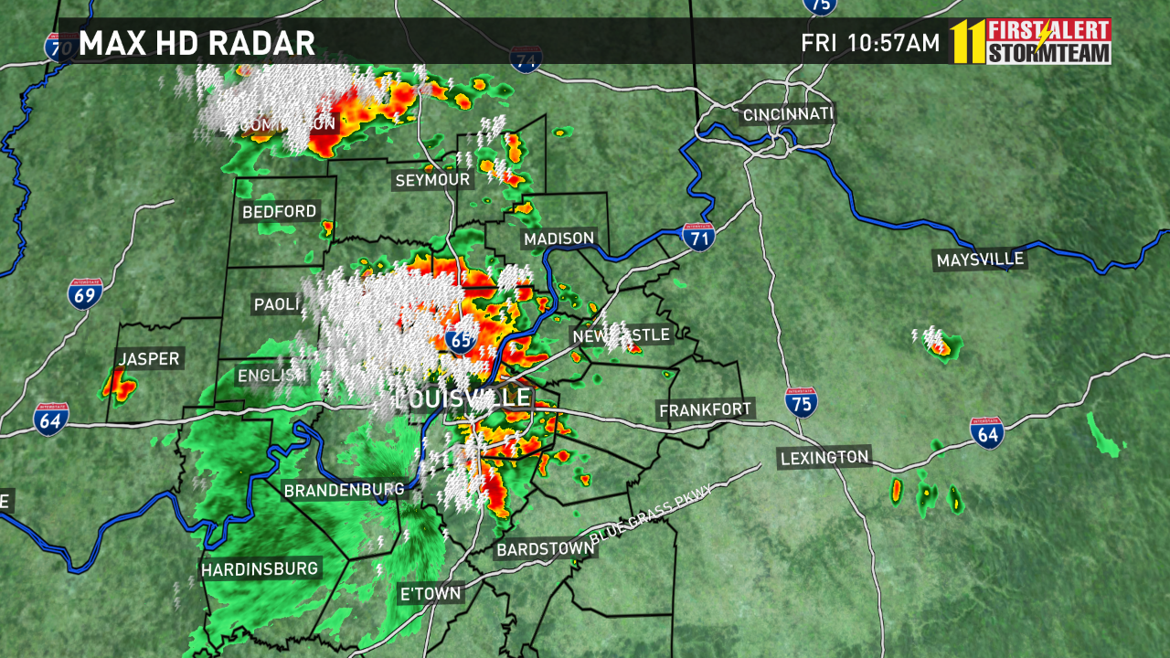
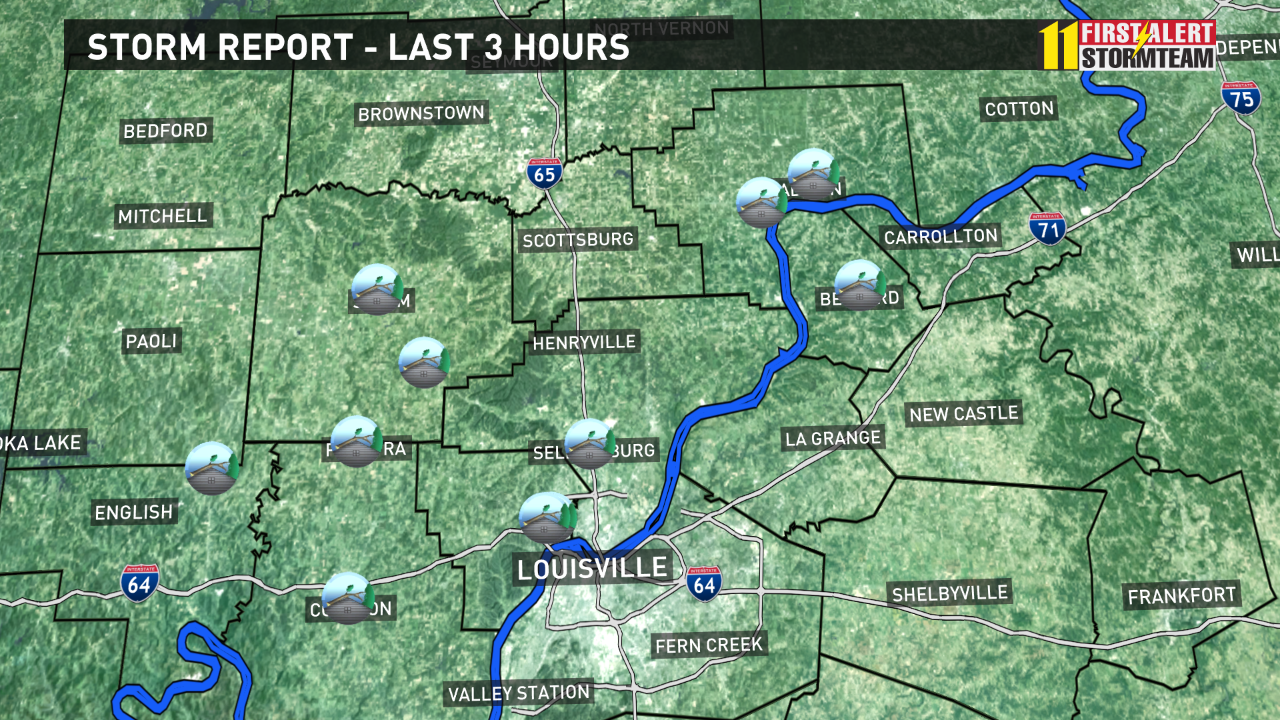
By 9:30 AM a large area of storms started to move in and we got our first warnings. Severe storms continued and hit Louisville and its suburbs around 11 AM leaving a path of downed trees which you see by those little icons. The stock app had "cloudy" as the forecast.
This was the first sentence of the written forecast.
"More storms from the west will move into the area for the mid-morning and early afternoon. Damaging wind and flooding will again be a threat."
The running joke is Meteorologists can be wrong (insert some made up percent here) of the time and still get paid. But while all this week the computer has told you little about significant weather, the human forecasts have kept you safe.
So what if you don't have time to watch the news in the morning. Download a local news app. The forecast is still provided by a person and you don't run into the same issues.
You can find the WHAS 11 app in your app store or download our weather specific apps here.
Download WeatherCaster
iPhone --> http://bit.ly/15lKrDS
Android --> http://bit.ly/19KawSl
iPad --> http://bit.ly/13viWVs