We are certainly and understandably getting this question a lot, "Is it going to be a White Christmas?". Well, we are certainly, still NOT certain at this point. Let me explain...
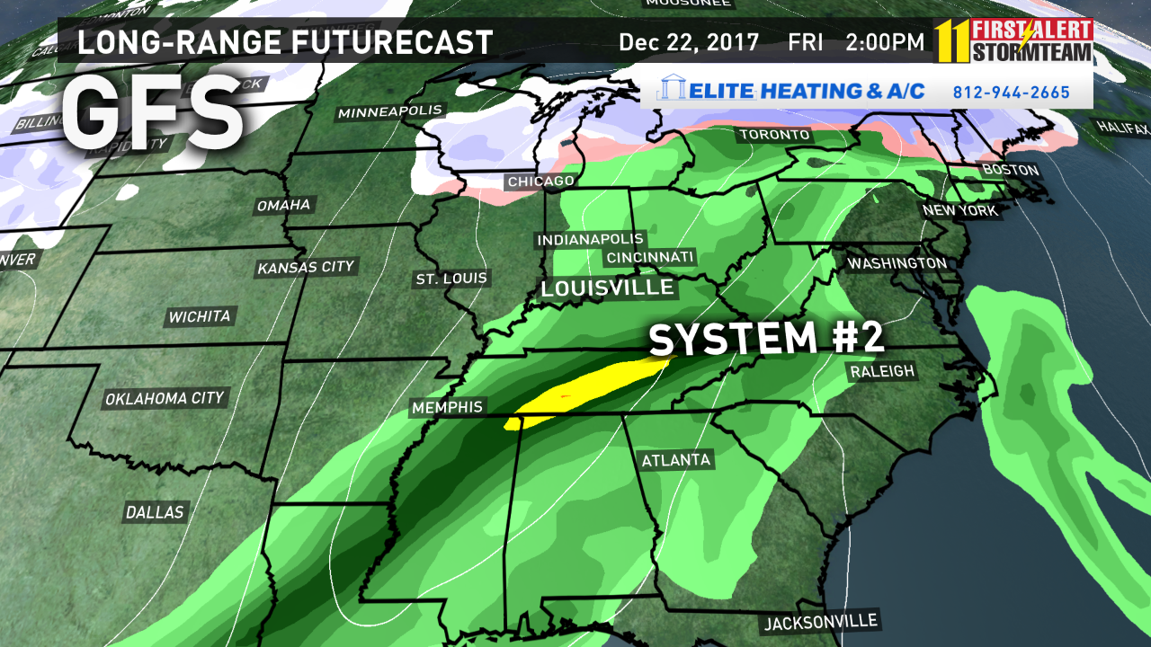
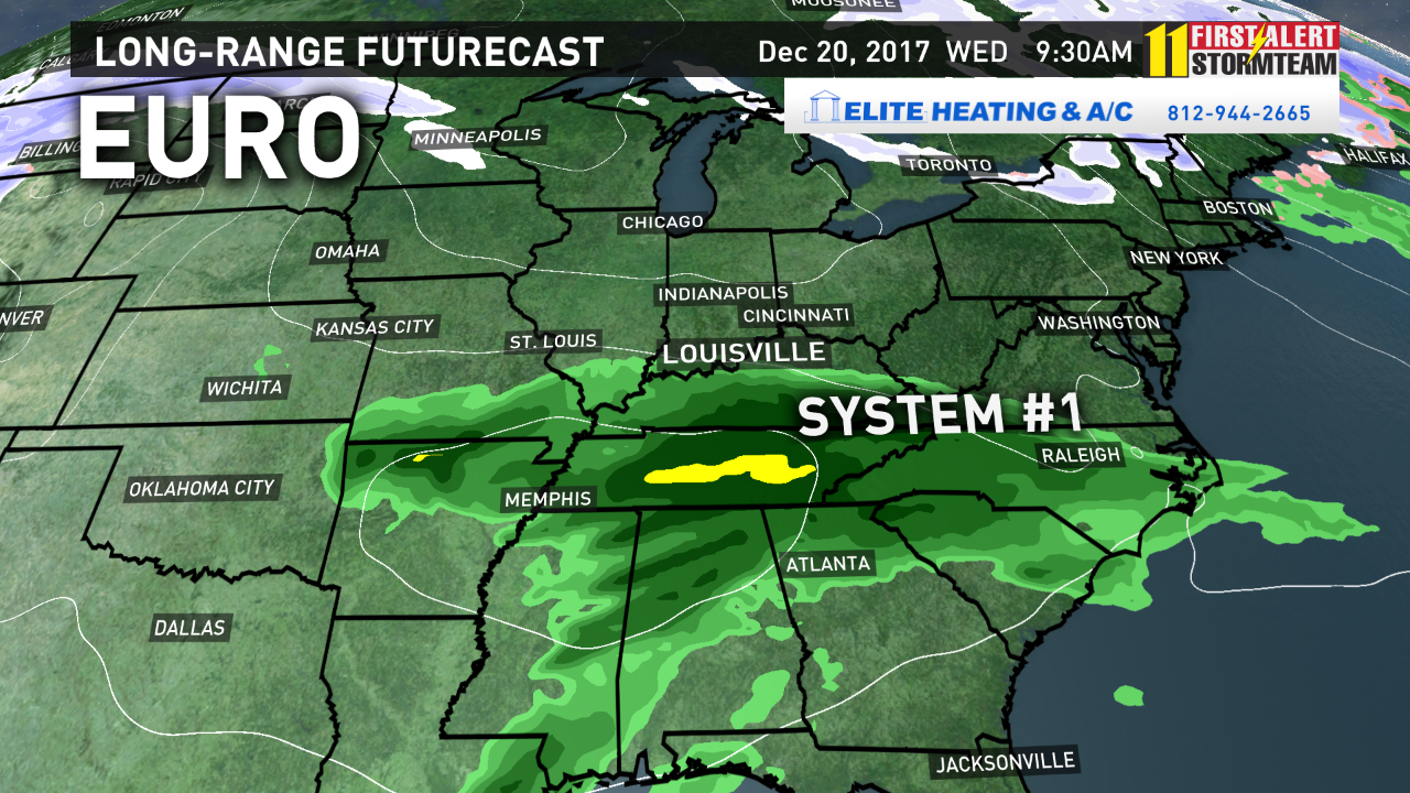
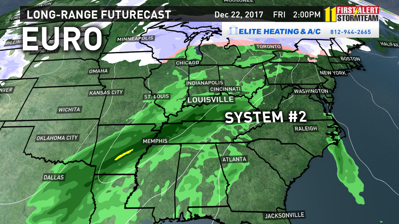
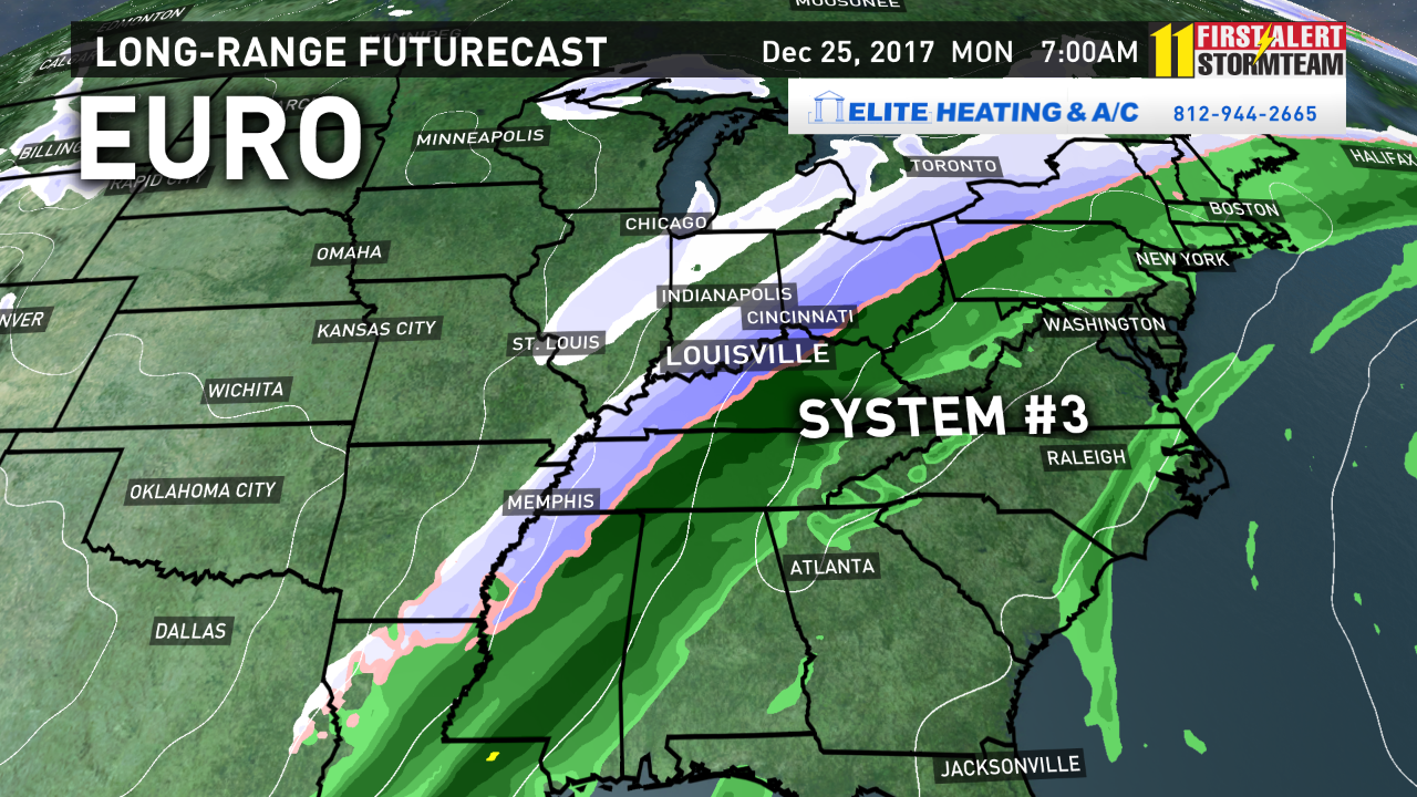
The two more reliable long-range weather models, the GFS and European, are calling for three systems to impact our region over the next seven days. They both agree on rain for Wednesday and Friday, but the third system is still a mystery!
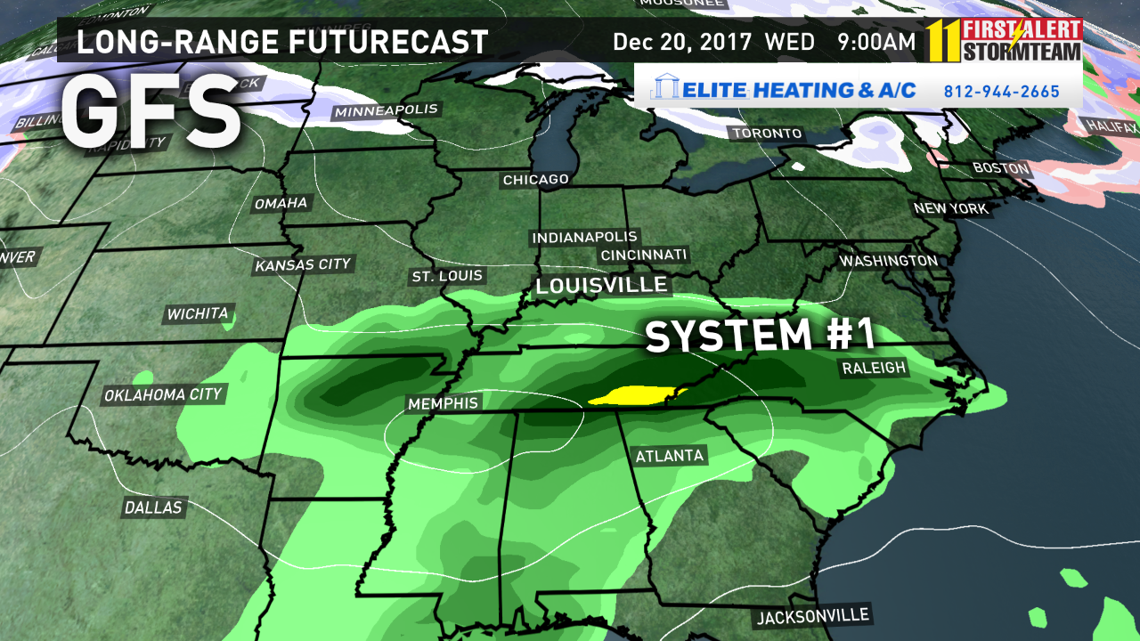
Let's start with scenario #1 with the GFS Weather Model data.
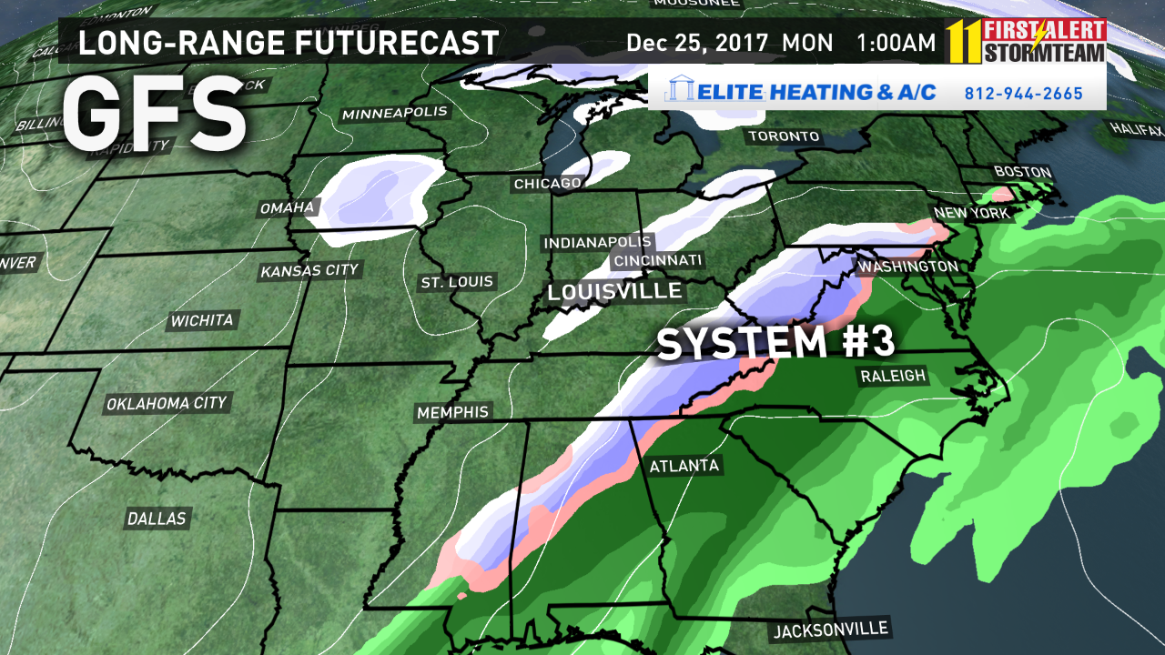
Rain is likely to develop for Wednesday, and again Friday, but the third system is developing east of our area. This will bring in cold air, but perhaps drier conditions for Christmas Eve into Christmas Day. This scenario brings mainly just flurries for Santa!
EUROPEAN WEATHER MODEL:
Now, the situation is a little different with the EURO solution. Notice, the EURO agrees with the GFS for Wednesday and Friday's rain chances (systems #1 and #2). However, notice the EURO develops storm #3 right over our area, much more west than the GFS. If this were to happen, we could have rain, turning to a wintry mix, then snow Christmas Eve into Christmas Day.
The bottom line?
As we have talked about for the last two weeks, our confidence is high that our weather pattern is turning more active with storm potential near Christmas. However, it is still too early to determine specifically what type of precipitation will occur, and how much, if any, accumulations we may see. So, monitor forecast closely for potential weather impacts, and stay tuned to our updated forecasts as the holiday weekend approaches!
So, all in all, yes, I'm telling you there is still at least a chance of a White Christmas!
-Chief Meteorologist Ben Pine @WHAS11Ben Facebook