

LOUISVILLE, Ky. — Let's take a look at what we can expect for our first week of August - there are some nice changes heading our way!
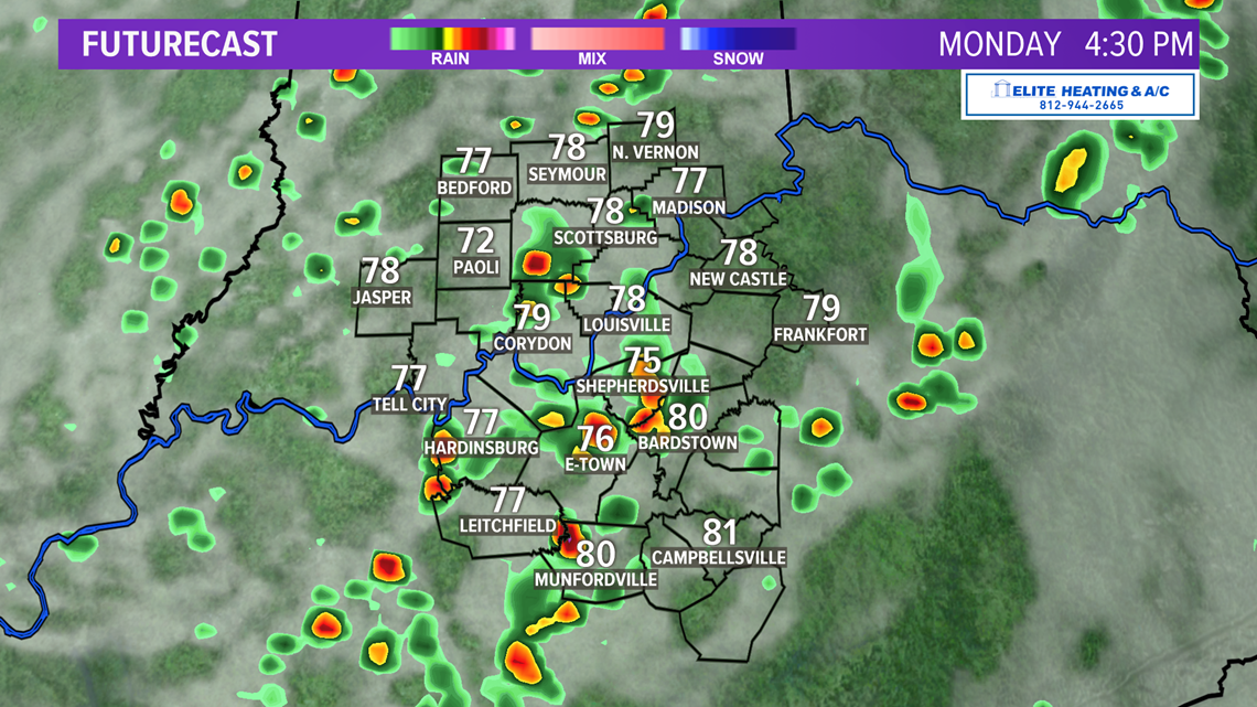
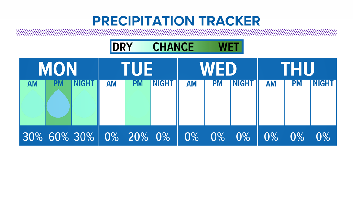
A weak cold front will first bring scattered showers and thunderstorms Monday. Severe weather is not expected, but locally heavy rain will be possible.

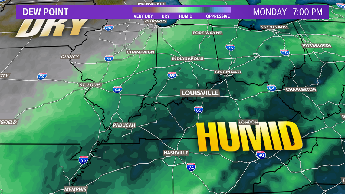
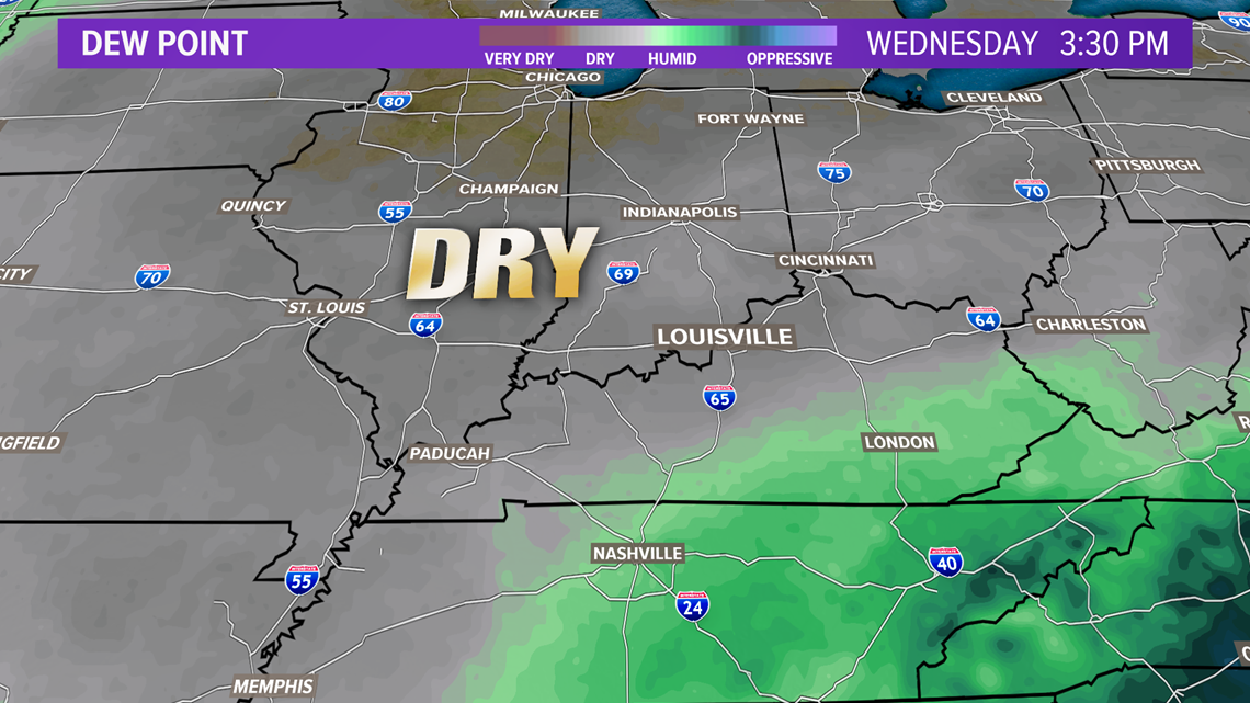
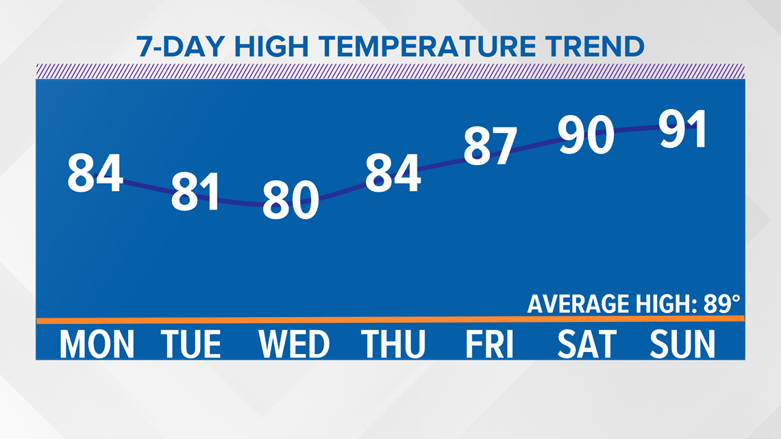
Monday will stay muggy (first map below), but much drier air will arrive behind the front Tuesday. Comfortably warm conditions are expected Tuesday through Friday as we stay in the "comfort zone" with low dew points = lower humidity.


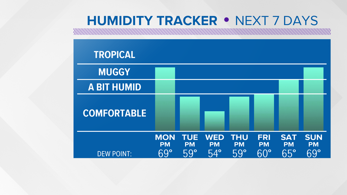
Temperatures will also stay below normal while the drier air hangs around. Heating back up to seasonably hot conditions this weekend. So, enjoy the break while we have it - we all know August can get very steamy.


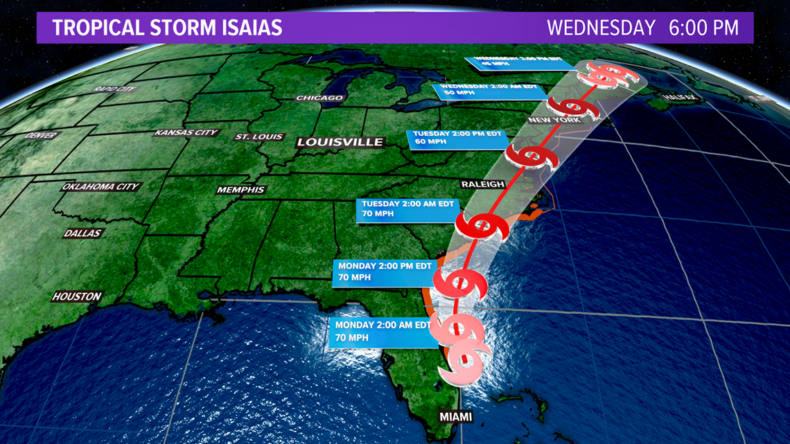
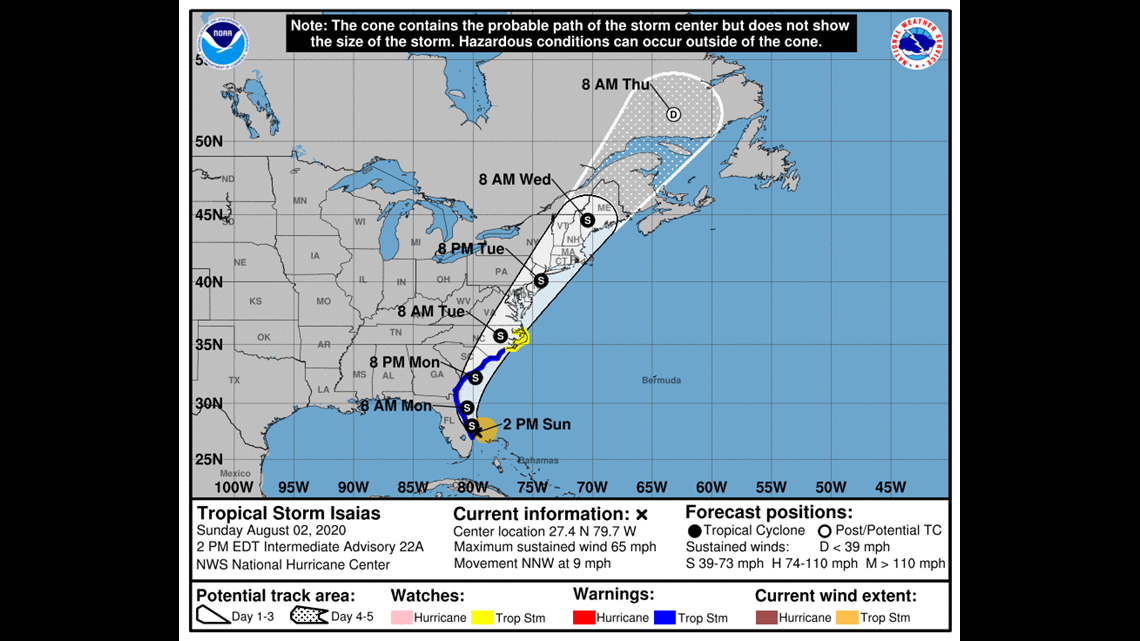
Tropical Storm Isaias won't have an impact on our weather as it slides up the East Coast over the next several days.


Have a great week everyone! -Chief Meteorologist Ben Pine