
LOUISVILLE, Ky. — When we are forecasting, we are looking at the movement of different air masses, but what is an air mass and the different types of air masses?
An air mass is large body of air with generally uniform temperature and humidity. Let’s look at all of the air masses and classify them.
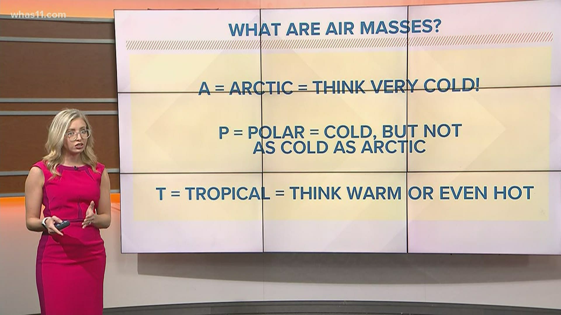
- A is for Arctic, which means very cold.
- P is for Polar. Polar air masses are cold, just not as extreme as Arctic.
- T is for Tropical, or warm and hot.
Next, we have the location where the air masses form.
- C is for continental. When you hear this, think dry.
- M is for maritime, wet or humid locations.
Now, let’s put them together.
- cA is Continental Arctic: dry and extremely cold
- cP is Continental Polar: dry and cold
- mP is Maritime Polar: wet and chilly.
- cT is Continental Tropical: dry and warm or hot, like a desert.
- mT is Maritime Tropical: warm and humid.
When these air masses collide and clash, that’s when we get storm systems, which could produce rain, snow, severe weather, and more. Here in the Ohio Valley, we often get a mix of these air masses throughout the year, which makes our weather very fun—and challenging—to forecast.
More Weather Wise:
►Make it easy to keep up-to-date with more stories like this. Download the WHAS11 News app now. For Apple or Android users.
Have a news tip? Email assign@whas11.com, visit our Facebook page or Twitter feed.