
LOUISVILLE, Ky. — “Baby it’s cold outside...”
Except not. If you’ve been outside at all in the last month and a half you’ve noticed that despite the calendar saying it’s winter, it certainly hasn’t felt like winter. Saturday, January 11th 2020 brought a new record high of 70° to Louisville breaking an old record high of 69° in 1890. Just the day before, on January 10th, Louisville reached 67° beating the 1975 record of 66°. Even today, January 15th, Louisville topped out at 67°, just one degree shy of tying the record of 68° in 1950. Christmas was the warmest ever at a sweltering 69°, and we’ve seen a slew of temperatures in the 60s during what’s supposed to be our coldest time of the year.
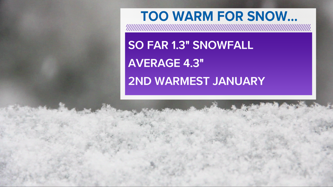
Warm January...for now: The First Alert Storm Team crunched the numbers and have found that through January 14th, Louisville is averaging a temperature of 47.2°. That’s a whopping 12 degrees warmer than normal and puts us on pace to be the second warmest January in the Derby City’s history. For perspective, the warmest January on record was an average temperature of 50° in 1880. The current standing for second warmest January is a tie between 1960 and 1890. Note that the average temperature is the average of both the daily high and low.
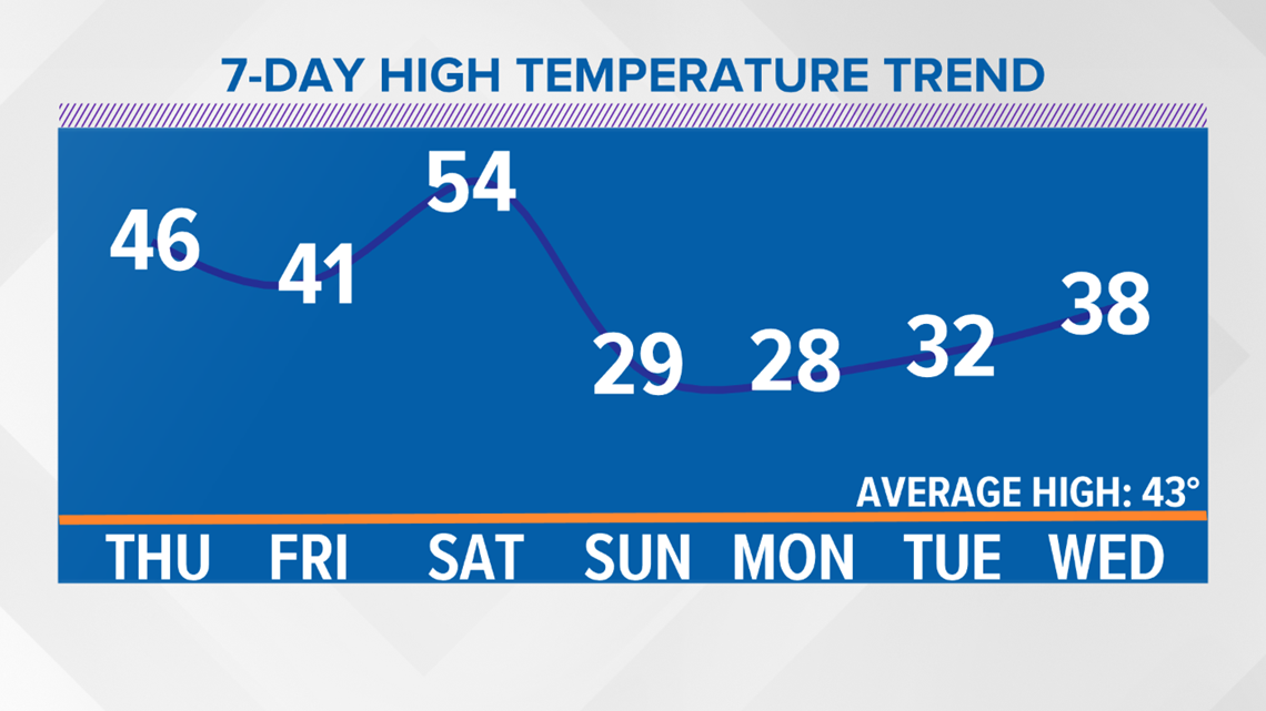
Yes, our average for 2020 is only through the first two weeks of the month, but an average temperature through two weeks of 47 degrees is very impressive. Will we end up being the second warmest, or even the warmest January ever? Probably not. A big cool down is coming for the latter half of the month and will bring us the coldest weather we’ve seen since November. We’ll get to that in a minute.

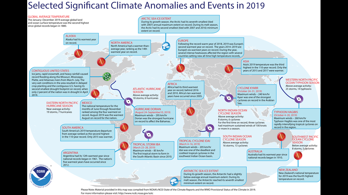
A warm 2019: Globally 2019 was the second hottest year ever according to NOAA. NOAA has been keeping climate records for the past 140 years. While North America had several months with much-below normal temperatures, we were more of the exception than the rule. In fact, a good chunk of North America experienced a cooler 2019 than average.
What’s “average”? NOAA uses a semi-rolling 30-year period to calculate what “average” is for temperature, rainfall, snowfall, etc. Our current 30-year period comes from 1981 to 2010. We’ll have new averages in 2021 (1991-2020). If you’d like to learn more about the yearly review of the global climate for 2019, visit this link from NOAA and NASA.

Back to that late-January cool down: Yes, the cold air has been bottled up in Canada and the Arctic for most of the winter, but that’s soon going to change. The almighty jet stream, which is stronger in the winter, will finally dip south and finally bring Arctic air back to the Ohio Valley. There’s a very complicated reason for our warm winter and involves global teleconnection patterns, various indices and oscillations and other technical and complicated stuff I won’t get into.
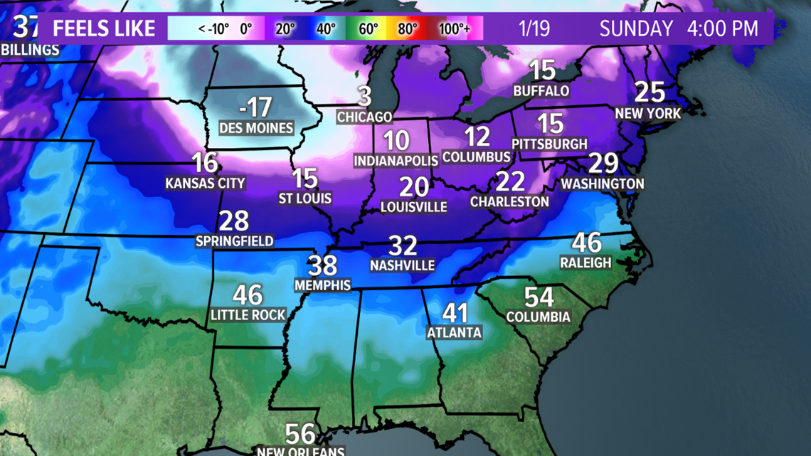
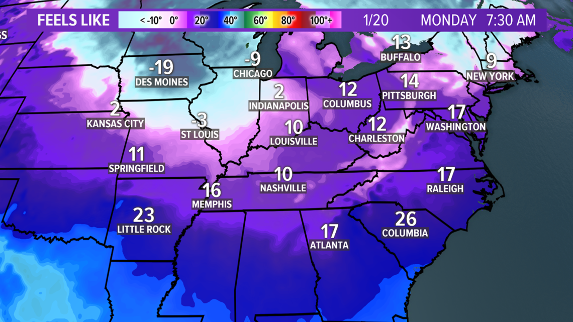
Just know that starting next week, specifically Sunday, temperatures will crash into the upper 20s and lower 30s for high temperatures. Should those high temperatures in the 20s verify, it would be our coldest days since November 12th, 2019. That was the last time we had a high temperature that failed to reach 32°. We may even see wind chill values in the single digits Monday morning!

With temperatures finally being cold, will we finally see snow? Not likely, at least not immediately. Temperatures will be as cold as 10 degrees below normal through at least Wednesday the 22nd and likely through the end of the month, but there aren’t any storm systems poised to impact our area through at least the next week and a half.
Through January 14th Louisville has seen just over 1 inch of snow at the airport (1.3” to be exact). That snow came late November 11th and into early November 12th. We saw the other whopping 0.3” on December 17th. Since then we’ve only seen a few measly snowflakes since. We normally average just under 4.5” by this time, so we’re running around 3” below normal. Not too awful, but we’ve got some catching up to do.

That said, another large and strong storm will bring ample rain to the Ohio Valley and snow to portions of the Midwest and Great Lakes. While we won’t see any snow fall in Louisville, we might still feel the impacts of snow in the Great Lakes! Thick snow cover results in colder air. A north wind would blow that cold air south and help contribute to our upcoming cold snap. In fact, the First Alert Storm Team is forecasting low temperatures Sunday, Monday, and Tuesday in the middle teens!

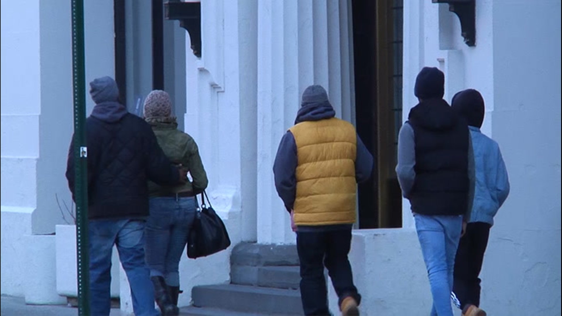
If you put them away, you better break out those thick winter coats! January is about to remind us that it IS winter.
Meteorologist Alden German
Facebook: Facebook.com/AldenGermanWX | Twitter: @WXAlden