
LOUISVILLE, Ky. — We saw an additional 1"-2" of rain across much of Kentuckiana Monday night and into Tuesday but despite all the rainfall, just minor flooding is expected into the mid-week along the Ohio and many area rivers across Kentucky and Indiana.
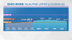
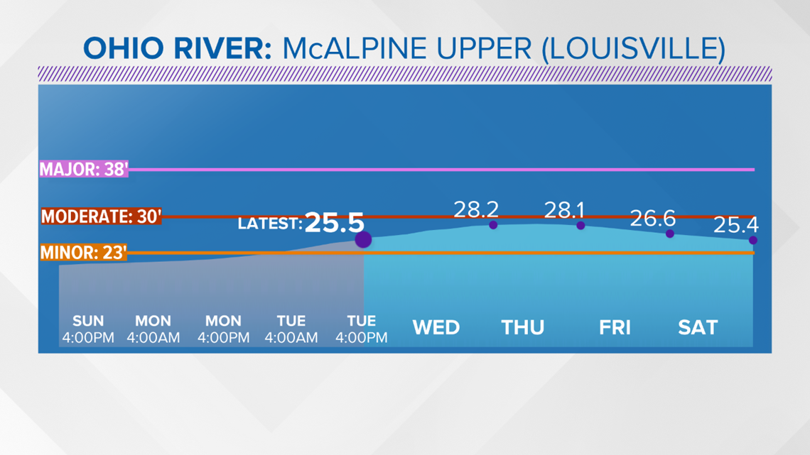
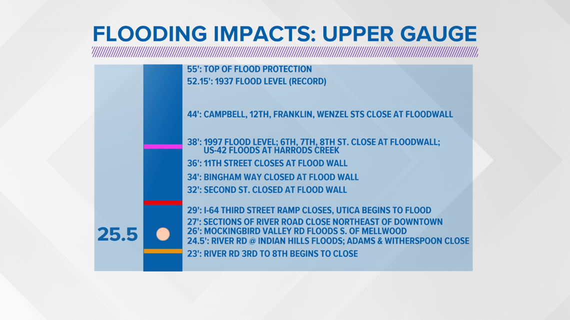
Just for some perspective since 2000 we have seen minor flooding along the Ohio River about every other year so this is not an unprecedented event. Of course the biggest impact in Louisville are areas along the waterfront and River Road, which typically closes in spots even with minor flooding. Below is a look at the expected crest (as of Monday afternoon) and the associated impacts at the McAlpine Upper Gauge...which impacts downtown Louisville and Jeffersonville Indiana. The crest numbers are slightly less than originally expected due to the rain falling right over the Ohio River basin and not upstream.

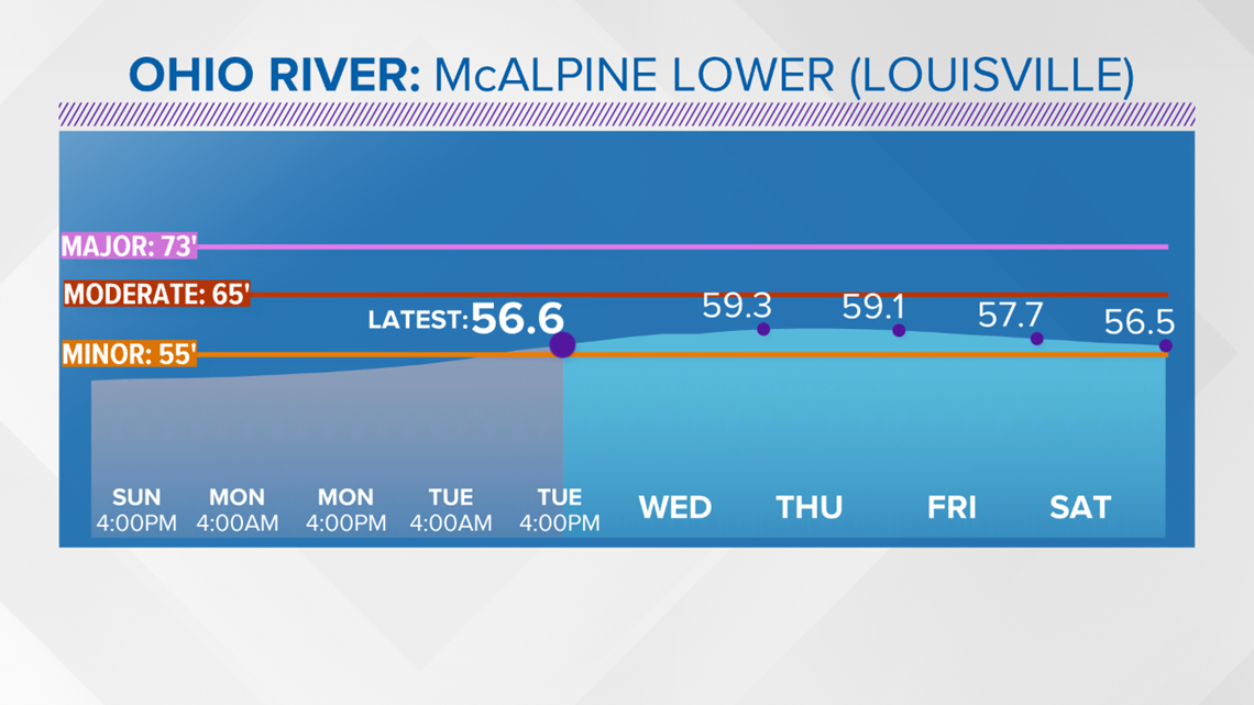
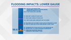
Below is a look at the expected crest (as of Monday afternoon) and the associated impacts at the McAlpine Lower Gauge...which is downstream and BELOW the Ohio River lock, which impacts New Albany and Clarksville Indiana.

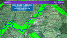
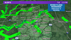
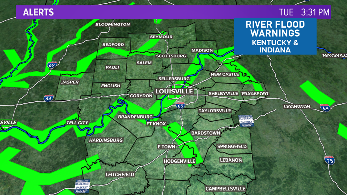
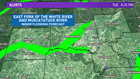
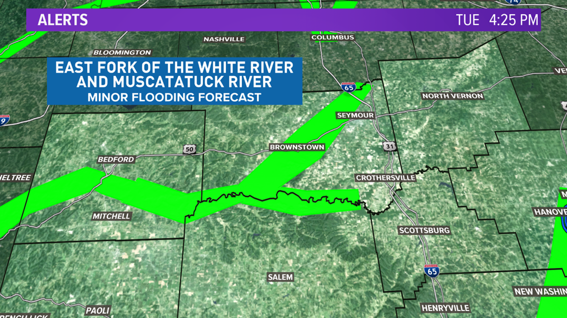
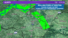
There are flood warnings and advisories for many rivers and streams across Southern Indiana and Central Kentucky.

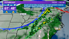
We finally get a chance to dry out into the mid-week with dry weather expected Wednesday and most of Thursday before another cold front brings some additional rain chances Thursday night and into Friday morning.

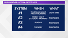
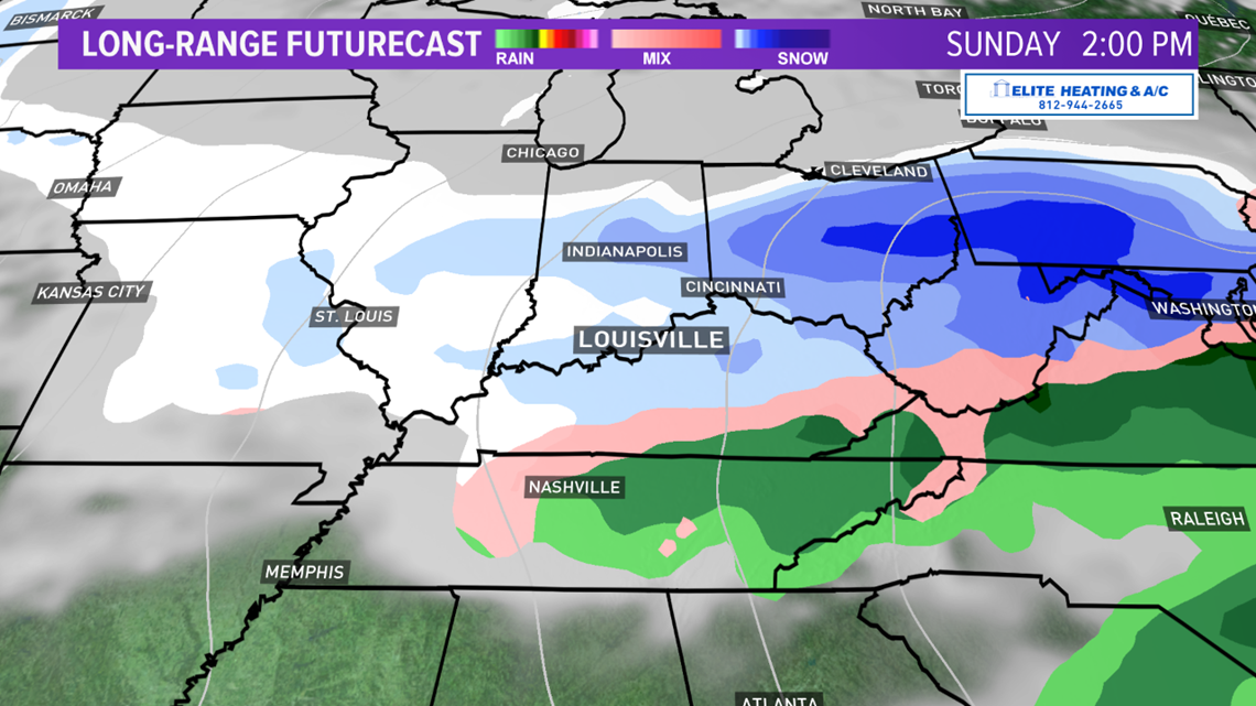
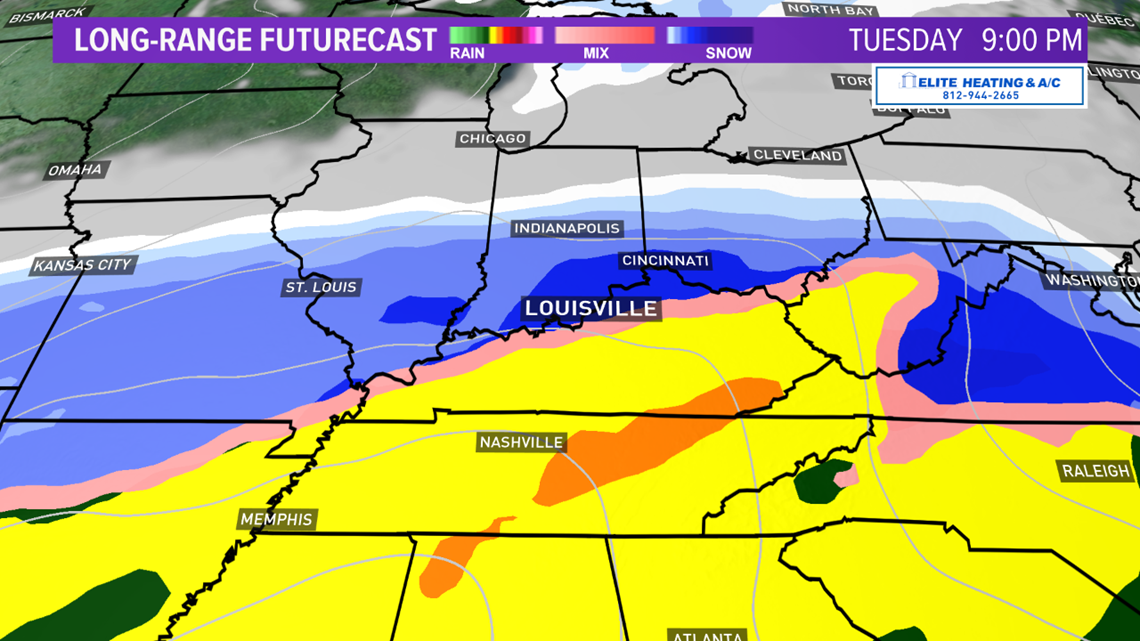
Our weather pattern is going to stay very active over the next 7 days with FOUR different systems rolling through our region.
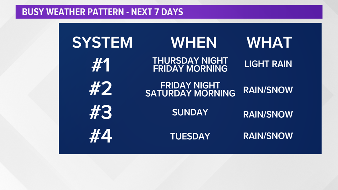

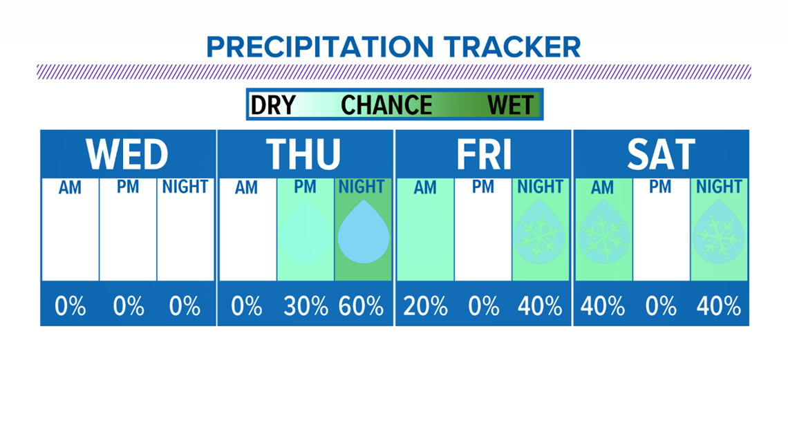
Temperatures are expected to be a bit cooler with some of the systems over the coming week so there may be a winter element in the precipitation chances.
Stay with the WHAS11 First Alert StormTeam for the latest on the flooding situation along the Ohio River and many area rivers and streams, along with our continued active weather pattern to come.
Meteorologist T.G. Shuck