
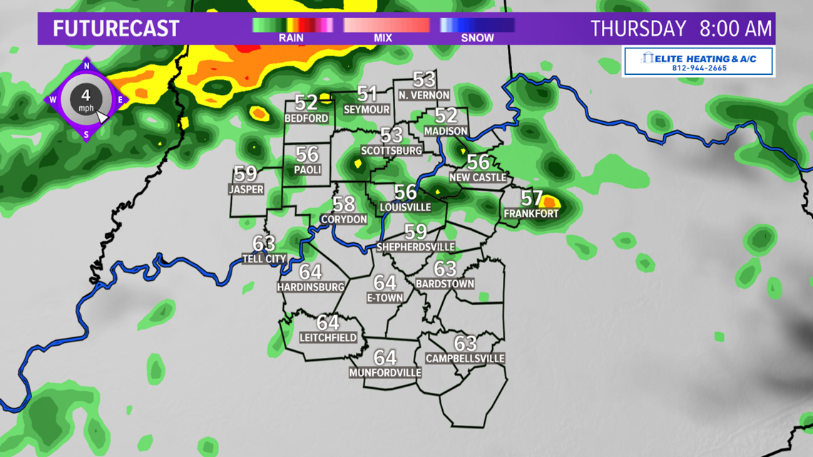
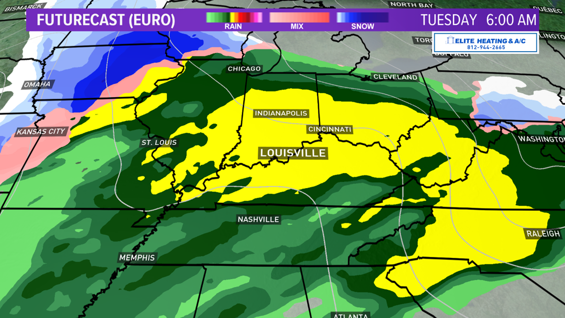
LOUISVILLE, Ky. — Wednesday turned out pretty damp across Kentuckiana with some solid rain across the area, although a good chunk of the area saw a brief break during the afternoon hours. Unfortunately, our rain chances are expected to continue through Thursday as several waves of energy slide along a stationary front while plenty of moisture streams up from the south.
Even though the activity may be more scattered in nature Thursday, some locally heavy rain will be possible. As the main surface cold front approaches Thursday afternoon, there is the chance the rain may end and we could see a few breaks in the clouds. Highs are expected to be in the upper 60s and low 70s, which would break record highs in a few locations.
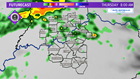
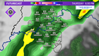

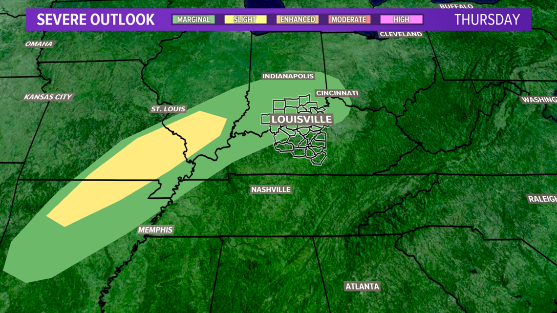
If we do see that clearing, we could see a strong line of thunderstorms into the late afternoon and early evening hours. While the threat for severe weather isn't widespread, we will have to watch for the potential of a few strong storms. The Storm Prediction Center has the best chances for organized severe weather just to our west on Thursday with the "Slight Risk (in yellow...Level 2 of 5) with the northern half of Kentuckiana in a "Marginal Risk" (in green...level 1 of 5).
► Download the WHAS11 News App and get weather alerts on your phone.Click/Tap here to download for iPhone or Android

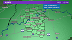
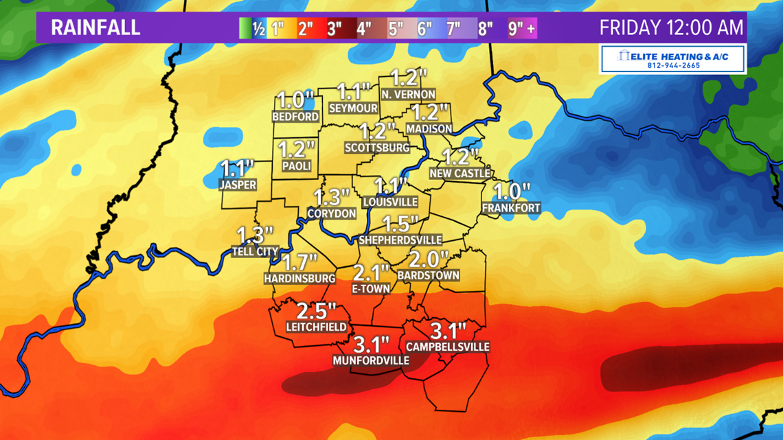
We could see an additional 1"-3" of rain across Kentuckiana through Thursday thus the continued concern for flooding around the area. A Flood Watch is out for the entire area until 1 AM Eastern Friday morning.


Once the front moves through Thursday evening, expect a BIG drop in temperatures and we shift from spring to winter temperatures over just a few hours. By the time folks wake up Friday morning across Kentuckiana, temperatures could be a solid 40 to 45 degrees COLDER than what we'll see Thursday afternoon.
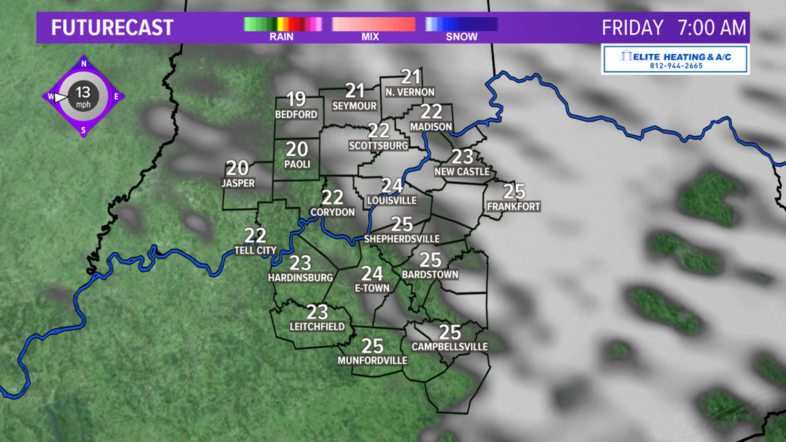
The good news is that we will see a dry stretch of weather into the first half of the weekend, which is much needed given the recent rains and more expected next week but it will be pretty chilly. Afternoon highs will only be in the low and mid-30s...and it will be a very cold Saturday morning with lows dropping all the way into the teens!

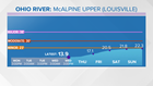
Because of the expected rainfall through Thursday, the McAlpine Upper gauge of the Ohio River (which impacts downtown Louisville) is forecast to be just over 22 feet by late Sunday...which is in the high end "Action Stage" and just 1 foot below "Minor Flood Stage" which is at 23 feet. Keep in mind that at 23 feet, some sections of River Road are closed from 3rd Street to 8th Street, Eifler Beach and Juniper Beach areas are cut off. Parts of Campbell St., Frankfort Ave., and Mockingbird Valley Rd. close. Right turns onto River Rd. from the I-64 ramp at 3rd Street are prohibited. Of course, this bears watching for a potential impact.

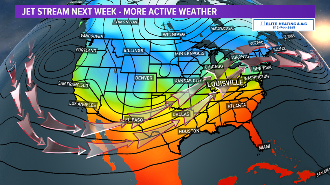
Unfortunately, our active weather pattern with more Pacific moisture is set to return by the end of the weekend and through the first few days of next week. Additional rainfall could exacerbate the flooding potential, especially for area streams and rivers through next week.
The overall pattern of an active southern stream pulling moisture all the way from the Pacific Ocean and into the Eastern U.S. looks to stick around over the next week or so with temperatures in general above average for mid to late February.
Stay with the WHAS First Alert StormTeam and WHAS11 on-air and online for the latest on this active weather pattern to come.
Meteorologist T.G. Shuck
► Join our WHAS11 StormTeam Weather Spotters Facebook group. Or, if you love weather photography, join our Kentucky/Indiana Cloud Watchers Facebook group.