LOUISVILLE, Ky. — Spring has sprung and Louisville faces its first potential severe weather event of the season starting Thursday.
Forecast at-a-glance:
- Warm weather continues Thursday
- Severe weather possible Thursday evening and night
- Breezy conditions continue into the weekend
Weather setup: Our next rain-maker was situated just east of the Rocky Mountains early Wednesday morning. This storm will move across Texas throughout Wednesday before it reaches the Gulf Coast late Wednesday night. From there it’ll turn and move northward up the Mississippi River Valley and bring an abundance of moisture that will stream into the Ohio Valley. This will act as the fuel source for this storm system.
Rain is set to come in two waves: first Thursday morning, then again Thursday evening, and the first part of the night. Wave #1 will move in from the southwest in the pre-dawn hours. Thunderstorms are expected with this first wave, but the severe weather threat at that time will be minimal. That said, heavy rain is still likely in some locations and could pose a localized flooding threat.

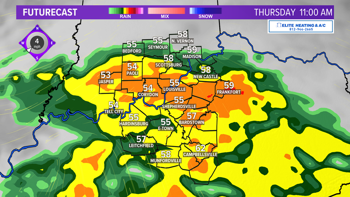
After that first round of rain ends after noon, we’ll get a bit of a break for a few hours, but scattered showers will remain likely. This will allow the ground and waterways time to absorb and filter water from earlier heavy rains.
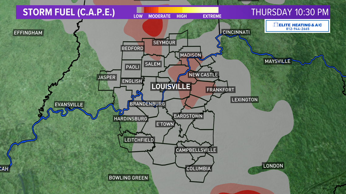
This break is going to be important: How much will the atmosphere recover? Any breaks in the cloud cover during that time will allow the atmosphere to become unstable again and provide later storms energy to be severe.

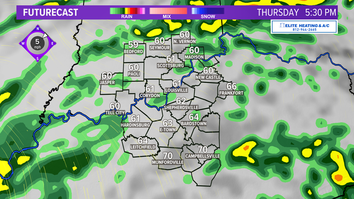

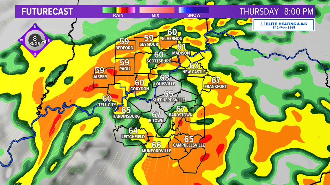
The second round of rain and storms will begin into evening. Models as of Wednesday afternoon keep the stronger activity south of Louisville and the Parkways, but severe storms could develop as far north as the Ohio River.

The Storm Prediction Center in Norman, Oklahoma placed our entire coverage area in risk level 2 of 5 for severe storms. The main risks would be heavy rain, damaging winds, small hail, and brief, spin-up tornado especially in any line or cluster of storms ahead of the cold front.

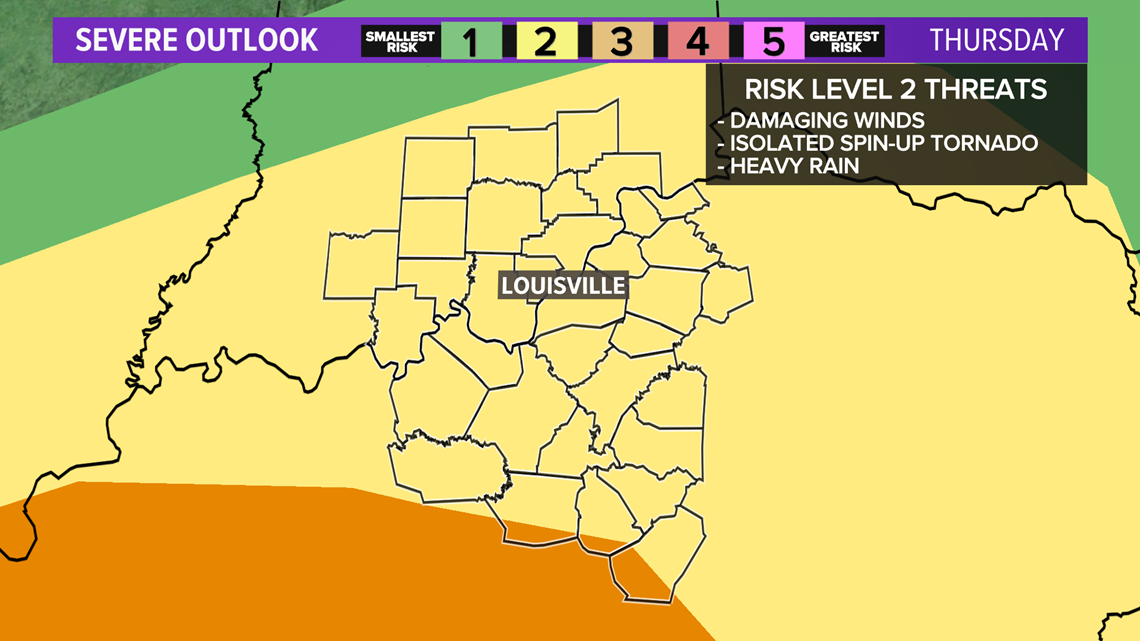

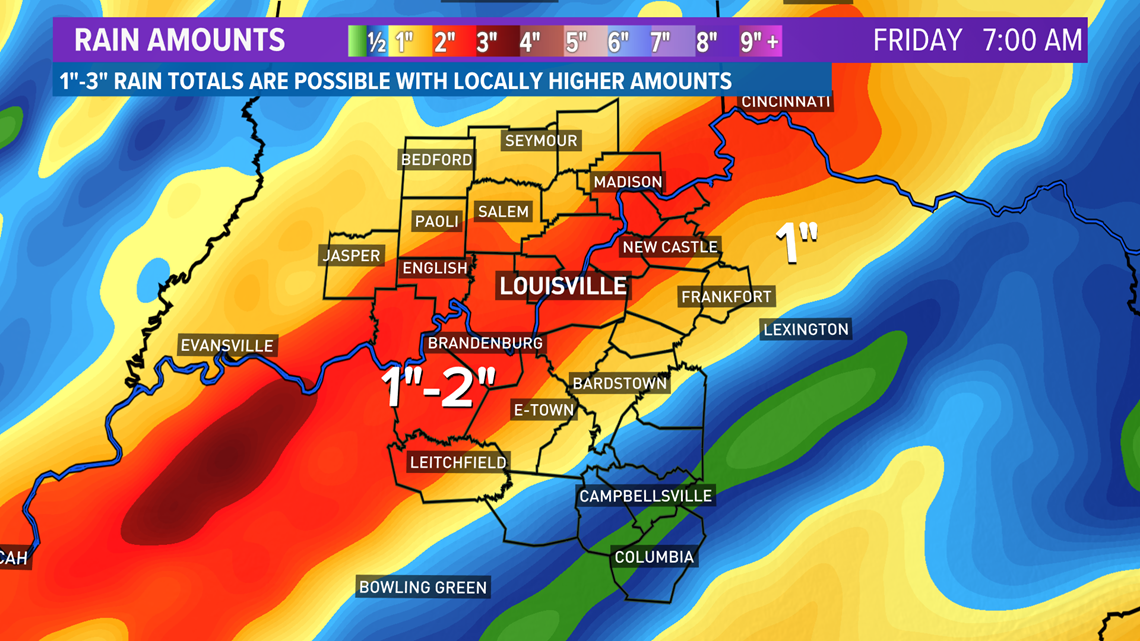
Another concern is the threat for some localized flooding issues given the expected 1"-2" rainfall totals with higher amounts in a few locations.

Long Term: After the storm passes us Thursday night a cold front will sweep in and bring cooler air for Friday. Temperatures back off to the lower 60s which is closer to climatological normal. Windy conditions will continue from the west 15-20 mph.
We’ll see a mix of sun and clouds Friday afternoon. By Saturday we warm into the middle 70s briefly underneath a mostly sunny sky – nice spring weather for the weekend! Half of it at least. Late Saturday night and early Sunday more rain showers are expected with another cold front.
Meteorologist Alden German/Meteorologist T.G. Shuck
Facebook: Facebook.com/AldenGermanWX | Twitter: @WXAlden
Make it easy to keep up-to-date with more stories like this. Download the WHAS11 News app now. For Apple or Android users.
Have a news tip? Email assign@whas11.com, visit our Facebook page or Twitter feed.