LOUISVILLE, Ky. — Spring 2020 is nearly a month old (although recent weather would imply otherwise), and severe weather season is ramping up. Easter tornadoes ripped through the southeast producing massive hail, floods, damaging winds, and several tornadoes, some of which were monster in size.
An EF4 tornado two miles wide tracked for nearly 70 miles in southern Mississippi. It was the largest tornado in Mississippi’s history. What kind of storm can create such a monster tornado? A supercell.
What is a supercell?
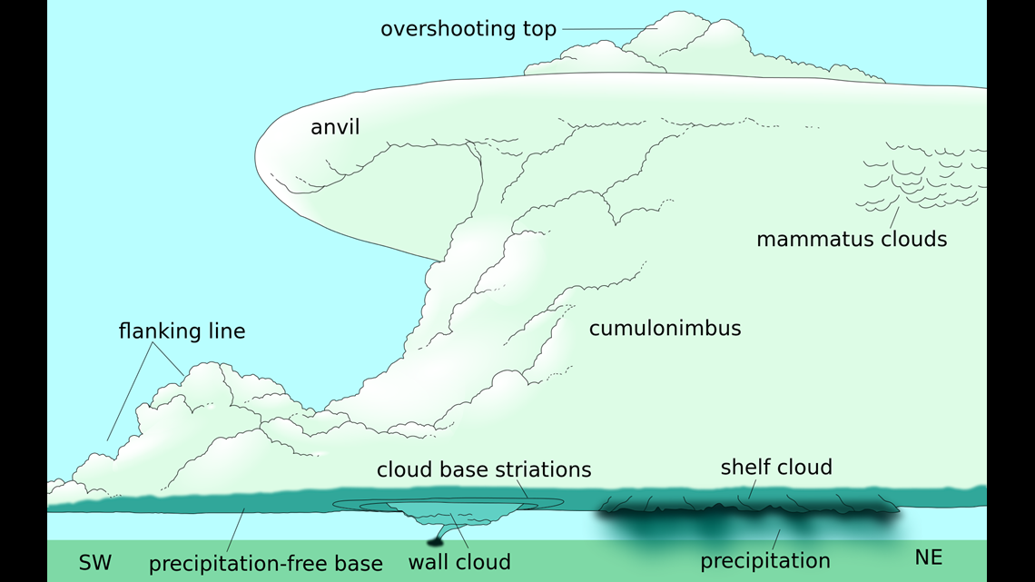
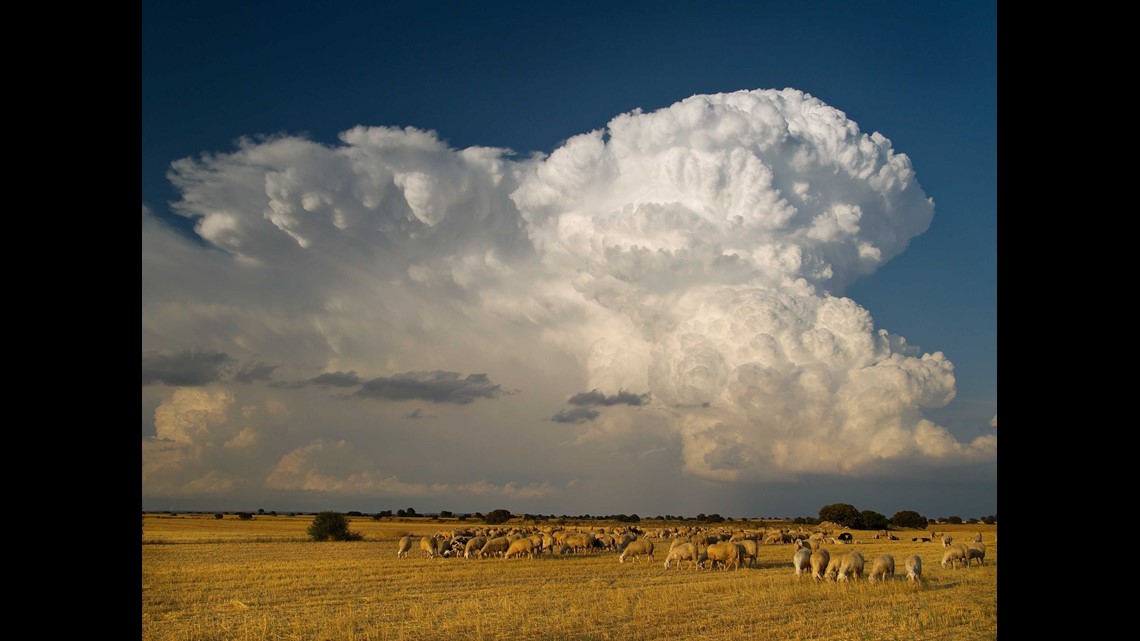
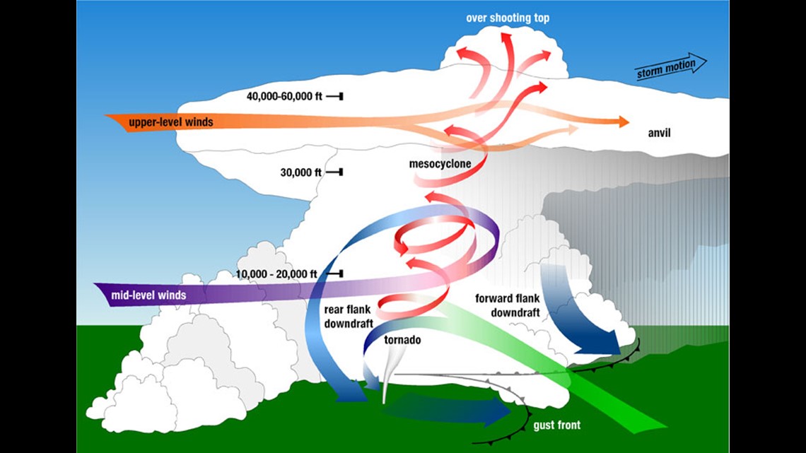
Supercells are often large, powerful thunderstorms that most commonly produce tornadoes (but not always). Even if they don’t produce a tornado, they can still be extremely dangerous. While most thunderstorms are generally short-lived, supercells can persist for a long time in ideal-scenarios. Below is a simplified diagram of a supercell. Let’s break down the basic anatomy of a supercell thunderstorm.

Cumulonimbus
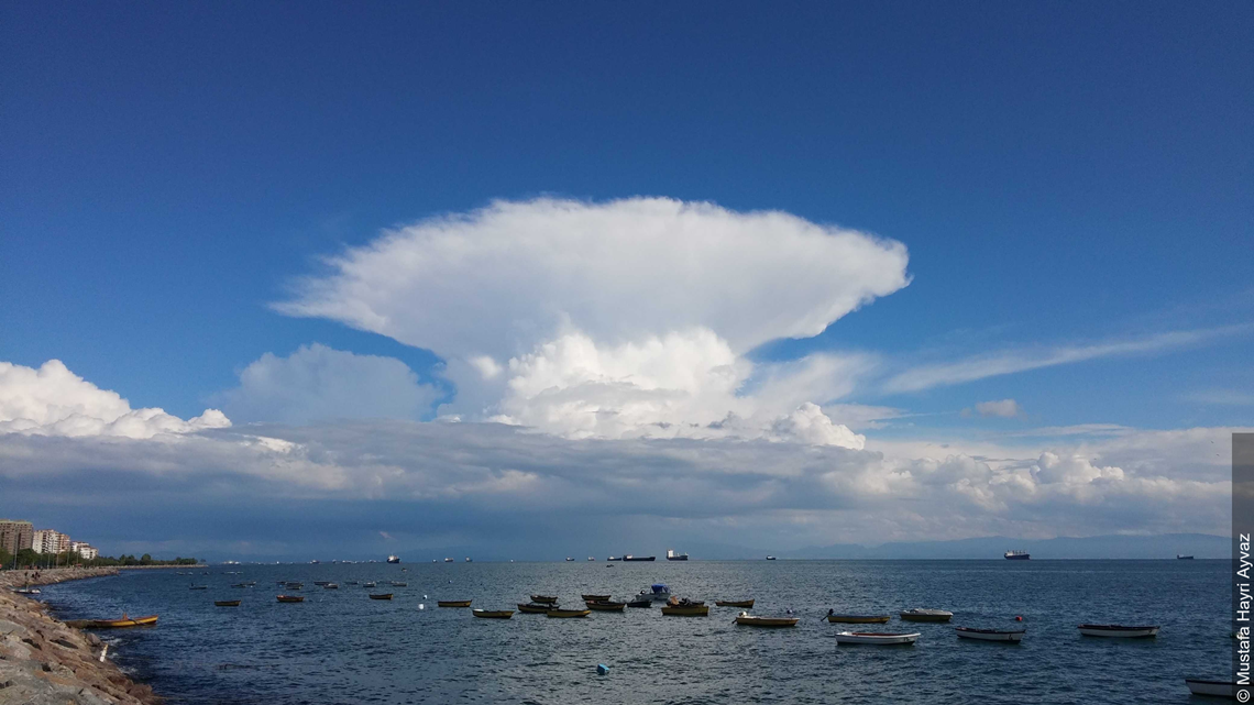
In a previous blog we discussed the “four core” cloud types and other cloud facts. By now we should know that cumulonimbus is the biggest cloud by vertical extent. The cumulonimbus is large and billowing and is home to most other features found in a supercell, including the updraft and downdraft.

Updraft
The updraft forms when a parcel of warm, moist air rises through the cooler air that surrounds it (think of a hot air balloon). It eventually reaches a point where it condenses, and a cloud develops. Strong updrafts can have upward-moving wind speeds over 100 miles per hour! This is part of the reason why aircraft actively avoid them. If air is sufficiently warm, or the environment sufficiently cool, this process continues until precipitation can form and falls. Now the downdraft is born.
Downdraft
The downdraft is a result of falling precipitation which cools the air. Cool air is more dense than warm air, so it sinks. Rain in the downdraft can be torrential and often mixes in with hail. Downdrafts can also yield extreme winds, potentially causing significant tree and structural damage. Pilots also actively avoid these.
Overshooting Top
The overshooting top is the little “button” of cloud that’s higher than anything else. There’s a reason for this. Sometimes the updraft of a thunderstorm is so strong that it penetrates the tropopause – the boundary between the troposphere (where we live) and stratosphere (where the famous ozone layer is found). This region of the atmosphere is more stable than the troposphere, meaning the average temperature begins to increase with height. The parcel of air that soars into the tropopause quickly finds that it’s the same temperature as the surrounding air, if not a little bit cooler, so it starts to sink. An overshooting top is a good indication that a supercell is particularly strong!

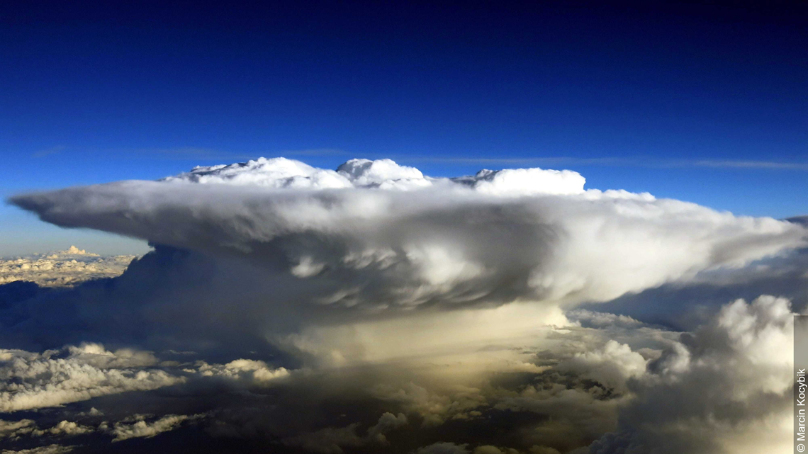
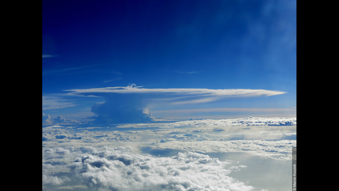
Anvil
The anvil is the large, flat cloud that spreads across many miles. Anvils result from precipitation that’s transported so high up it doesn’t have the opportunity to fall to the ground, so it condenses into a cloud and upper level winds fan it out ahead of the storm. Just looking at an anvil can give you an idea of what direction winds are blowing at the top of the thunderstorm. Air is very cold at the anvil layer, so the cloud is largely made of ice crystals.


Mammatus
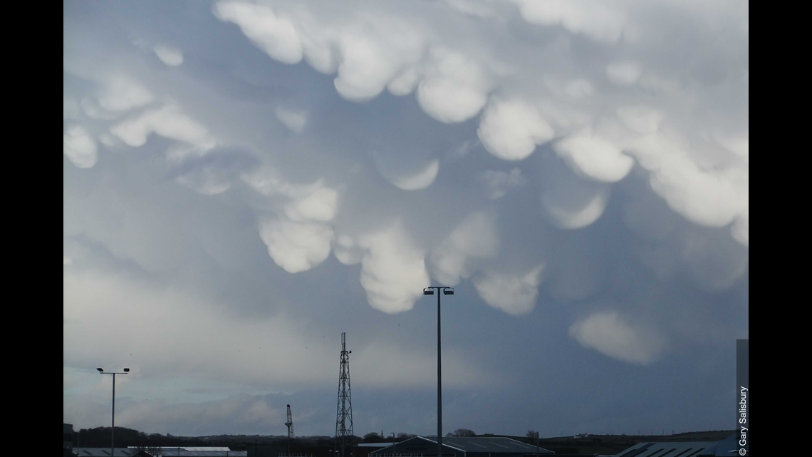
Mammatus are one of the most beautiful cloud formations on the planet. The name comes from the Latin word mamma, which means udder. Mammatus are often associated with the anvil. While mesmerizing to look at, they are somewhat poorly understood; meteorologists are not entirely certain why they form. While we do know that mammatus are heavy with moisture, we don’t know why they come to take the appearance they do. There are several hypothesizes, but nothing concrete quite yet.

Rain/Hail Core
The rain and hail core is the region of heaviest precipitation, be that rain or hail. It’s often found just outside of the updraft and can produce torrential amounts of rain leading to flash flooding.
Forward/Rear Flank Downdrafts
There are multiple downdrafts in a supercell. The forward flank downdraft (often abbreviated FFD) forms from the rain-cooled air of the main downdraft hitting the surface and spreading out in all directions. This is called an outflow. Outflows usually race out just ahead of the supercell and help force warm air upward, keeping the thunderstorm alive.
The rear flank downdraft (RFD) develops when winds in the middle and upper levels of the atmosphere hit the back side of the updraft. The updraft is strong enough that some of that air is pulled in, bring some precipitation with it, and wraps around the updraft, while other air is deflected down to the surface. The air deflected downward compresses and warms, so the RFD is often dry. RFD is also an important component in the formation of tornadoes.

Flanking Line
A bit more technical term, the flanking line is a line of developing cumulus clouds away from the main updraft of a supercell. They can feed into the main updraft and later produce rain themselves. The flanking line is formed in part by the RFD.
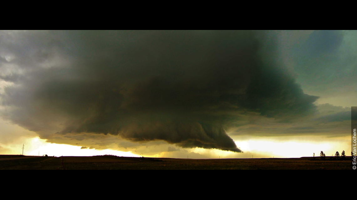
Wall Cloud
One of the scariest looking features of a supercell is a wall cloud – if it forms. Not all supercells create wall clouds, but if it does, it’s a sure sign that the supercell is strong and healthy. These are found in the updraft of a supercell due to quickly rising air that cools and condenses into a cloud. It’s close to the surface, too. If a tornado develops, it’ll happen underneath the wall cloud.

As you can see, there is a lot that makes up a supercell thunderstorm. They’re powerful forces of natures that can also be quite striking to look at it. If we have a supercell in our region soon, hopefully you can look at it and identify some of these features and know how they came to be!
All photos courtesy of the World Meteorological Organization's International Cloud Atlas.
Meteorologist Alden German
Facebook: Facebook.com/AldenGermanWX | Twitter: @WXAlden