LOUISVILLE, Ky. — The weekend is coming to a close and thankfully things are looking up. A dreary and nasty Saturday will give way to much nicer weather for today and Monday before things start to get really messy again before Thanksgiving. I'm going to enjoy the temporary quiet before the weather center gets really busy dealing with these storms.
Temperatures will recover a little bit today as clouds decrease into the afternoon leaving us with mostly sunny conditions. A west-southwest wind will help, but we'll still be well below average. Louisville's high temperature Saturday (44°) was 10 degrees below normal. Highs to end the weekend should max out in the upper 40s across the region getting close to 50 degrees.
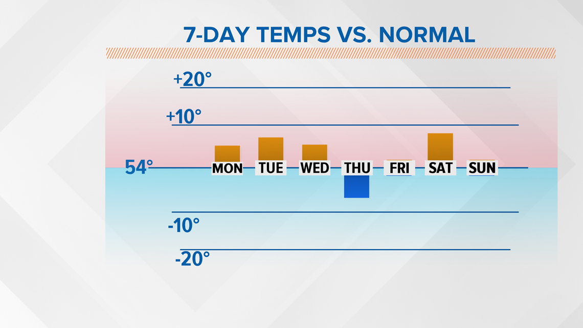
The sky will remain mostly clear tonight, and Monday is looking spectacular. Plenty of sunshine and a southwest wind will push us well over 50 degrees and into the upper 50s for high temperatures. Yes, that means we'll actually be above average for once (Figure 1). We'll be even warmer on Tuesday as we try to crack the 60 degree threshold. There's a catch with those 60s, however. Models indicate that the warm air might arrive in the middle of the night, which would mean one of those odd instances when the high temperature occurs in the middle of the night before dropping through the rest of the day.

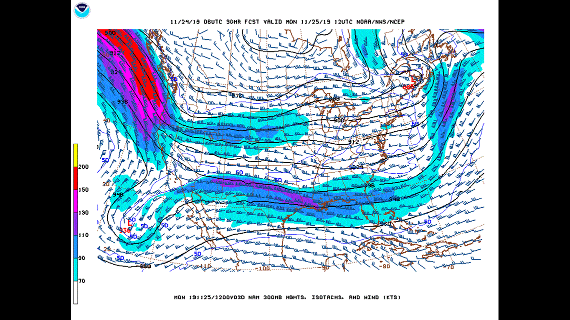
The weather setup: As discussed yesterday, we're currently in a northwest flow which will turn zonal (west-to-east) come Monday. However, broad cyclonic flow over the Pacific Northwest will result in a deeply digging trough in the West Coast which will eventually form a storm in the southern Rockies. That storm is then going to move through the Midwest (where a snowstorm is expected in parts of Nebraska and Colorado) into the Great Lakes (Figure 2).

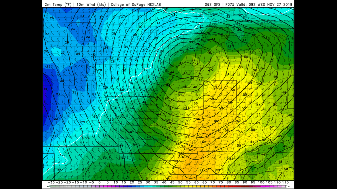
This storm is shaping up to be a mammoth. As the storm moves into the upper Midwest, it will continue to strengthen. All models are indicating a central pressure of 990 mb or less by late Tuesday night! Check out the surface map in Figure 3. This is a classic example of a mid-latitude cyclone. As I also talked about yesterday, the black circular lines are isobars and represent lines of equal pressure. The closer those lines are to each other, the higher the winds. We're still expecting windy conditions Wednesday with sustained winds from the south between 15-20 mph occasionally gusting to nearly 40 mph. Hang on to your hats and umbrellas tight! We'll begin to notice the winds of change Tuesday afternoon as conditions get breezier.

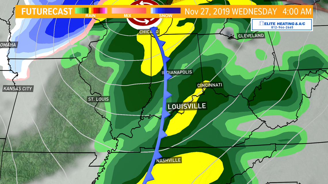
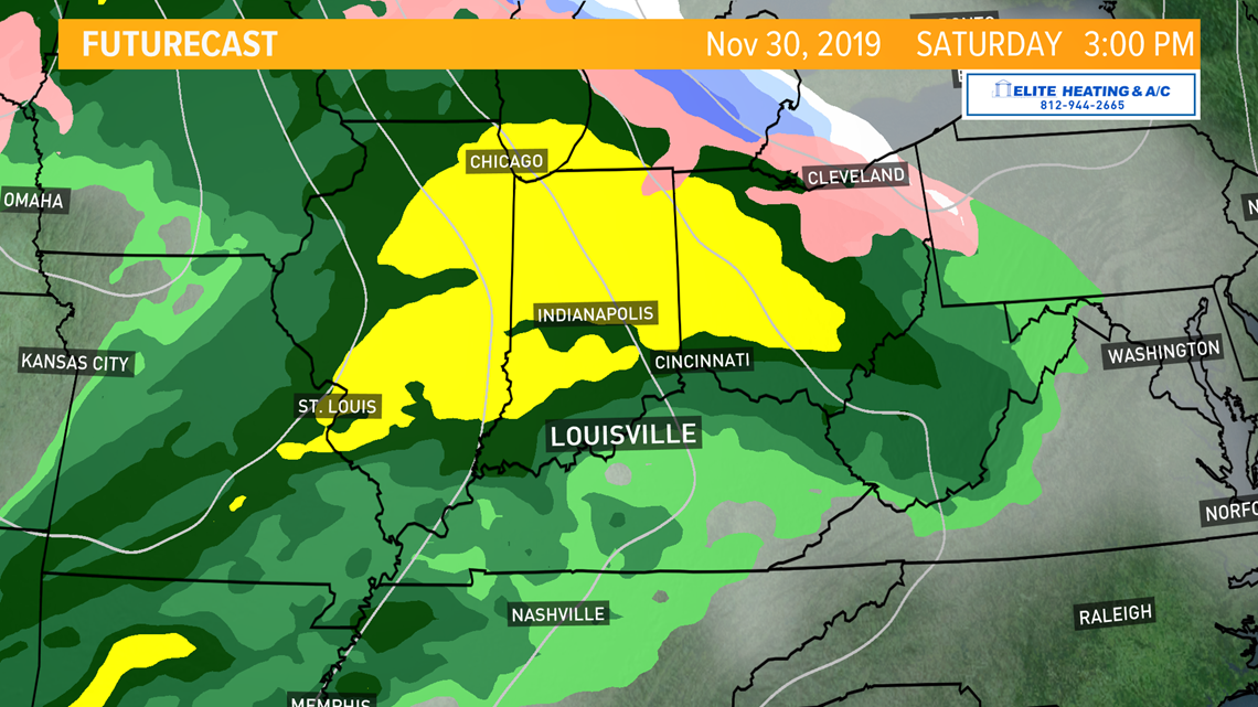
Rain looks quite likely for Tuesday. A few of the higher resolution models give us a couple passing rounds of rain with a dry spell in the middle of the day, while the other models produce rain throughout much of the day. Regardless, pockets of light to moderate rain will progress as a cold front slides through the area late Tuesday night. We'll see plenty of rain develop ahead of the front and it will linger into early Wednesday morning. A few thunderstorms - non-severe - are also possible Tuesday night. After some lingering morning precipitation, Wednesday looks afternoon and evening looks dry as the rain marches east (Figure 4).
Traveling Tuesday? Those wiper blades will be getting a workout if you're leaving early and headed east. If you're trying to fly to portions of the Midwest there could be some delays thanks to snow. If you're traveling anywhere in the Ohio Valley Wednesday, conditions might be wet depending on which direction you're headed but generally okay if you're driving. Flying, on the other hand, might also see some problems to our east. Just a heads up.

How much rain? Things are looking wet for Tuesday and Wednesday. Models as of Saturday night indicate rain totals up to 3/4" possible across the entire Kentuckiana region with a potential bulls-eye right along the Ohio River. That's just the first round of rain. The second round of rain late Thursday won't add as much, maybe an additional tenth of an inch.
The third round comes starting later Friday and into next Saturday. This storm system is shaping up to be another whopper like the one we're anticipating for Tuesday and Wednesday. There's still quite a bit of time between now and then, and we have to focus on the early week storm before directing our attention to the late week one.
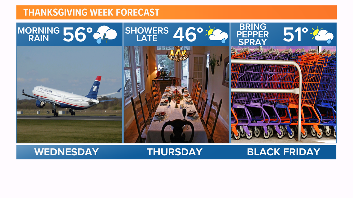
Thanksgiving: The weather for turkey (or ham if you're my family) isn't looking too bad. We'll be much cooler as temperatures fall back into the middle 40s for highs. Rain should hold off until the evening and even then it will only be a few passing showers with minor accumulation. Expect mostly cloudy sky cover during the day.

Heading into December: This active weather pattern continues for a while. Several disturbances in the atmosphere to close November and start December bring multiple opportunities for rain to our parts of the country. Much is still uncertain, particularly the timing and track, for next weekend's rainmaker. The European model holds rain off until late Friday evening into early Saturday. The GFS, on the other hand, brings that rain in several hours earlier beginning in the afternoon Friday. The Canadian model solution is similar to the European (although it's Saturday evening run appears much different than the other two), so for right now I'll say that precipitation will hold off until late Friday into Saturday.

Meteorologist Alden German
Facebook: Facebook.com/AldenGermanWX | Twitter: @WXAlden