LOUISVILLE, Ky. — Saturday certainly wasn’t the nicest start to the first weekend of the new year, but the good news is Sunday will be much nicer! If you didn’t get outside Saturday (and honestly, who could blame you), you’ll have a much nicer opportunity to close the weekend.
Forecast at-a-glance:
- Sun returns Sunday, but it will be windy
- Monday will be nearly cut-and-paste of Sunday, but showers are possible later
- Tuesday might bring some more showers to the region
- Next weekend is looking very wet
Weather setup: The forecast is still on track compared to earlier Saturday. Rain and snow showers have largely left the area and Saturday night will be dry with clouds slowly decreasing. The break up in cloud cover will allow us to cool off to the upper 20s-to-low 30s for overnight low temperatures.
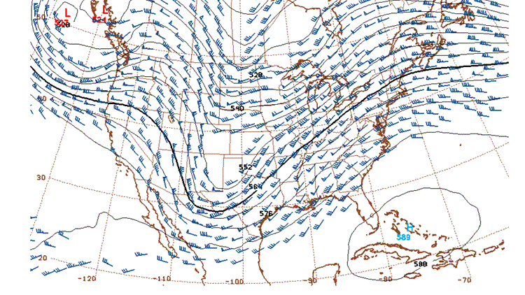
Sunday is going to be worlds better than Saturday was. A broad area of high pressure and generally zonal flow aloft will allow for a mostly sunny afternoon. That said, winds pick up for the end of the weekend as a storm riding the United States-Canada border drags a cold front east and pulls in warmer air from the south (Figure 1). That warmer air will help to – obviously – raise temps to the lower 50s, but it comes with southwest winds between 15 and 25 mph, occasionally being gustier than that. A dry cold front will also move across the Ohio Valley late Sunday afternoon, bringing a few more clouds with it.

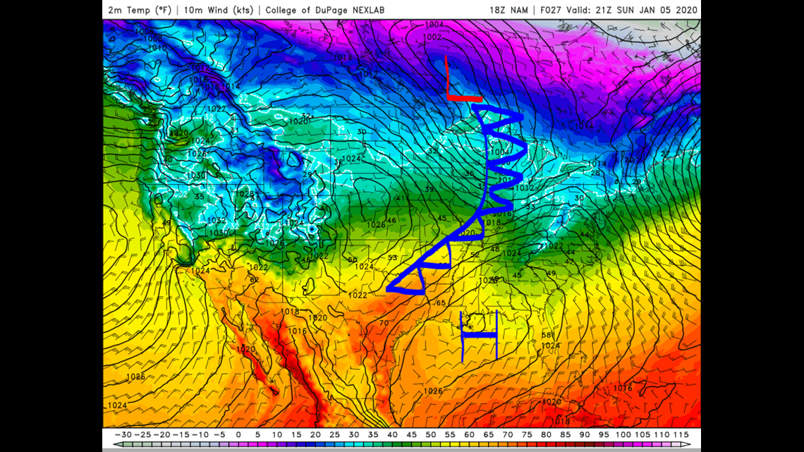
We remain under the influence of high pressure and zonal air aloft to start the new week. Remember, a zonal air pattern generally means unexciting weather. It won’t stay too inactive for long as an short wave in the upper levels will quickly move overhead late Monday and through Tuesday (Figure 2). Models have begun to back off the precipitation for Tuesday, especially the Saturday afternoon run of the GFS. I’ve lowered POPs (probability of precipitation in the weather world) for Tuesday. Kentucky is best suited to see anything of note, with Indiana largely being dry (Figure 3).

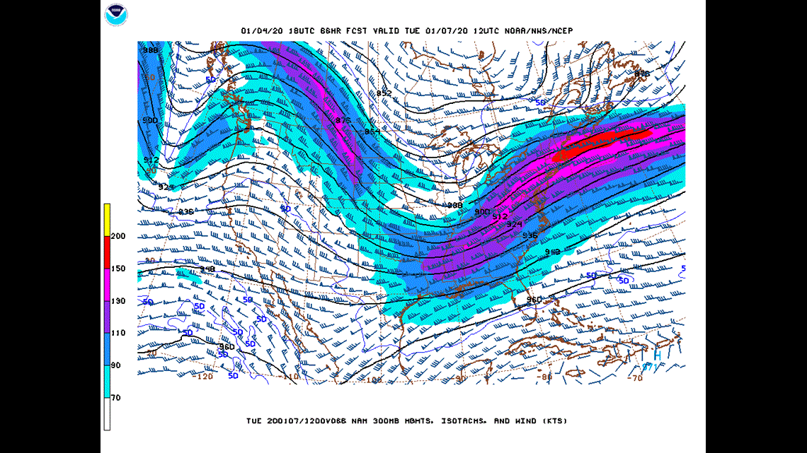

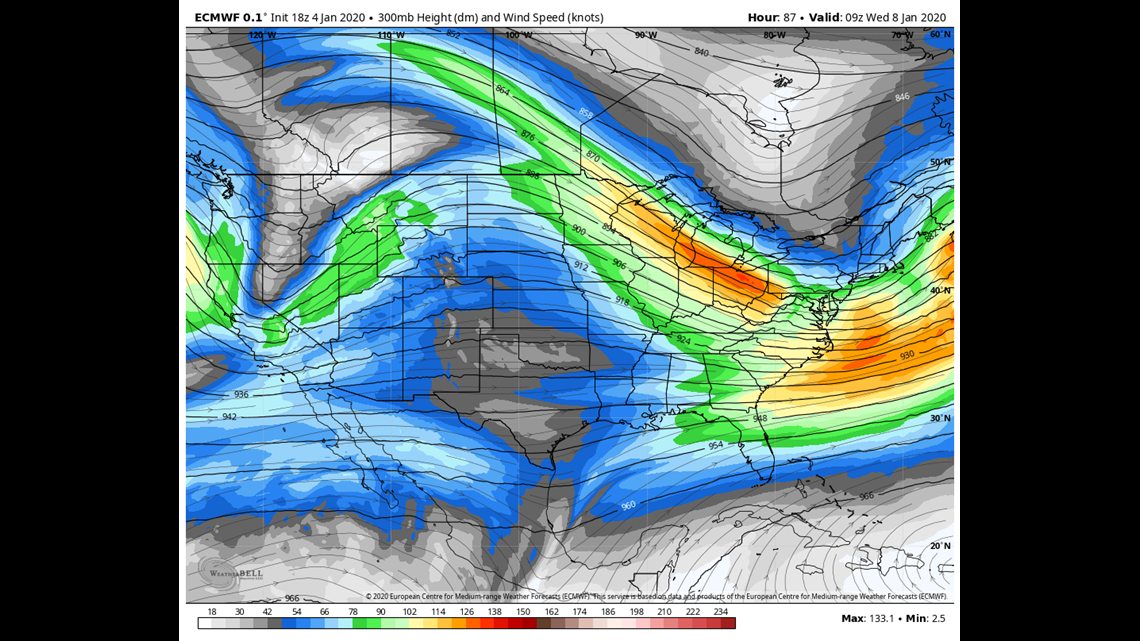
Another large area of high pressure Wednesday will again bring us a mostly sunny sky to the Ohio Valley, although temperatures Wednesday (and Tuesday for that matter) will be slightly cooler than the prior couple of days hanging out in the middle 40s. Jumping back to the “land” where the jet stream flies we note a short wave coming onshore of the Pacific Northwest (Figure 4). This is going to be our next major storm system, and it’s looking very wet.

Next weekend looks very wet: The shortwave that enters the Pacific Northwest late Tuesday will deepen significantly by late Wednesday and interact with a subtropical jet in the Pacific Ocean, helping to strengthen it further. As the storm nears it’s going to face an area of high pressure pushing back on it (Figure 5). That’s where the forecast gets interesting. This area of high pressure will act as a resistance to the approaching trough, slowing it down. This would mean that the approaching surface low would take a while to move out the area setting the stage for a potentially very wet weekend (Figure 6).


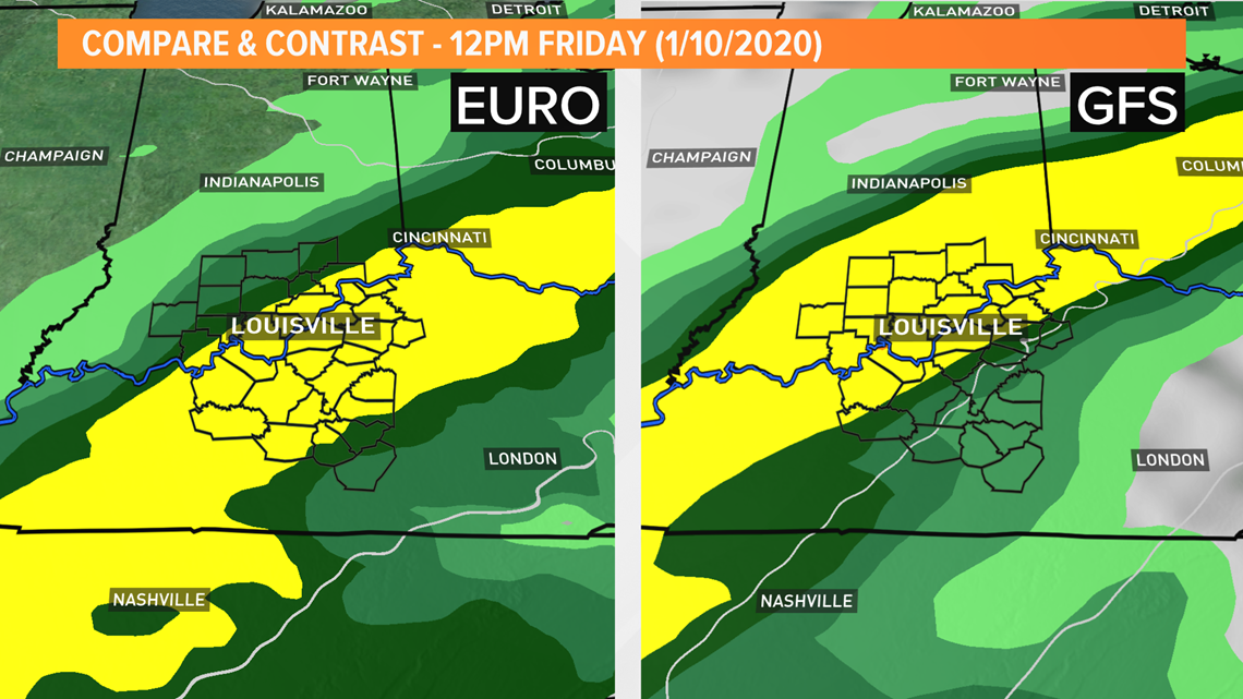
Current signs are that rain showers approach late Thursday with the main action arriving Friday and lasting through possibly Saturday. It’s important to remember that this is still a week out – a very long time in meteorology! However, there is good agreement among models about next weekend, and they’ve been persistent. Confidence his high that we’ll see rain next weekend. The question is how much rain, when will the rain start, how long will the rain last and the exact track of the surface storm.
It hasn’t even been a full week into January and the weather is already causing headaches. Stay tuned.
Meteorologist Alden German
Facebook: Facebook.com/AldenGermanWX | Twitter: @WXAlden