LOUISVILLE, Ky. — The weather center has been pretty relaxed since our first measurable snow last Monday. The forecast will remain unremarkable through the first half of next week before our next opportunity for rain arrives Thursday.
Note: This blog is going to be fairly technical. I want to give the reader an idea of how we (or at least I) analyze maps in hopes of showing you all the different variables meteorologists have to take into consideration when making a forecast. I'll try to provide layman terminology so it doesn't sound like a college lecture, as well as links for more information.
Let's jump in...
The weather set up: The general weather pattern is a northwest flow across much of the continental U.S. A couple of shortwaves embedded in the general flow will try to squeeze out sprinkles or a couple showers late Sunday and Tuesday, but moisture is lacking and I believe the majority of us will stay dry.
Looking at the upper level charts (Fig. 1) we notice a cut off low hanging out near the Baja Peninsula. Remember that feature as it's going to be important later. A cut off low is an area of low pressure that is completely detached from the general air flow. They tend to meander about and do their own thing. A common phrase in the meteorological community is "cut-off low, weatherman's woe." It's a woe for us because they can be difficult to predict, move very slowly, and result in the same weather day after day until it either falls apart or something finally pushes it on its way. This cut off low will be off the coast for a couple days before it finally moves on shore and gets absorbed into the overall flow, but that won't happen until late Tuesday.

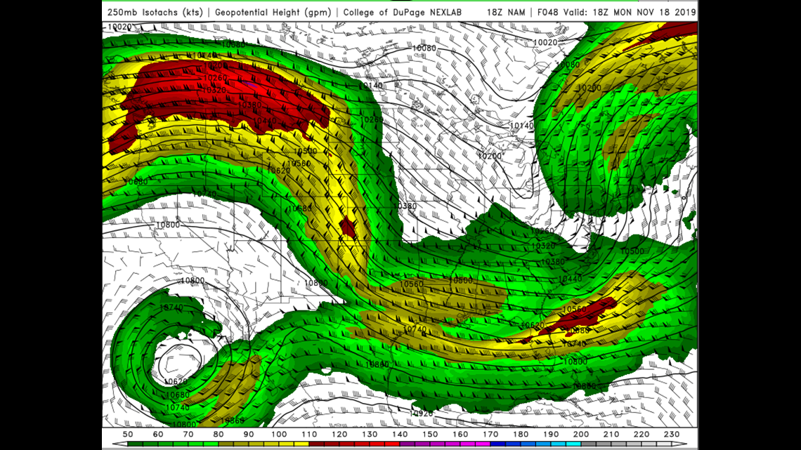
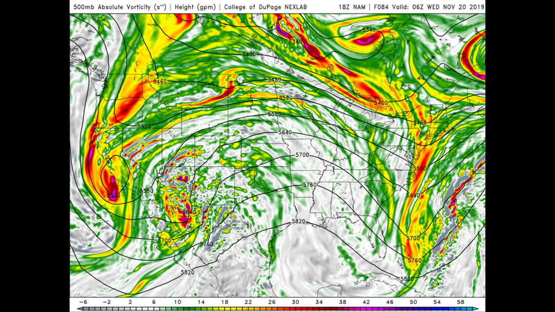
Another storm will be digging (moving south) down along the California coast and finally give that Baja storm a push into the desert southwest. The next map (Fig. 2) is a map of vorticity and is an important parameter to look at when forecasting. Vorticity measures the clockwise or counterclockwise spin in the atmosphere and can result in rising air which is one of the necessary steps to produce precipitation. You can read more about vorticity here. What we see in the vorticity map are several areas of deep reds and purples. These are localized areas of vorticity maxima (where the spin is greatest). Air flowing through those maxima generally results in rising air downstream (to the immediate east). In this particular instance, the Baja storm is being "shredded" by the digging California storm and pieces of energy are being ejected into the main flow toward the Ohio Valley. In short, the storm currently off the Baja Peninsula will be partially responsible for our next rain event! Neat.

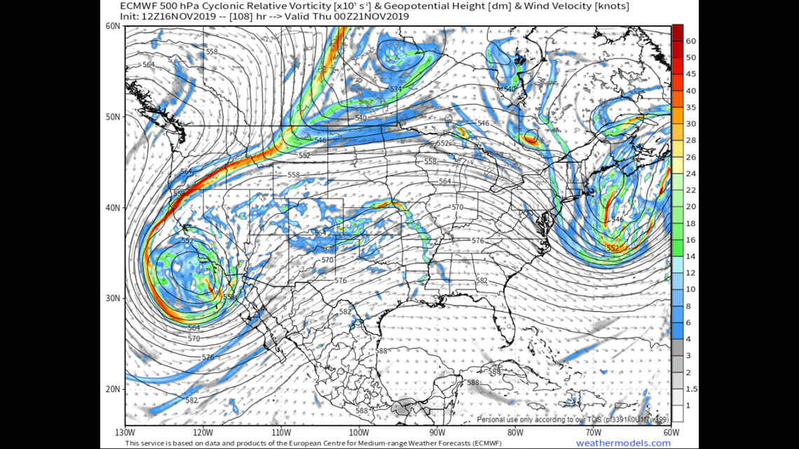
The next chance for rain: Note in the last sentence I said "partially responsible." At the same time as all of that, a storm will be sliding south along the Rocky Mountains from Canada (Fig. 3). Atmospheric disturbances that originate from Canada and travel along the Rockies almost always produce a mid-latitude cyclone (basically, a storm in the mid-latitudes of the northern hemisphere) that traverse through the Midwest. Read more about mid-latitude cyclones here.
The Canadian area of low pressure (the storm) will be shredded by the one then sitting over California: parts of it will interact with the remnants of the Baja storm and gain a lot of juice needed to become a decent cyclone as it begins the next part of its journey, while other parts of it will move through the northern High Plains.

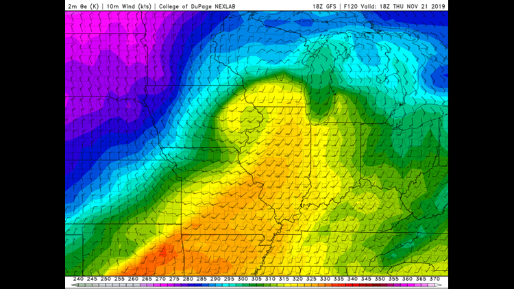
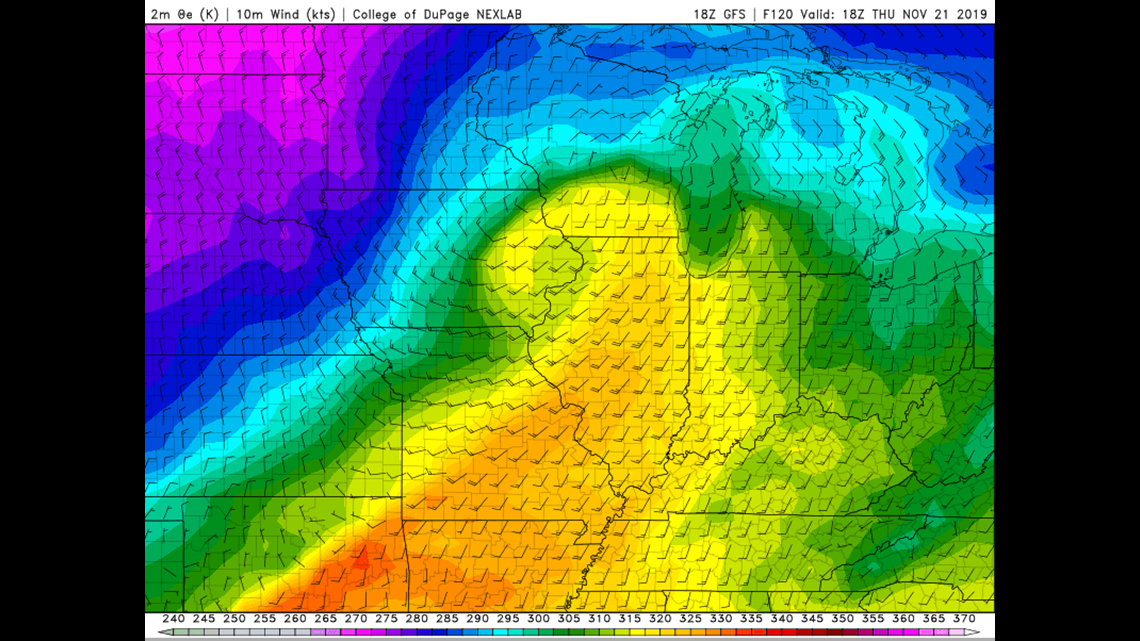
A storm is born: Now that our mid-latitude cyclone is alive, it'll start to feast on warm, moist air from the Gulf of Mexico. What that means for us is much warmer weather Wednesday and Thursday. Temperatures Wednesday and Thursday will climb into the upper 50s and low 60s (Fig. 4); by that point those numbers will be warmer than average for once! The Gulf moisture will really give this storm the moisture it needs to be successful. As you may have guessed by now, snow is not an option this time around. Sorry snow lovers.

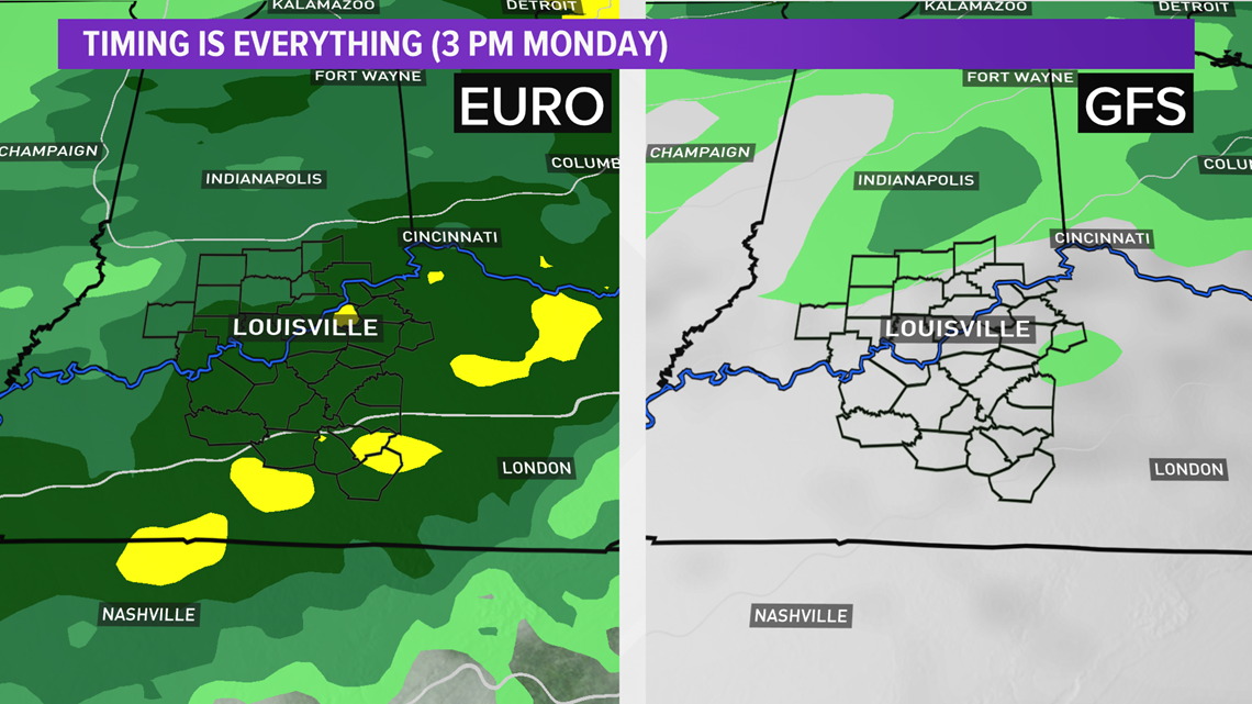
There, of course, exists differences in the long term models. GFS brings the rain in a couple rounds with a break in the mid-afternoon, while EURO is largely wet all day Thursday (Fig. 5). The second round of GFS rain would linger into early Friday, while Euro would be dry. I'm splitting the difference and leaving Thursday likely rainy with left over showers possible early Friday.

Enjoy those warmer temperatures. Another cold front will shove temps down into the 40s Friday through the weekend. Fear not, though, as this blast of cooler air won't be nearly as intense as the air that followed last weeks snow.
Phew! That was a lot, and the most technical discussion I've ever written. I hope you stuck around to the end. I've left out some details, but all of this is what my analysis has been for a rain event on Thursday. There is still a LOT of time between now and then, and the forecast will most definitely change.
Meteorologist Alden German
Facebook: Facebook.com/AldenGermanWX | Twitter: @WXAlden