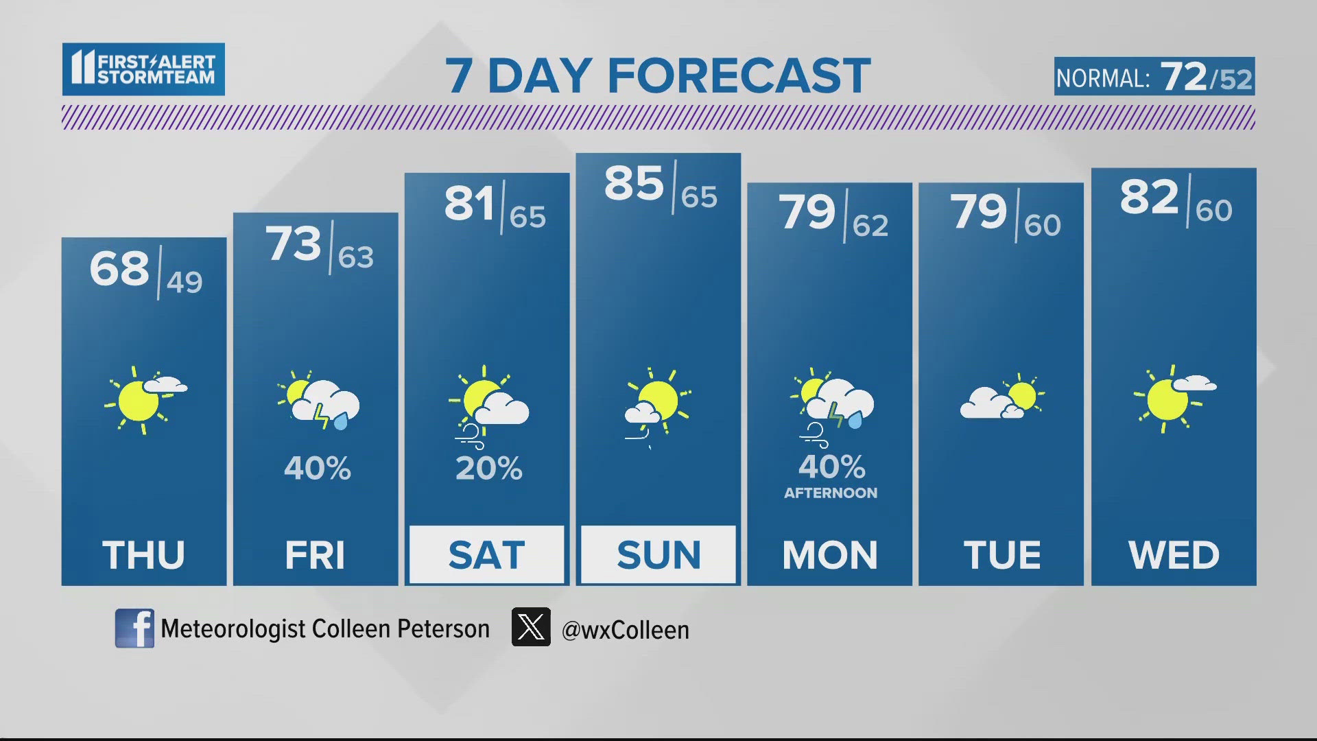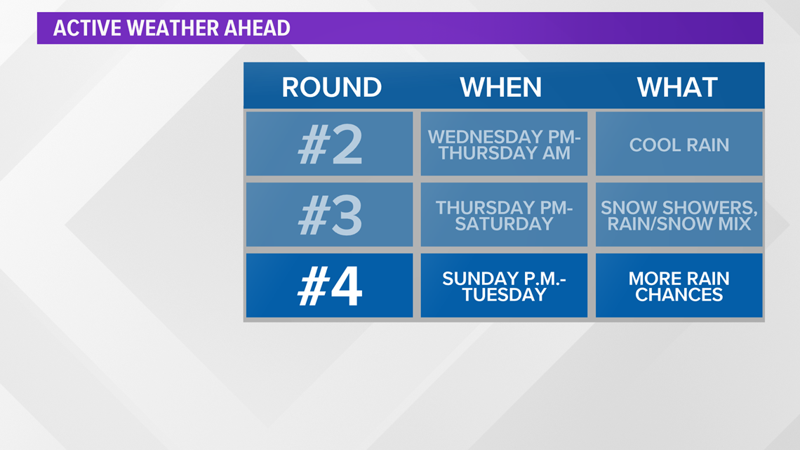
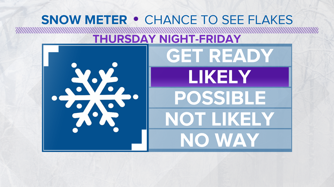
With the damp Tuesday across Kentucky and Southern Indiana, our active weather pattern has kicked in and that will be a prelude of things to come over the next week! With a frontal system moving in and stalling out over Kentuckiana into the mid-week, cooler air will drift in from the northwest with another round of moderate rain possible Wednesday night and into Thursday. Once the main area of low pressure moves eastward later on Thursday, even colder air will move in. This coupled with some lingering moisture and upper level energy could produce some light snow Thursday night and into Friday morning.

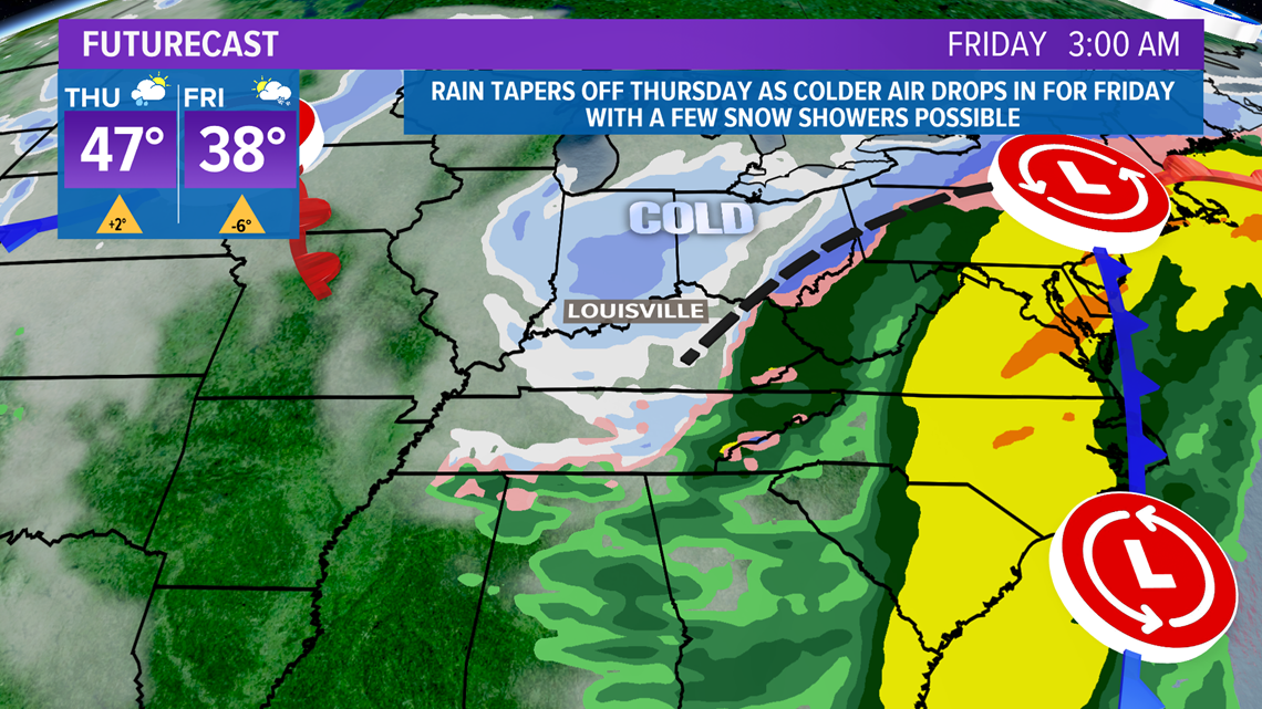
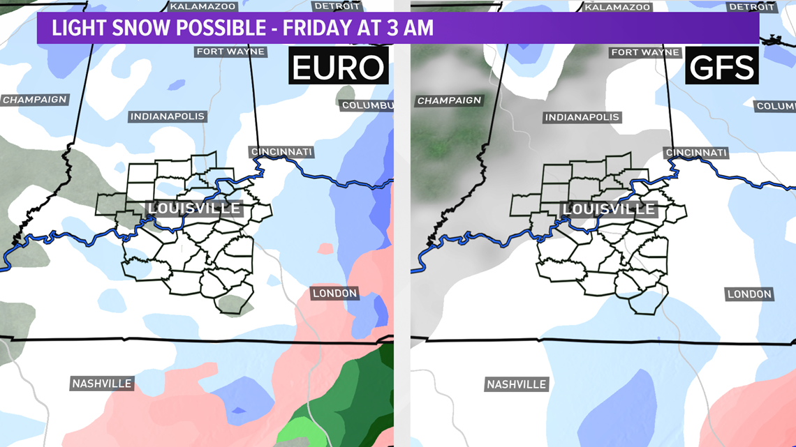
Both the major models have some light snow flying Thursday night and into Friday morning and there is the chance of some light accumulation. With temperatures at or just below freezing, this could have an impact on the Friday morning commute with a few slick spots possible so that's something we'll keep an eye on the rest of the week.


Temperatures should top out into the mid to upper 30s on Friday with a few flakes/flurries hanging around through the day. Heading into the weekend, 2 separate systems will come together to keep the chances for wintry weather for parts of Kentucky and Southern Indiana. A fast moving clipper system diving in from the northwest with join forces with a mid-level wave of low pressure moving up from the southwest to bring additional moisture to the area. It may be all about location with the best chances for additional snow showers either side of I-64 and up into Southern Indiana at this point but with a few days before this system arrives, so this bears watching as well. Keep in mind, afternoon highs look to be in the upper 30s and low 40s so the snow could change to rain as the day wears on.

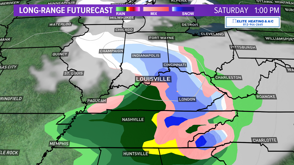
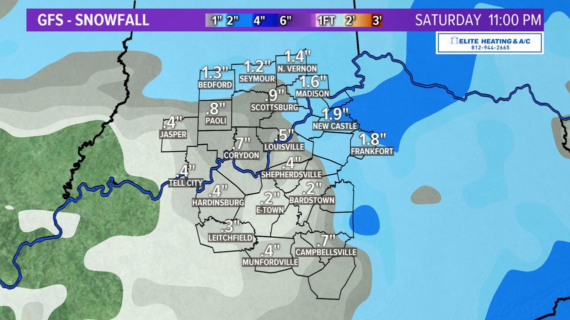
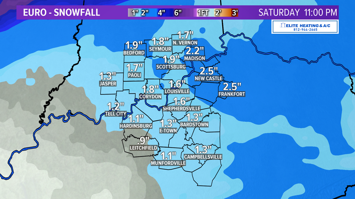
Even though these graphics are VERY EARLY with the snow chances not even set to kick in until Thursday night, below are what the 2 major models are expecting as fair as POSSIBLE accumulations from Thursday night THROUGH Saturday, which includes BOTH systems discussed above.


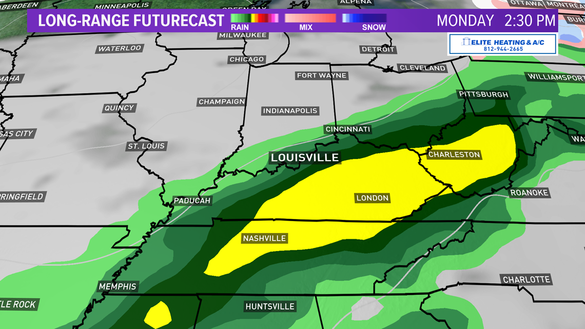
Keep in mind even if we do get some snow and wintry weather, it won't stick around long as our active weather pattern continues into the second half of the weekend and early next week. Afternoon highs will be back into the upper 40s on Sunday as the rain chances return late with more rain expected on Monday and Tuesday as highs reach the low 50s.

Stay with the WHAS 11 First Alert StormTeam for the latest on this active weather pattern over the next week.
Meteorologist T.G. Shuck