LOUISVILLE, Ky. — All tornado watches and warnings have been canceled. Despite this, the weather is still very active and dangerous. Extreme wind is causing major power outages across Kentuckiana.
Be careful of any downed powerlines and assume they are live!
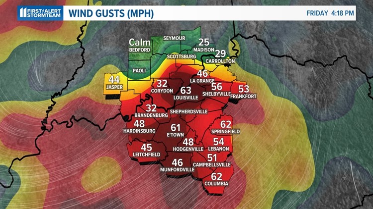
Wind gusts may continue to blow well over 60 mph through sunset before gradually diminishing overnight.
-----------------------------------
Forecast at-a-glance:
- Record wind gusts continue through sunset Friday before gradually diminishing
- Flooding risk is decreasing
- Cooler, but sunny and less windy, weather for weekend
-----------------------------------
Severe weather: As of Friday evening the severe weather threat has ended and no further rain outside of some lingering showers or sprinkles anticipated. That said, wind gusts will remain very high through tonight, but gradually diminish.

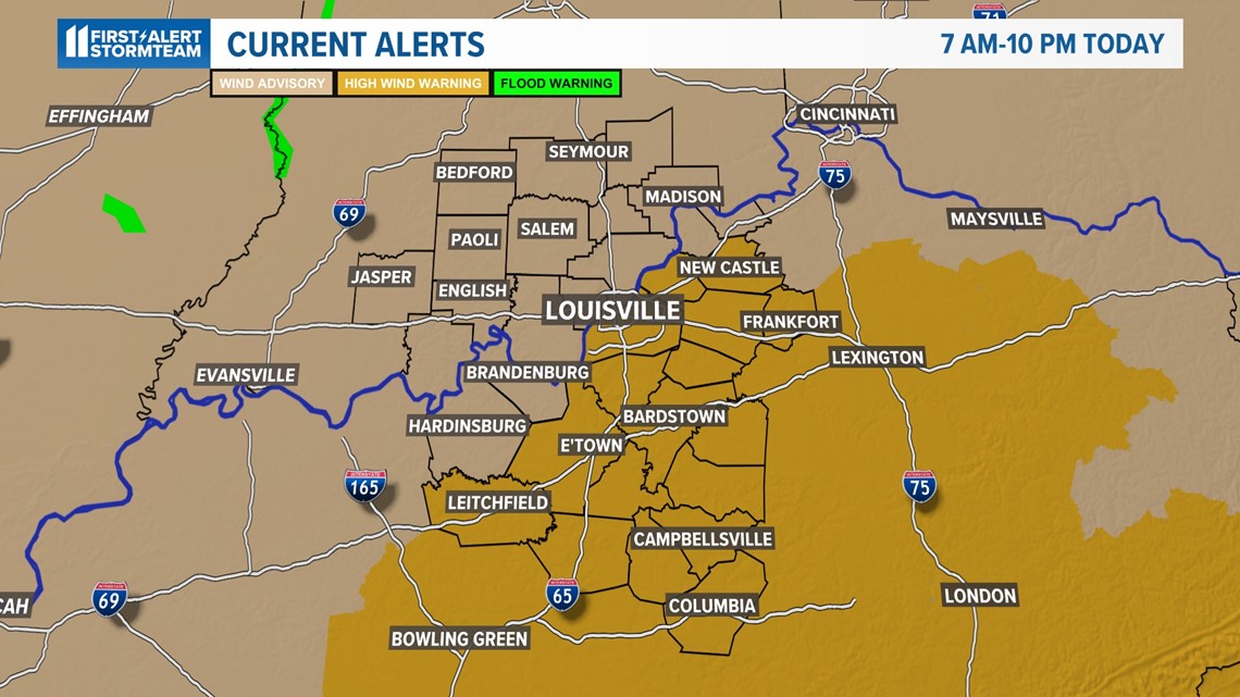
Weather setup: A powerful storm system has brought historic winds to the area. A High Wind Warning is also in effect until 10 pm.
By sunrise tomorrow gusts will be 15 mph or less with winds through tomorrow from the west only around 10 miles per hour.
We'll also have decreasing clouds with most of the day being sunny, but cooler, as temperatures only make the middle/upper 50s.
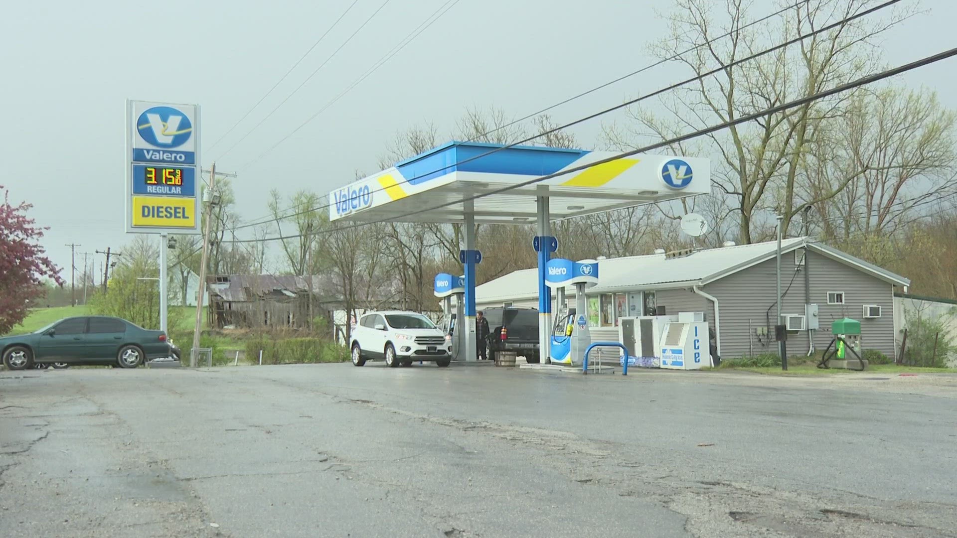
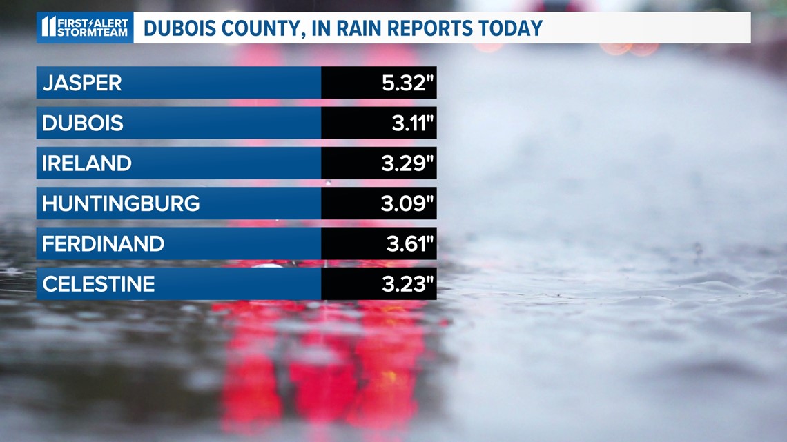
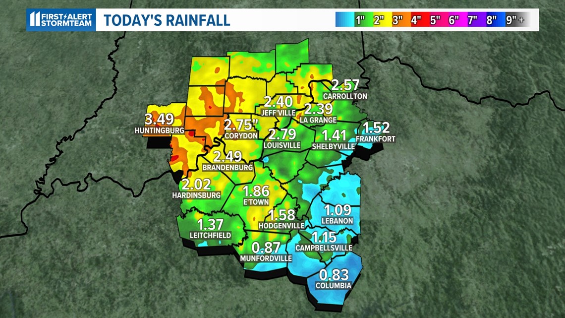
Rain totals and flooding: Louisville set a daily rainfall record for March 3rd with 2.79" of rain. Southern Indiana saw the most rainfall with over 3" in many areas.
DuBois County, Indiana in particular had severe flooding with rain totals through the county exceeding 5".


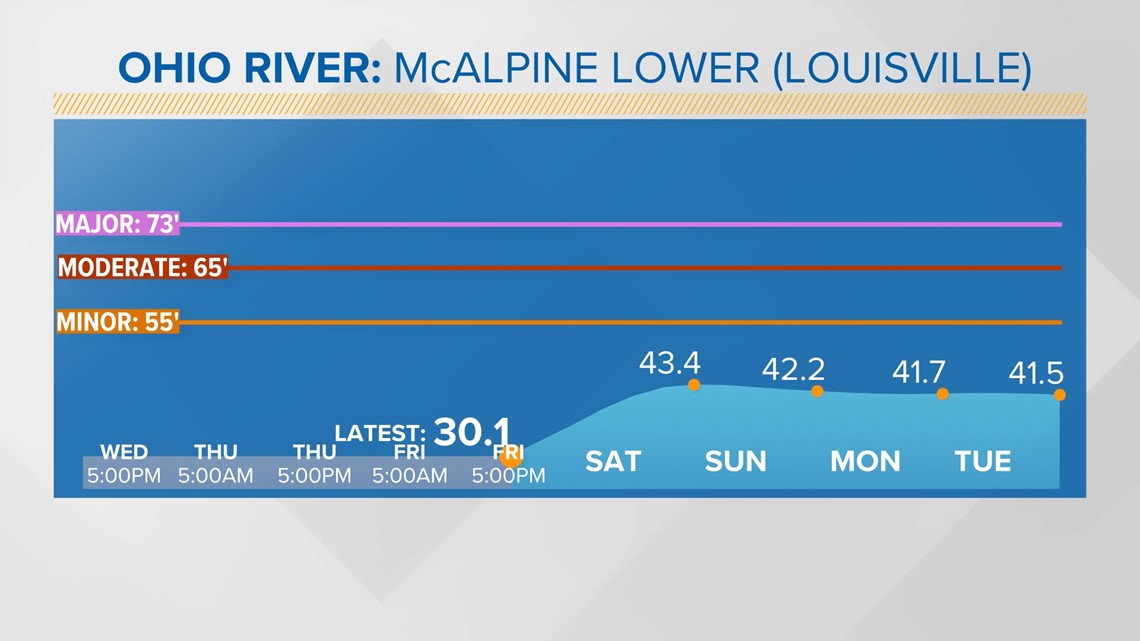
Although the flooding risk has lowered, river levels will rise over the weekend.
They're forecast to stay below flood stage, but you'll notice area rivers looking higher than normal into early next week before slowly falling.

Long term: Next week's forecast will be much quieter with largely dry conditions (though we may have some light showers overnight Monday).
Temperatures will be noticeably trending cooler. In fact, by next Friday we may be cold enough for the next storm system to bring us snow...
As always, be sure to download the free WHAS11 app for the latest weather alerts from the First Alert Stormteam. For Apple or Android users.
Sign up for the WHAS11 newsletter: "WHAS Up Kentuckiana." Get the latest headlines and videos from around Kentuckiana delivered daily to your inbox.