Severe Thunderstorm Warning for Green and Taylor County in KY until 8:15pmCDT/9:15pmEDT
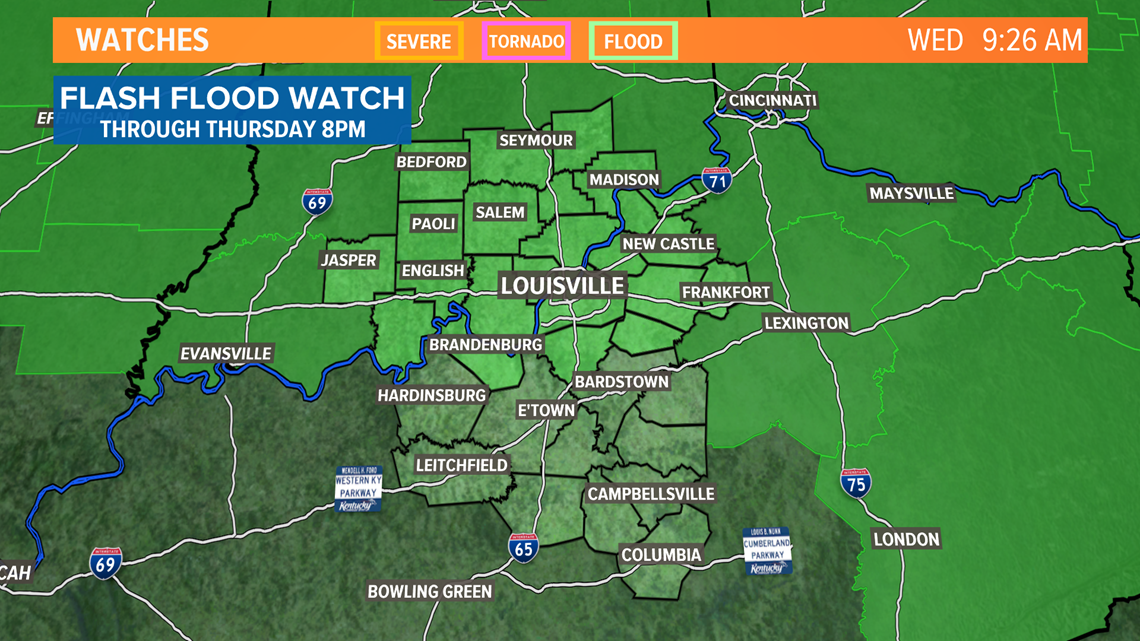
A Flash Flood Watch remains in effect for areas of Kentuckiana through Thursday due to the rounds of rain and storms moving through Wednesday evening into Thursday. We could see a few inches of rainfall over the course of this time frame thanks to an area of low pressure and cold front moving through Kentuckiana.

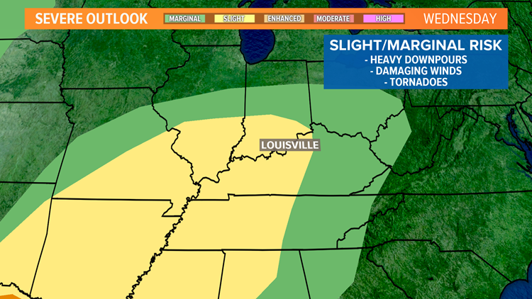
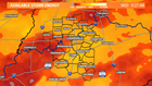
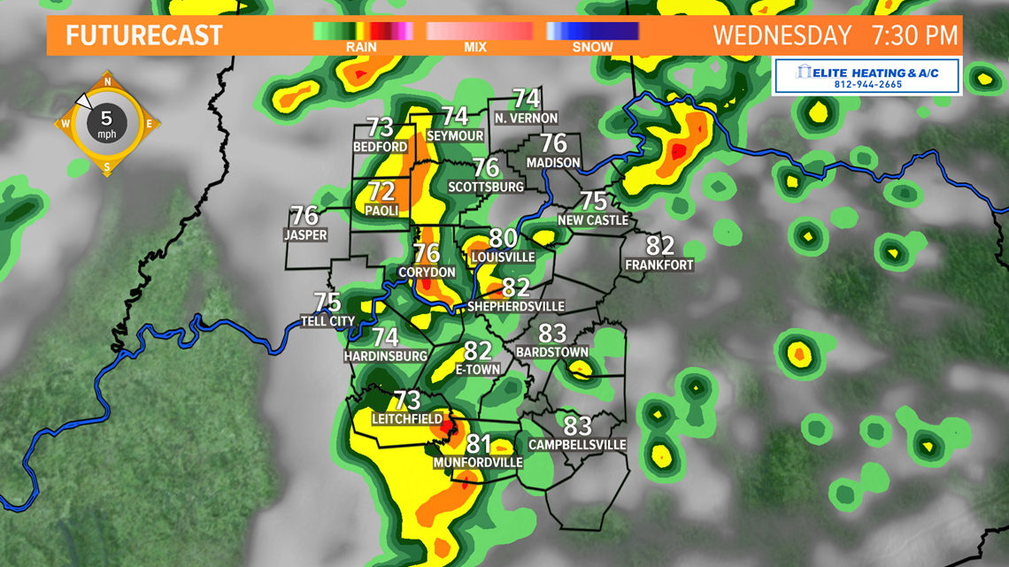
We do have the potential for severe weather Wednesday evening after about 5PM. Many factors contribute to our storm potential energy shown across Kentuckiana in the moderate to high range this morning. We will likely see these same levels into the afternoon.
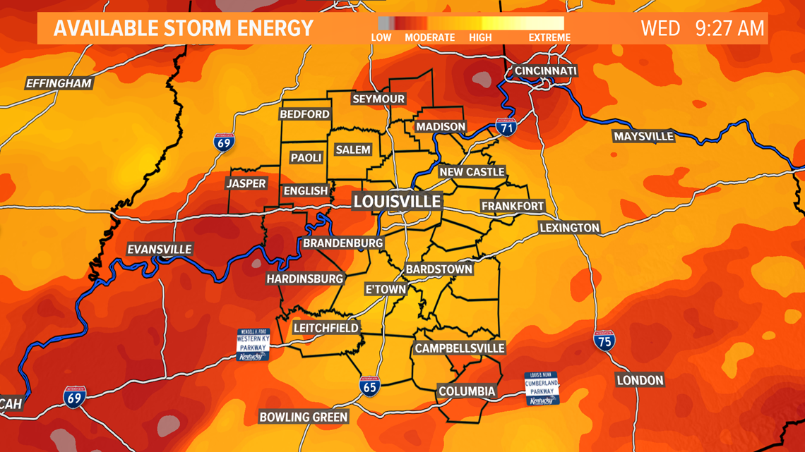
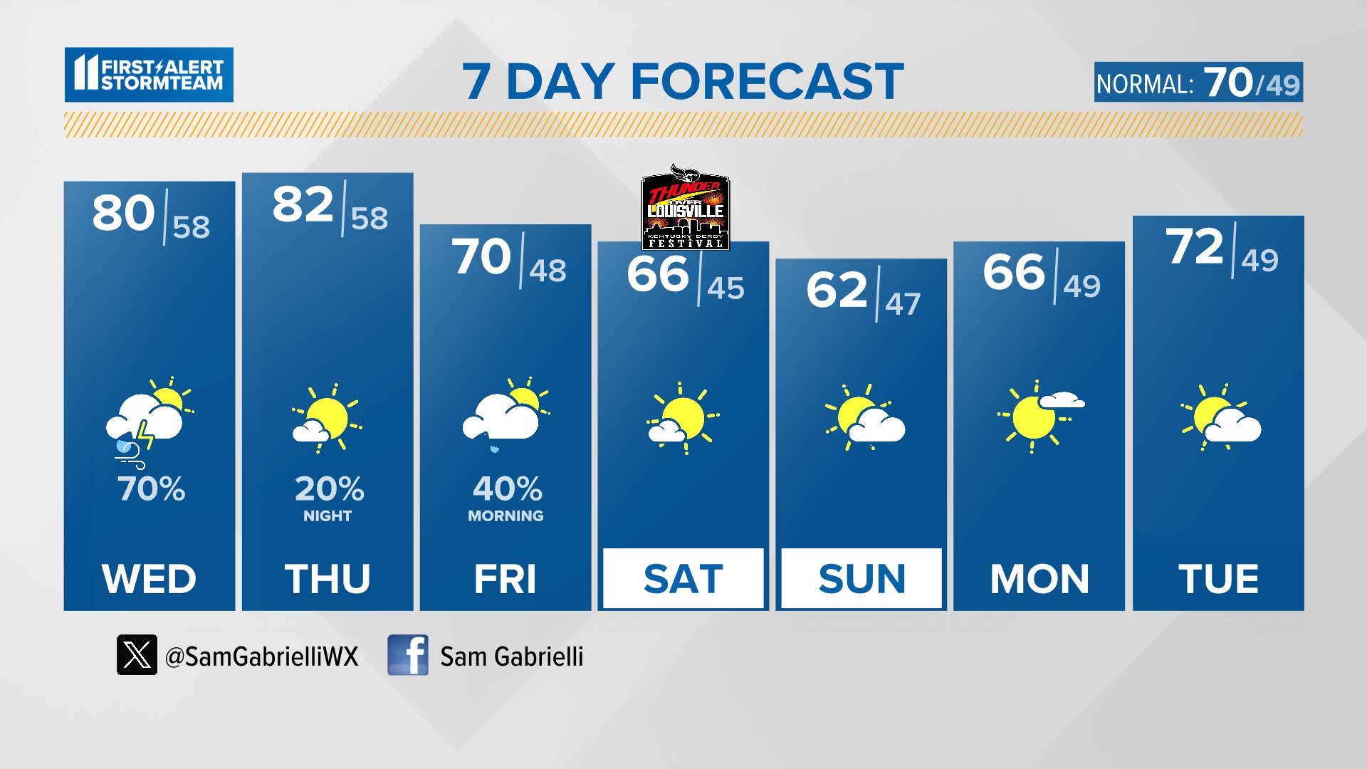
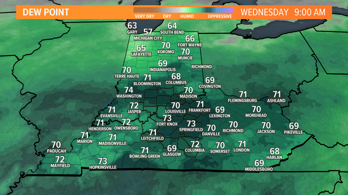
These factors include warm afternoon high temperatures in the mid 80s, high dewpoint values indicating a good amount of moisture in the atmosphere as well as shear in the atmosphere.

Below is an hour-by-hour look at some moments throughout the course of the evening when we could see stronger storms moving through. As they move through, our biggest threats will be heavy downpours, damaging winds gusts, hail and the potential for spin-up tornadoes.

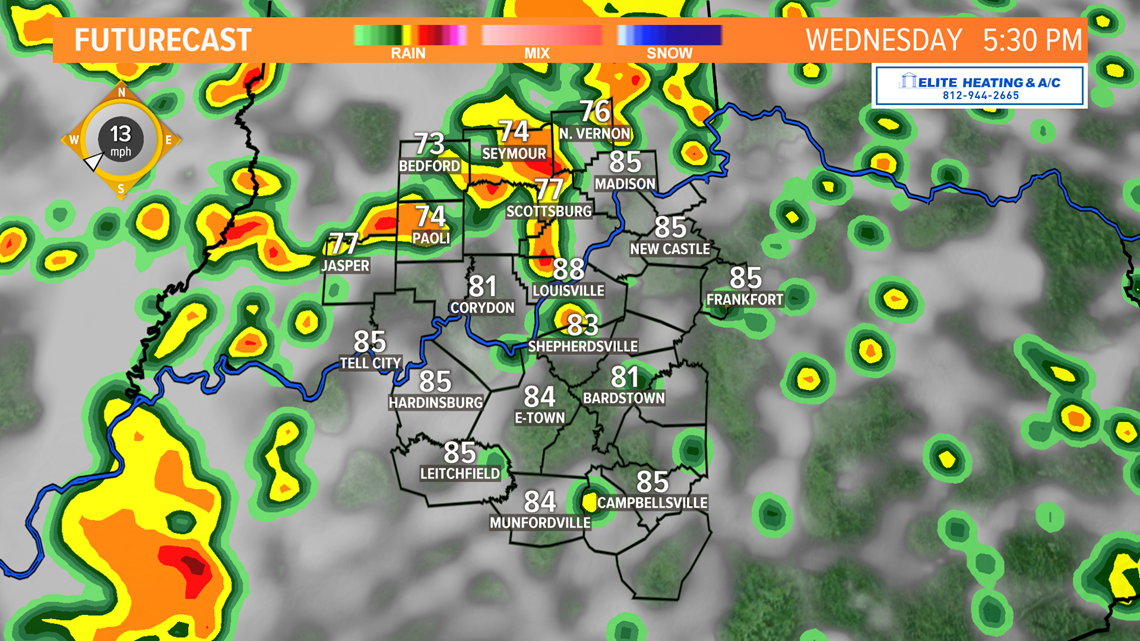
Storms are possible during the evening commute and through dinner time hours tonight. Some storms could have torrential rainfall over a short period of time.

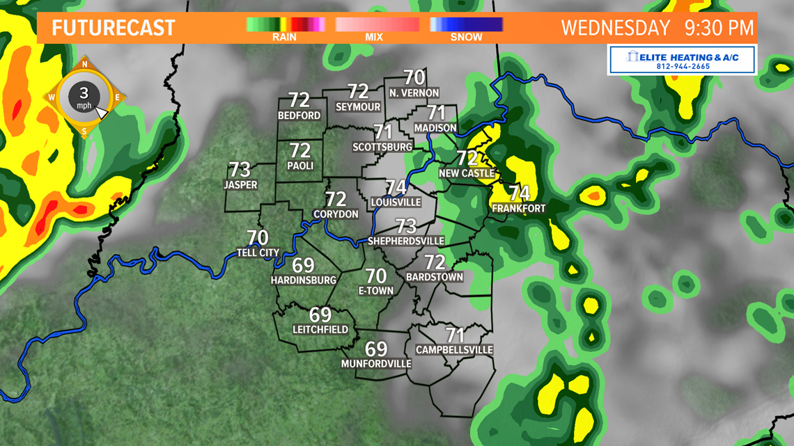
We'll be watching a break from the storms through the late evening hours that may give us energy for redevelopment overnight into Thursday.

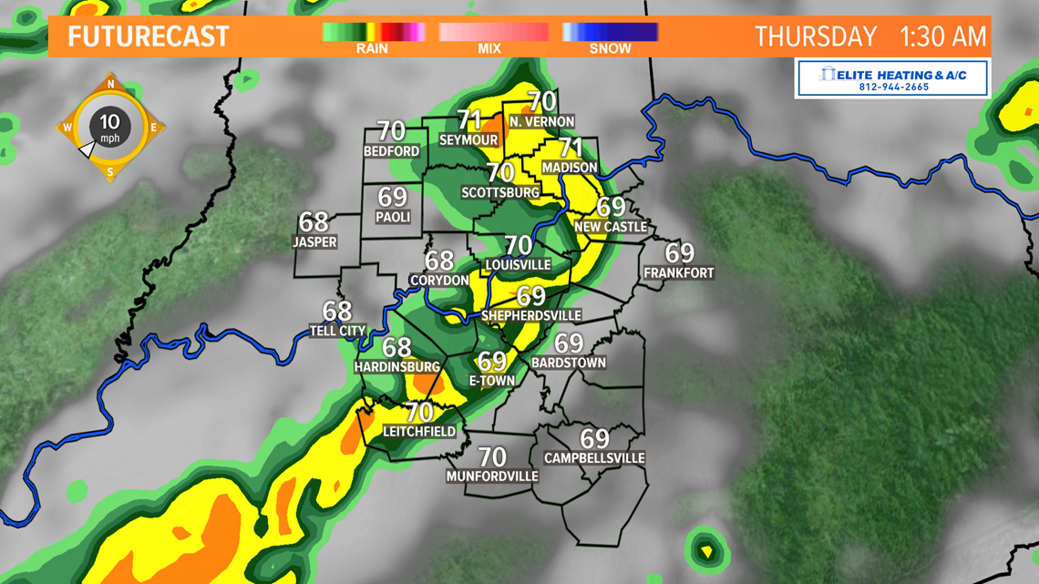
A round of storms may be possible into very early Thursday morning, but cooler temperatures overnight should keep any storms from being severe.

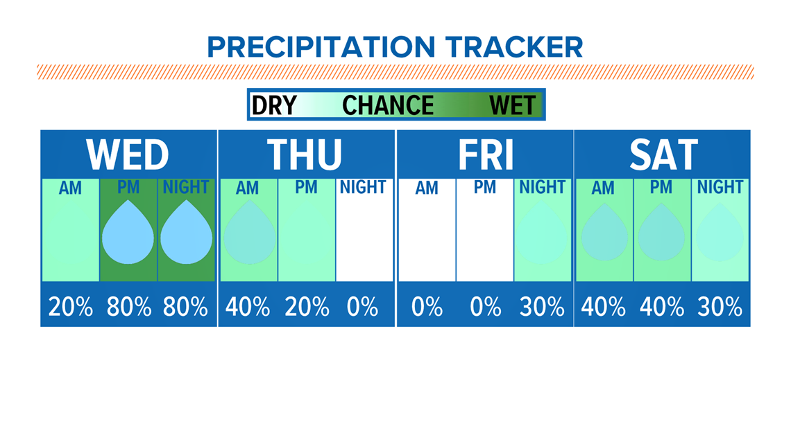
Shower and storms chances linger into Thursday as a cold front pushes through behind Wednesday's low pressure system. We finally see drier conditions for much of Friday before scattered shower and storm chances return for the weekend.