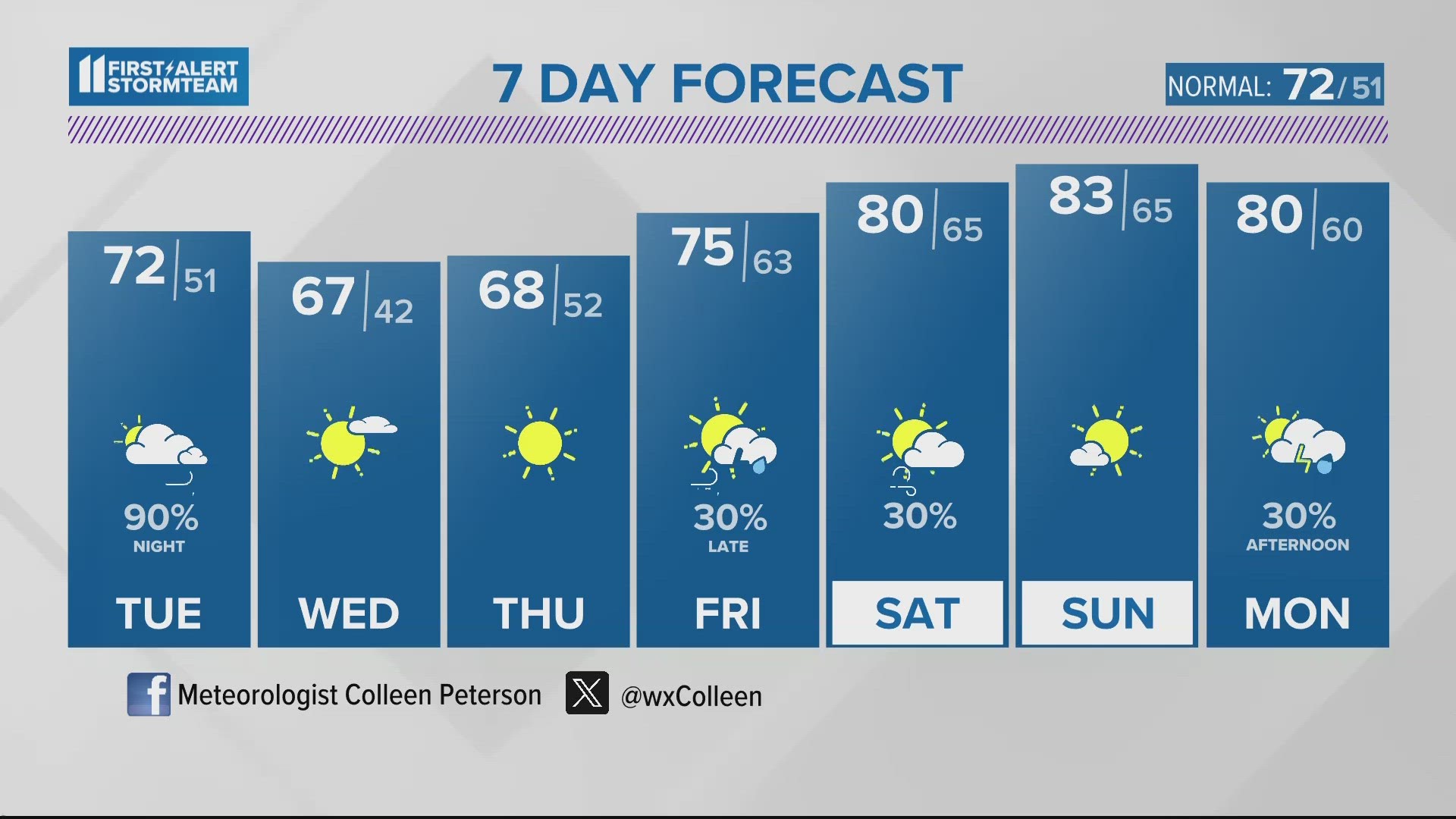
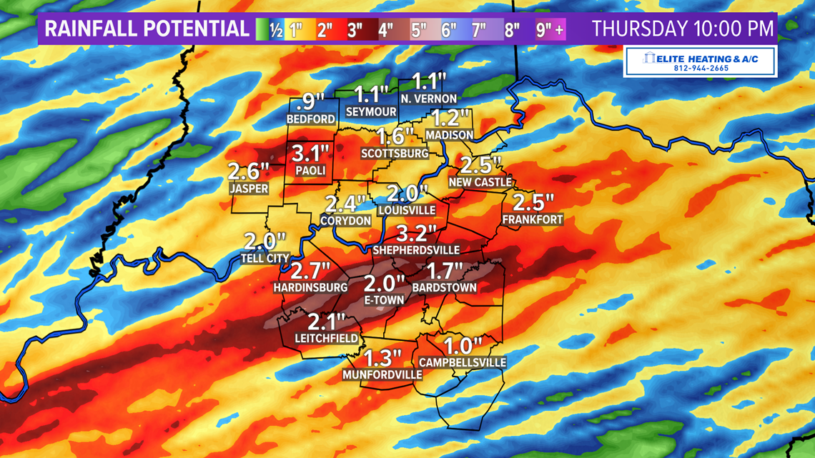
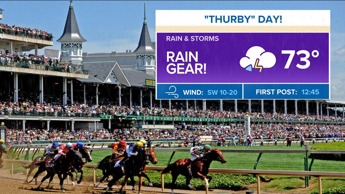
LOUISVILLE, Ky. — A slow-moving cold front will keep scattered showers and thunderstorms across the area from time to time through Thursday afternoon/evening. The overall severe weather threat will stay pretty low, but heavy rain could cause localized flooding issues. You can follow along with our Futurecast maps below.

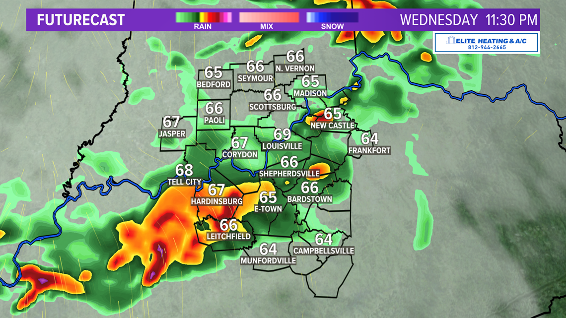


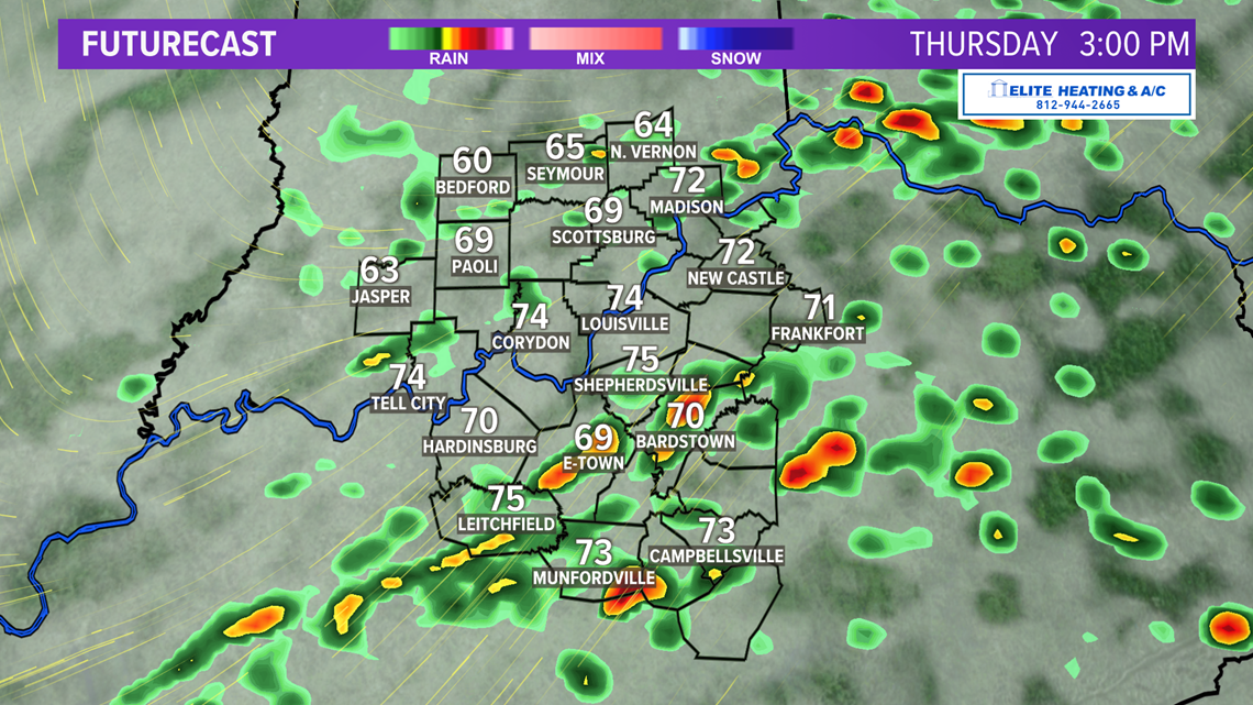
Rainfall totals of 1-3" possible by late Thursday.

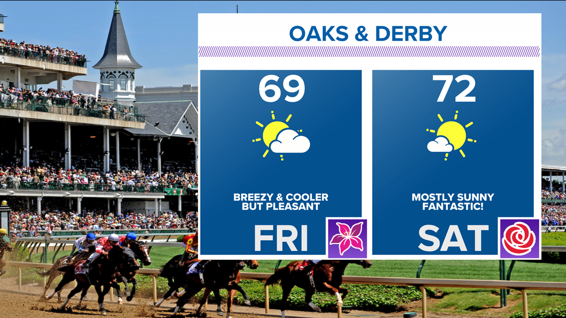
The cold front will move south Thursday night and drier air follows! This will set-up nice and sunny conditions for Oaks and Derby Day. Expect highs in the upper 60s for Friday and lower 70s on Saturday. Friday will be a bit breezy with northwest winds around 10-20 mph. Hold onto those hats and fascinators! Light winds expected for Saturday. UV index will be high both days so bring the sunscreen.


Enjoy and have a wonderful Derby Weekend!