LOUISVILLE, Ky. — If you have been dreaming of a white Christmas in Kentuckiana statistics show that you should keep dreaming (or move to northern Minnesota).
It certainly did not feel or look like Christmas last year in Louisville. The city set a record high temperature of 75°, Lexington made it to 70° and Bowling Green even reached 76°. We have to dig all the way back to 1890 in order to find the last time we measured 4.5" of snowfall.
The map below, courtesy of NOAA Climate, shows the probability of getting at least 1 inch of snow on Christmas -- based on data collected between 1991-2020.

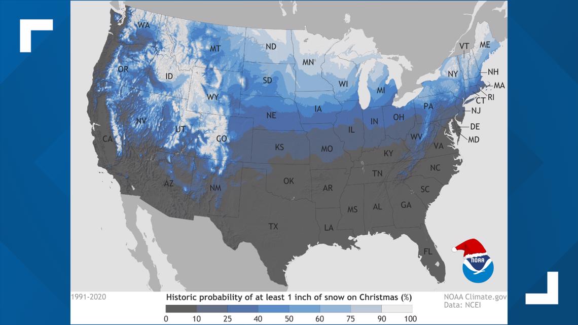
According to the climate data collected by NOAA, snow lovers should travel anywhere near the Rocky Mountains, Idaho, upstate New York and/or northern Minnesota for a good shot at snowflakes flying for the holiday.
There is a less than 10% chance of at least 1 inch of snow on Christmas in Kentucky and slightly higher probabilities over the river in Indiana.
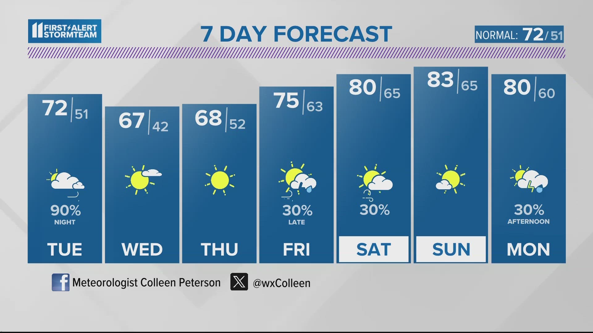
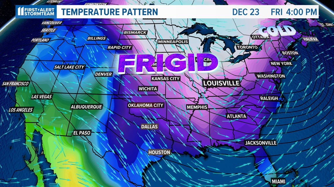
So, how does this fare with this years' forecast?
We are going to go against the statistics here, because snow does look possible leading up to the big day. It is far too early to tell just how much snow we could see and the exact timing. At the very least, it will certainly feel like Christmas with temperatures in the single digits and teens.
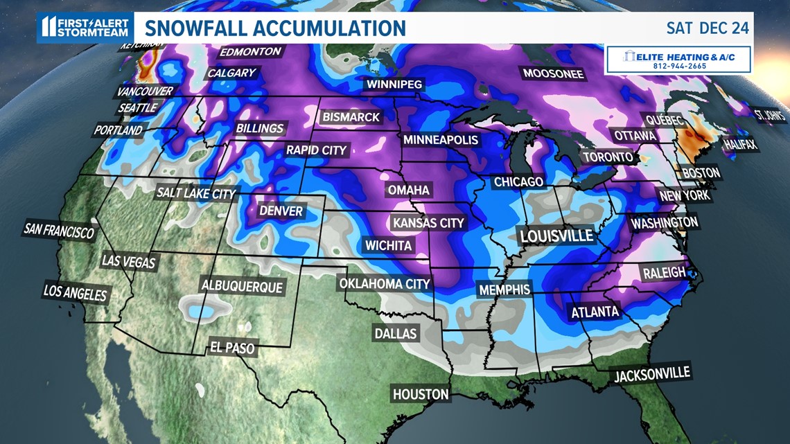
Below is a comparison between 2 weather models (European and GFS, respectively) indicating potential snowfall accumulation through Christmas Eve.


Both models agree that there will be arctic air in place, but differ in location and intensity of the snow. Notice how the European is showing deep blue all through Kentuckiana, but the GFS has the snow just clipping southern portions of our area. It will all depend on where the low pressure sets up.

In summary, there is a storm system headed our way toward the end of next week and into Christmas weekend that could bring us a white Christmas this year. Since we are over a week away, a lot can and will change with this forecast. If nothing else... prepare for the extreme cold!

As we get closer, the WHAS11 First Alert Storm Team will be ironing out the details on what could be a winter wonderland on Christmas.
Follow along with our latest forecast on-air, online and on the WHAS11 mobile app.
Make it easy to keep up-to-date with more stories like this. Download the WHAS11 News app now. For Apple or Android users.
Have a news tip? Email assign@whas11.com, visit our Facebook page or Twitter feed.