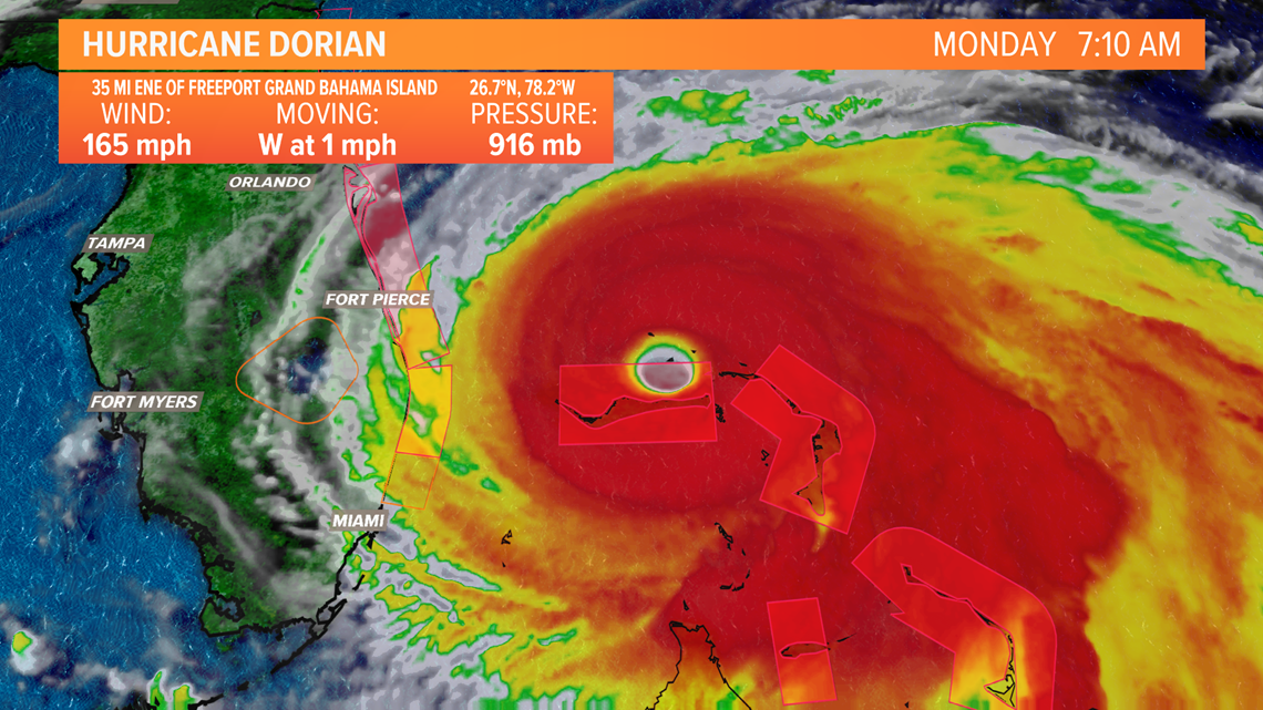
LOUISVILLE, Ky. — Hurricane Dorian became one of the strongest hurricanes to ever make landfall in the Atlantic Basin when it struck Abaco Island in the Northern Bahamas on Sunday with maximum sustained winds at 185 miles per hour and gusts over 200 miles per hour.
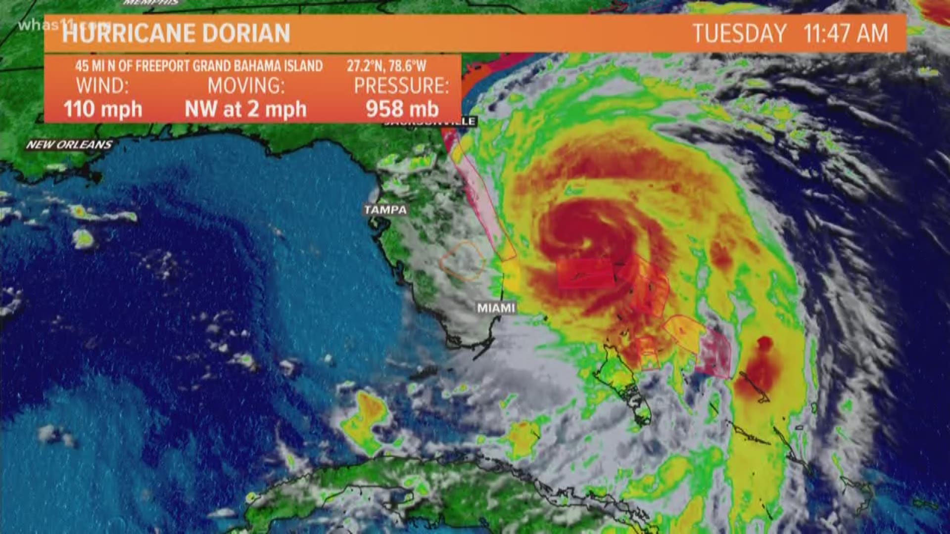
As of Labor Day morning, Dorian's winds had "weakened" to 165 miles per hour maximum sustained winds, but the biggest issue is that fact that the storm is virtually stationary. Dorian has been sitting and spinning like a top on a table with very little forward movement early on Monday, which is continuing to cause catastrophic damage and life threatening conditions to those in the Northern Bahamas

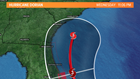
The big question is what happens with Dorian once it begins to move again? There is a trough digging into the Eastern U.S. that is expected to cause Dorian to turn northwest to north to northeast over the next several DAYS and with the current forecast track keep the eye of the hurricane out over the ocaen. This is important because the strong winds and storm surge are found in the northern and northeastern quadrant of a hurricane. Of course the east coast of Florida and points northward should expect hurricane conditions (winds around 75 mph or greater) along with heavy rain and some storm surge, but behind on the left side of the system is a better place to be looking at the big picture.
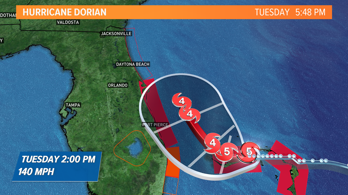
Dorian is expected to weaken some as it progresses up the coast but should still be a major category 4 hurricane on Tuesday and into Wednesday as it heads up the east coast. Hurricane warnings are posted along the Florida coast from West Palm Beach up to the Space Coast with Hurricane Watches farther north.

By Wednesday, Dorian may still only be as far north as just off the Georgia coast and still forecasted to be a major category 3 hurricane. The official track has the center a little father off shore that far north but impacts are still expected.
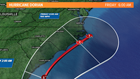

One amazing thing is that Dorian may take the better part of this WEEK to finally move northeastward and clip the Outer Banks of North Carolina before getting back into the open water. Remember the cone of uncertainty and that any adjustment in the track could mean some major issues for the Carolinas, even with some impact from Dorian expected at this point.
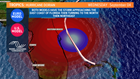
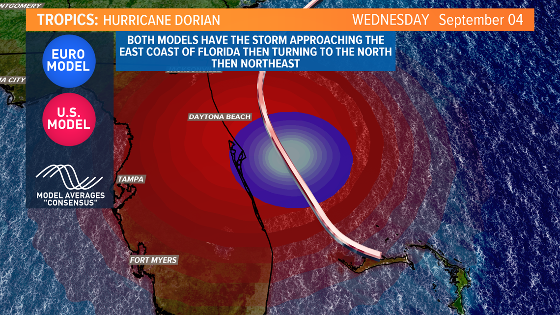
Both the U.S. and European models (along with much of the model guidance) keep the center of Dorian JUST off the Florida coast as the week wears on, so while a pretty significant impact is expected along the coast on the Sunshine State, the best case scenario is that the forecast track holds and the center of Dorian does not make landfall in the U.S. and lessens the winds and storm surge somewhat for most locations.
We will continue to track Hurricane Dorian as it progresses slowly northward this week.