MAIN POINTS:
1) Snow showers likely early Friday morning, mostly before sunrise.
2) Snow showers return Friday evening.
3) Big warm-up Sunday - 60s!
4) Warm/wet next week - flood potential.
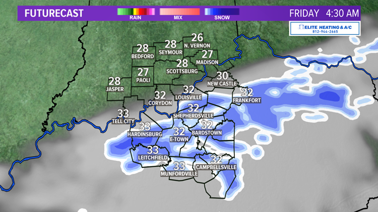
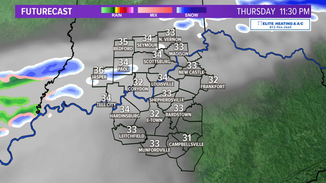
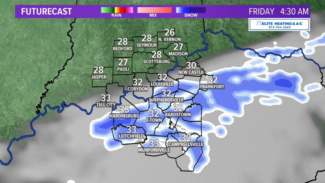
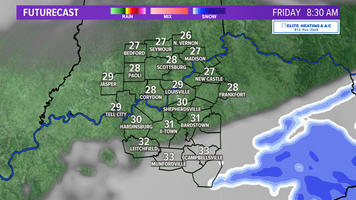
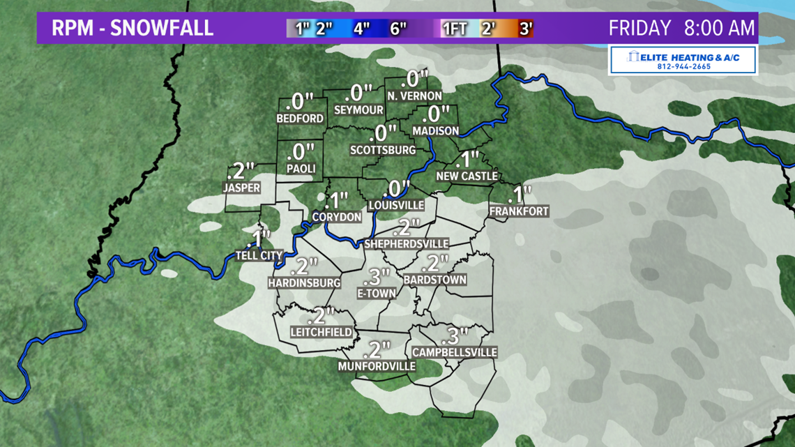
Alright, let's first breakdown the next couple of snow chances. A couple little disturbances will be riding the west/northwest jet stream flow, producing light snow showers late tonight into very early Friday morning (mainly before sunrise).
You can see some of the timing with our Futruecast graphics below. A dusting will be possible in spots, especially for areas south of Louisville. When, this batch of snow is falling temperatures will likely be at or above freezing, so much of the snow will melt on the roadways. Minimal impacts are expected for our travel conditions Friday morning. (Scroll down for the next chances)


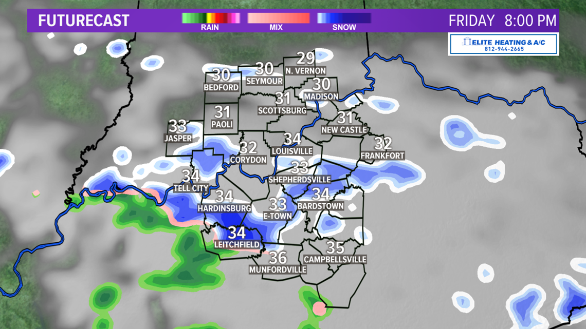
The next disturbance will arrive Friday evening with some more snow showers. Once again temperatures are likely to be above freezing. Little to no accumulation or impacts are expected.


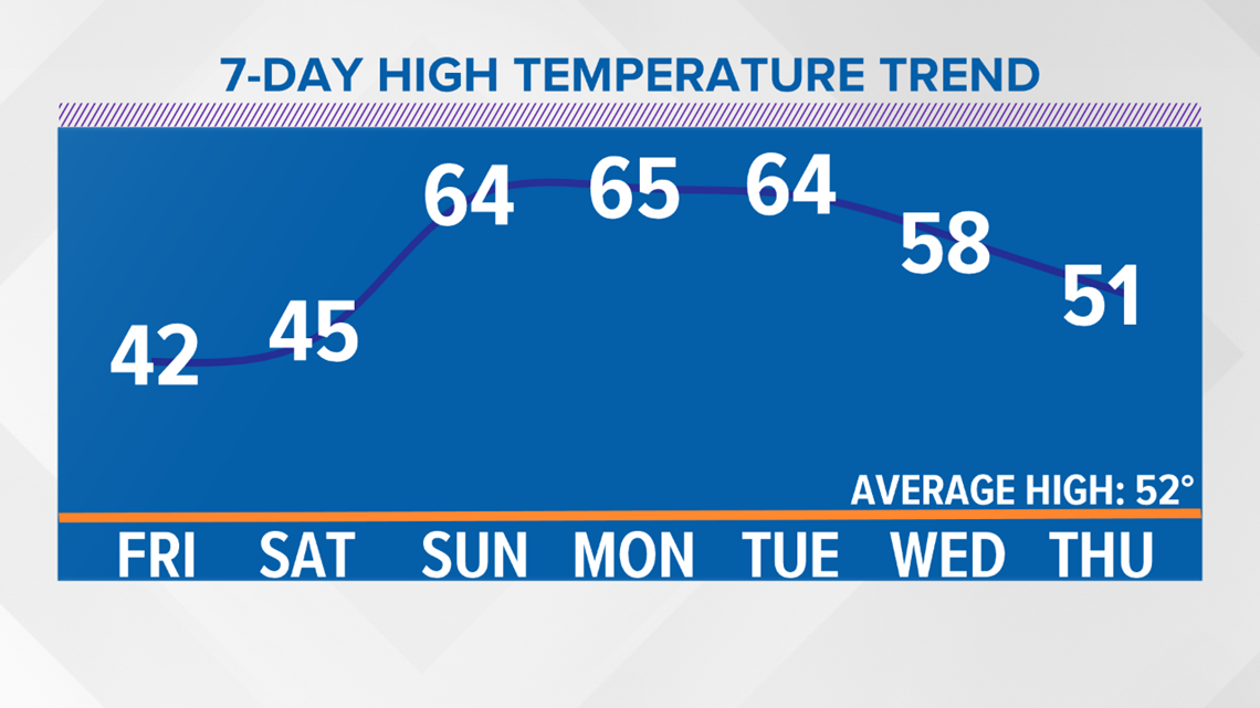
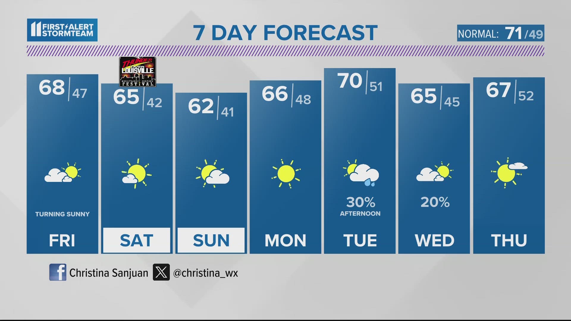
We'll have chilly sunshine around Saturday, but a big warm-up begins Sunday. Temperatures will be back to the 60s Sunday through Tuesday.
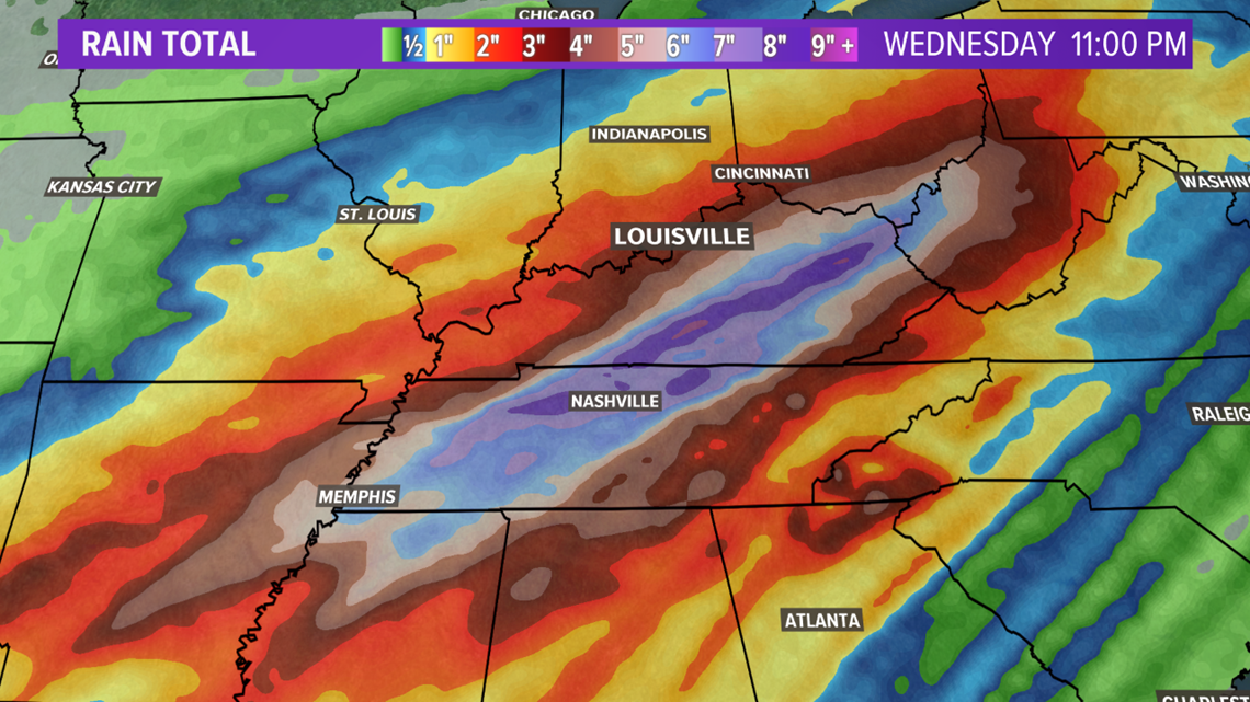
While it will be much warmer, it will quickly turn wetter. A stalled out front will bring waves of wet weather Monday through Wednesday. A bulls eye of heavy rain will likely set up near our region, and where this happens, flooding could become a concern next week.