

LOUISVILLE, Ky. — Heavy rain has moved in to the Ohio Valley today, but the heaviest rain and greatest storm threat is still expected late tonight..
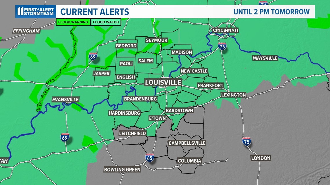
A Flood Watch is in effect through 2:00 p.m. Saturday for most of the WHAS11 viewing area.
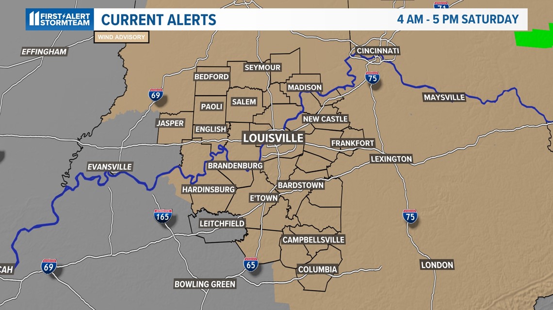
A Wind Advisory will be in effect tomorrow from 4:00 a.m. until 5:00 p.m. More on that at the end.
Be sure to download the free WHAS11 app for the latest weather alerts from the First Alert Stormteam. For Apple or Android users.


Forecast
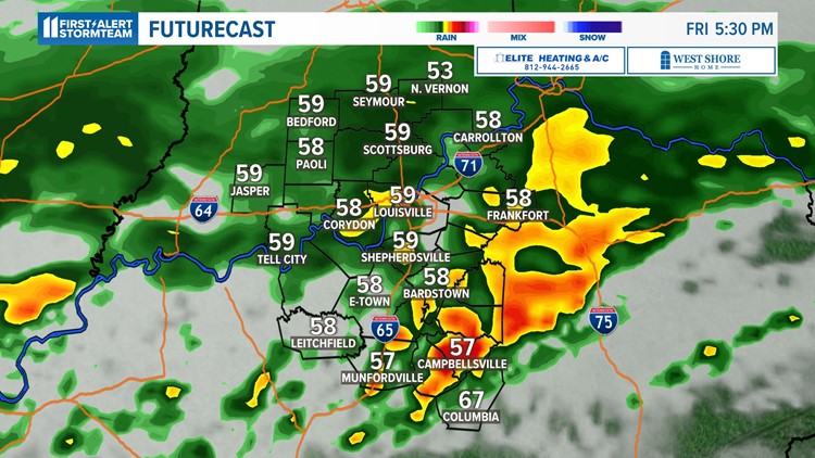
Rounds of heavy rain will continue through today as energy travels along the stationary front. The second wave of heavy rain is expected in the mid-afternoon hours between 3-6 p.m. Severe weather isn't expected during this time, but torrential rain and flooding remain possible. Gusty winds may also develop, but should stay below severe levels.
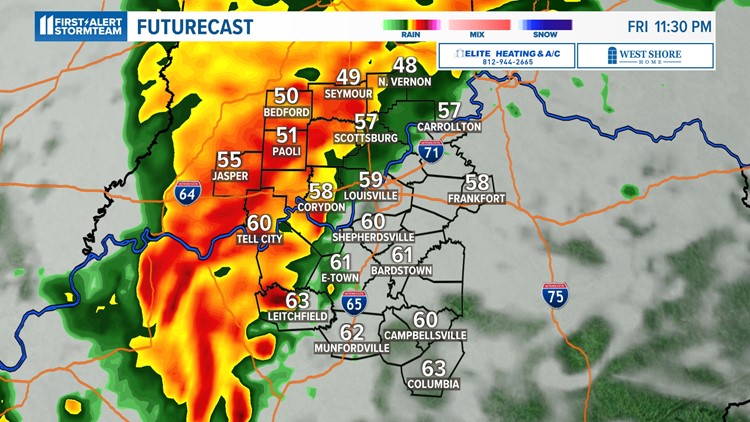
The overall threat of severe storms remains low at this time, but the greatest threat of severe weather will be after sunset, particularly between 10 p.m. and 1:30 a.m. Torrential rain causing flash flooding and damaging winds are the main hazards. The tornado threat is low, but not zero. Locations south of the Parkways would be most likely for a tornado spin-up.
Futurecast timeline Friday, March 24


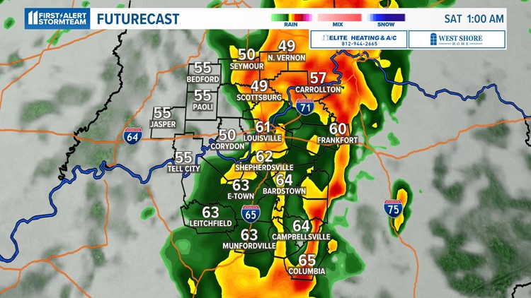
As of 12:30 p.m. today, parts of southern Indiana have already seen over 2" of rain with metro Louisville sitting a little under 1.5". Once all rain finishes late tonight, widespread totals of 2-4" will be possible with localized higher
Flooding Concerns
All the heavy rain still to come may send area rivers and streams over their banks. Thankfully, no river is expected to experience major flooding, and the high waters should only be temporary.
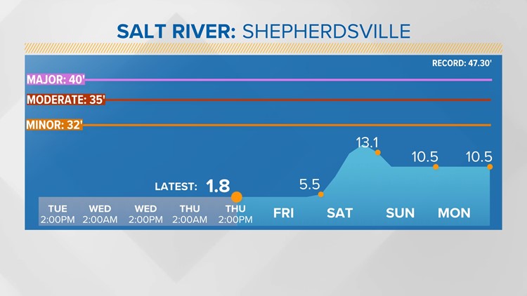
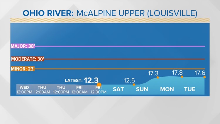
The Ohio River is forecast to come close to flood stage late Saturday, but should stay within its banks. It'll be noticeably higher, though, into early next week. The Salt River will also be higher, but should stay within its banks.
Forecast river levels into early next week


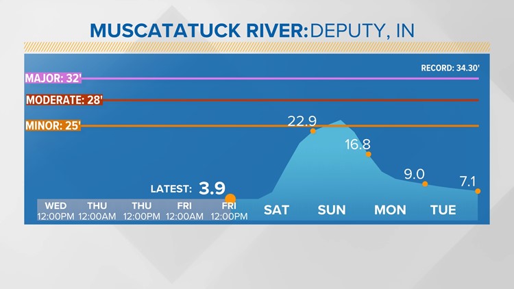

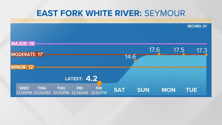


Other rivers such as the East Fork of the White River near Seymour and the Muscatatuck River are already experiencing minor flooding. Muscatatuck is expected crest this weekend, but the East Fork may run high into early next week
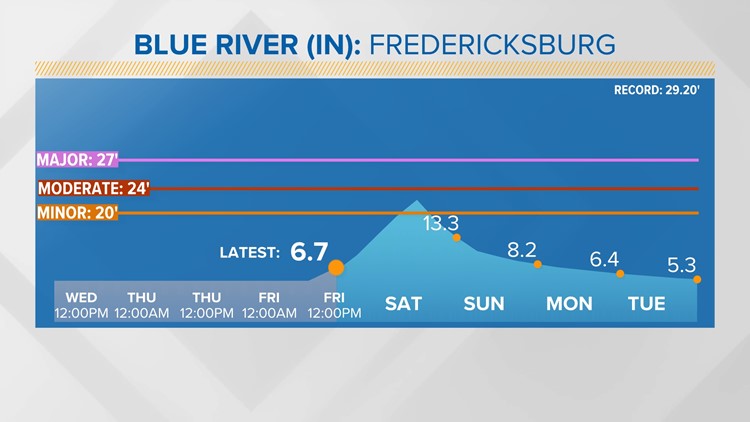
The Blue River in Indiana near Fredericksburg will also experience minor flooding Saturday but quickly recede into Sunday.
Tips to help keep you and your family safe if flash flooding occurs:
- Avoid flooded areas altogether if the water depth is unknown
- Turn around, don't drown! 1-2 ft. of flowing water washes away vehicles
- 6 inches of flowing water will knock you off your feet
- Don't go into flooded basements before ensuring your electricity is off


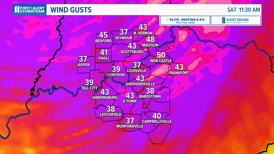
High winds
Wind speeds pick up tonight and, much like our windstorm a few weeks ago, will be strong after rain ends. Expect sustained west-southwesterly winds tomorrow 20-30 mph with gusts between 45-50 mph.

Contact meteorologist Ben Pine at bpine@whas11.com. Follow him on Twitter (@WHAS11Ben) and Facebook.