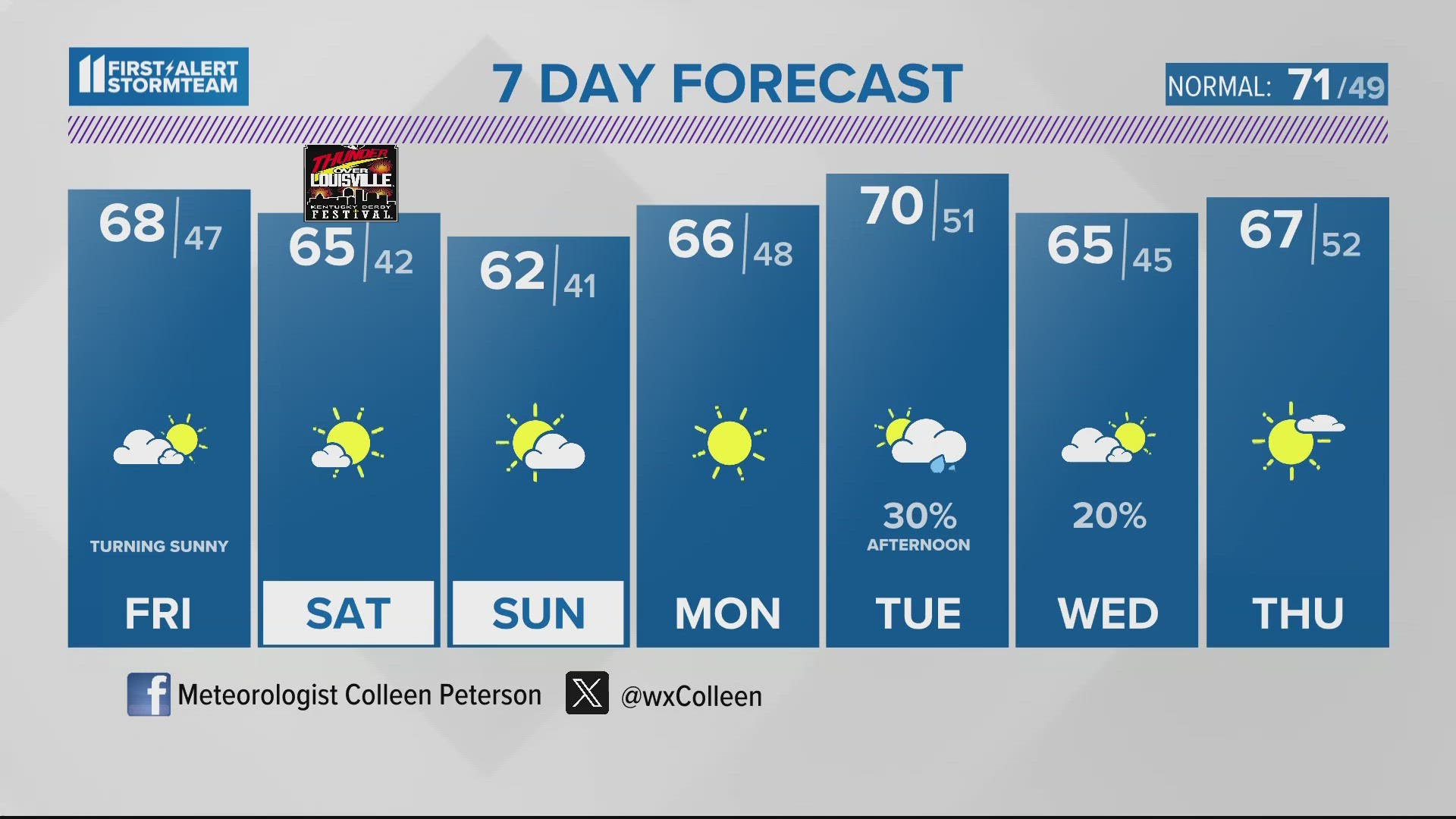
The First Alert StormTeam is tracking an active weather pattern in the early part of February. The potential for rain and snow will be with us at times.
The storm track will be located to the south of a very cold Arctic air mass that will settle into Canada and the far northern United States.
SNOW POSSIBLE THIS EVENING
As a sharp cold front moves through, there will be a transition from rain to snow across the area.
Here is a break down on FutureCast.
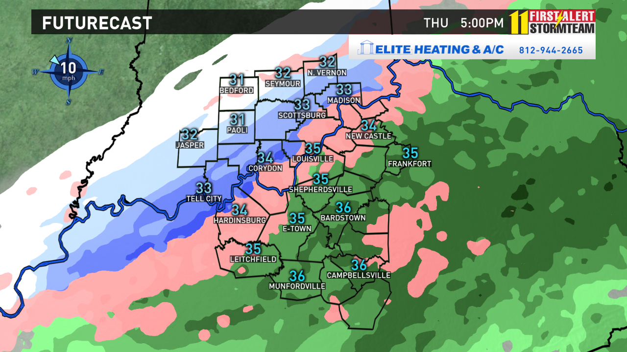
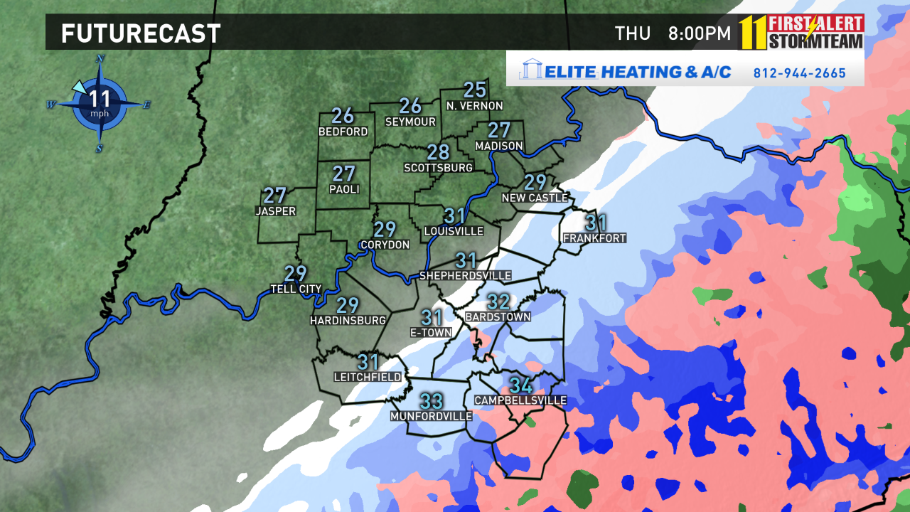
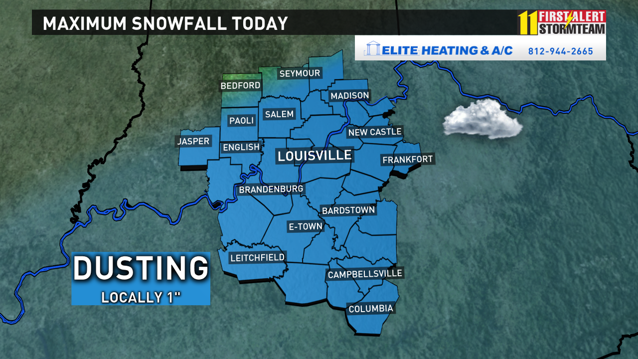
By tonight, a dusting to an inch is possible. There could be a few slick spots.
Very cold air with wind chills in the single digits can be expected first thing Friday!
STORM #2 - SUNDAY
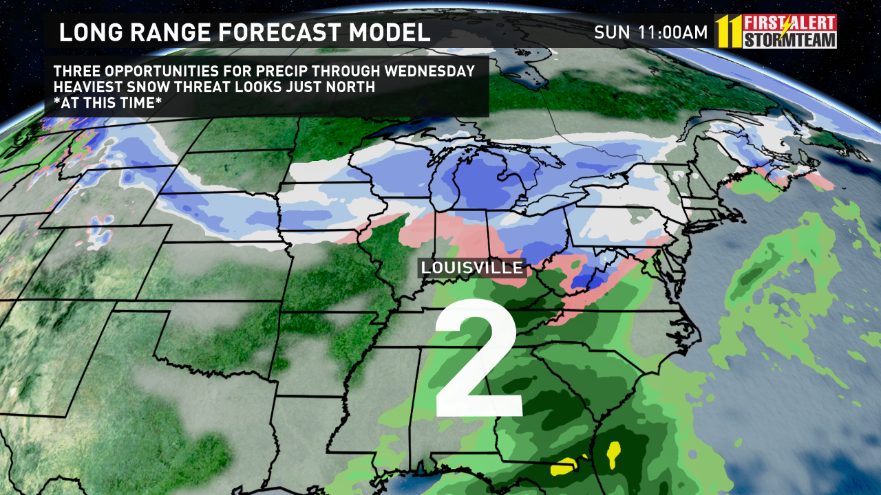
Another weather system will move by the area on Sunday. At this time it looks to start as some snow early Sunday morning before transitioning to drizzle or light rain Sunday afternoon as temperatures warm. More flurries are possible Sunday night as colder air returns for Monday.
STORM #3 - TUESDAY / WEDNESDAY
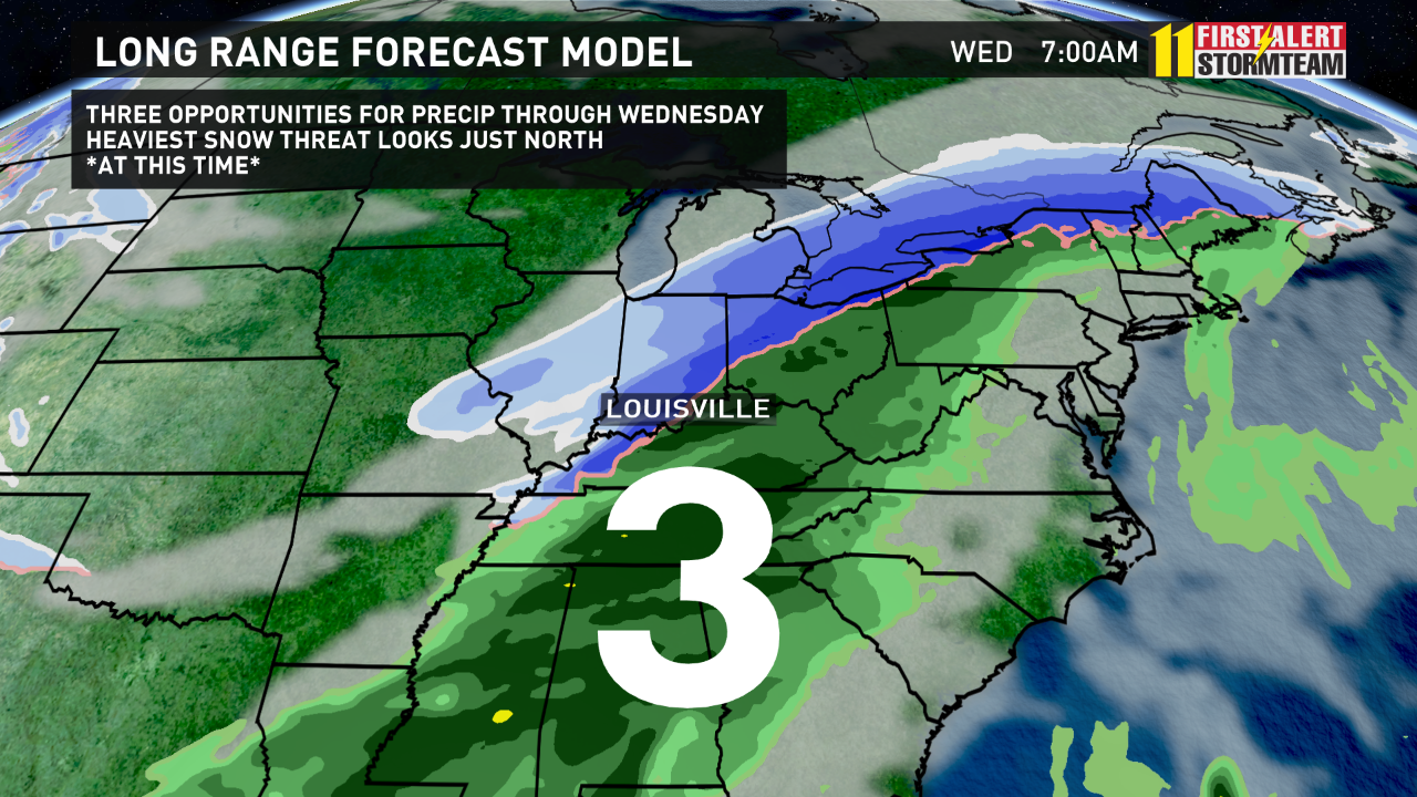
The third storm arrives Tuesday and Wednesday. Details are uncertain but heavy rain and snow will likely accompany the system. The track of the low will be critical in determining precipitation type. At this time, most models are keeping the dominant precip type as rain for much of Kentuckiana with this system, but it will be a close call! We will keep you posted.
Be sure to follow the StormTeam on Facebook and Twitter as we keep you updated on this active forecast!