
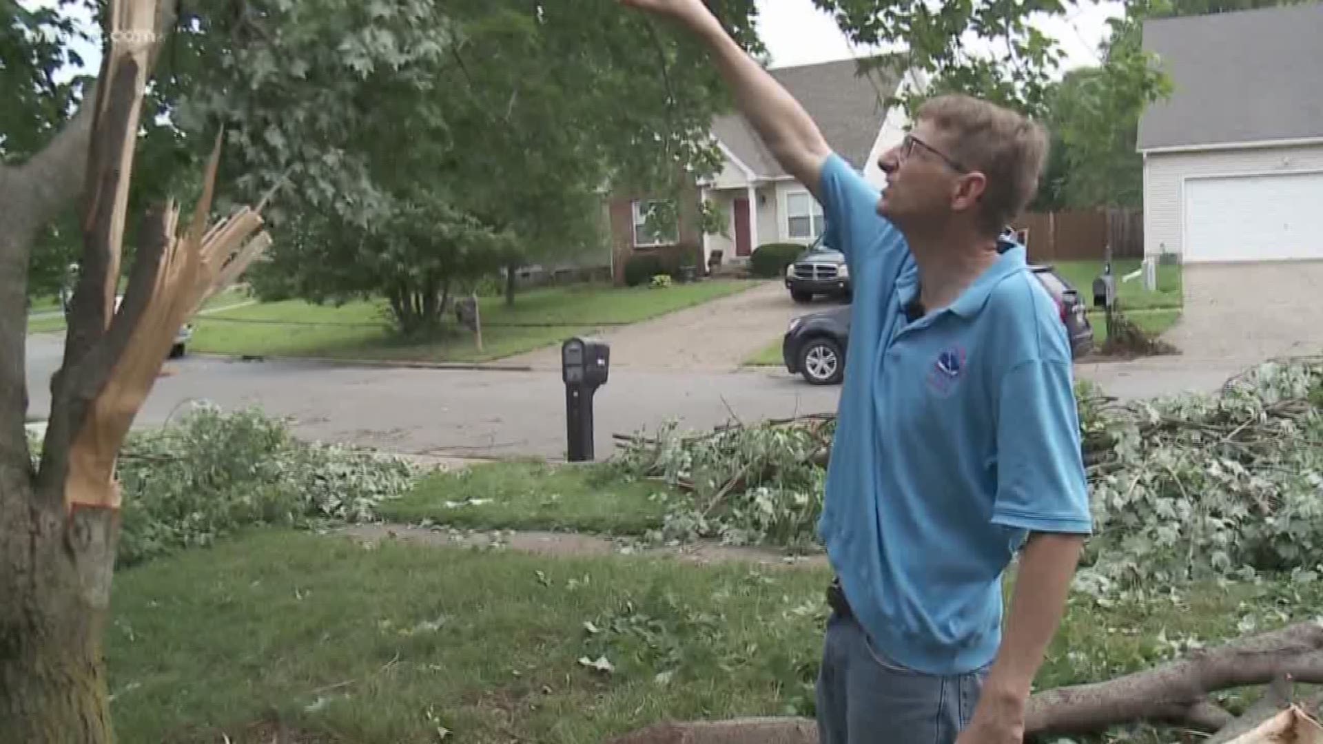
An EF-1 tornado touched down yesterday in far eastern Jefferson County afternoon during a strong line of thunderstorms making their way across Kentuckiana. The rotation was detected shortly after 1:00 P.M. Tuesday afternoon near the Crestwood neighborhood.
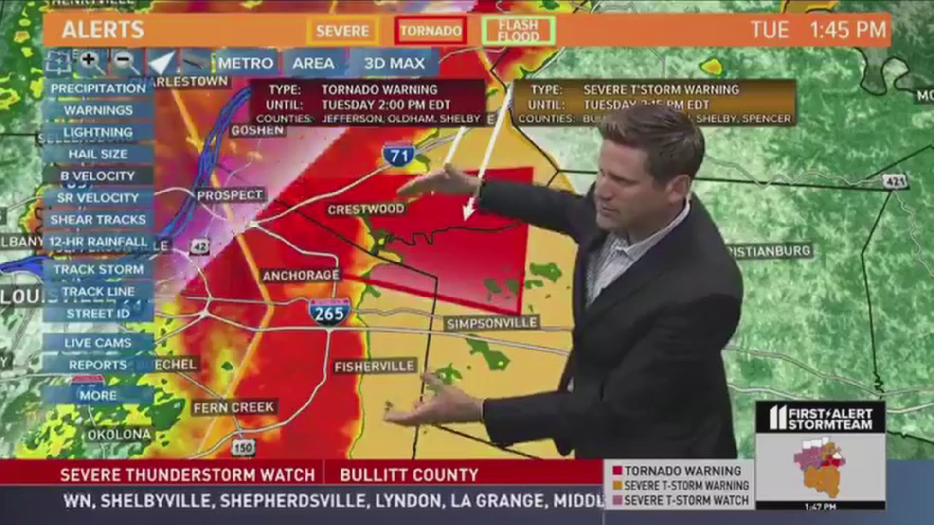
The National Weather Service surveyed damage in the Worthington Hills neighborhood between Westport Rd and Highway 22 and determined the storm reached wind speeds up to 88 mph. Tree limbs were snapped and some homes and buildings sustained structural damage.
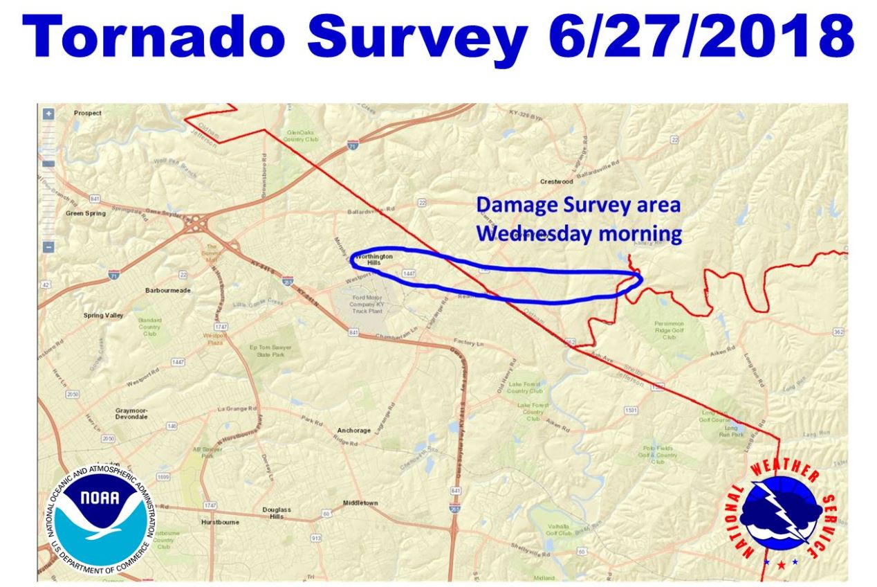
The Weather Service will continue to survey damaged areas throughout the day on Wednesday. Our last recorded tornado in metro Louisville occurred on January 30, 2013. That EF-0 storm touched down in Elizabeth, Indiana and crossed the Ohio River into the Shively neighborhood where it left a 2.8 mile long path of destruction. The tornado damaged barns and homes and knocked down trees.
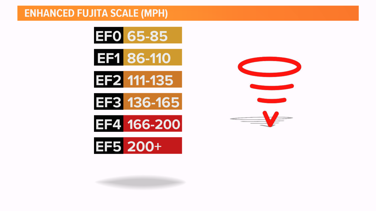
The scale for measuring tornados is the Enhanced Fujita Scale and is based on damage sustained to an area once a tornado touches down. Damage is surveyed by the National Weather Service and they classify the tornado based on what they believe were the sustained winds within the storm.
For the latest weather updates anytime, follow the WHAS11 Storm Team on social media.
Chief Meteorologist Ben Pine:
Facebook: Facebook.com/MeteorologistBenPine
Twitter: @WHAS11Ben
Instagram: @whas11pine
Meteorologist Jared Heil
Facebook: Facebook.com/wxjaredheil
Twitter: @WHAS11Jared
Meteorologist T.G. Shuck
Facebook: Facebook.com/tgshuck
Twitter: @TGweather
Meteorologist Kaitlynn Fish
Facebook: Facebook.com/WXkaitlynnfish
Twitter: @kaitlynnfish
Instagram: @kaitlynnfishwx
Meteorologist Reed Yadon
Facebook: Facebook.com/reedyadon
Twitter: @whas11reed