


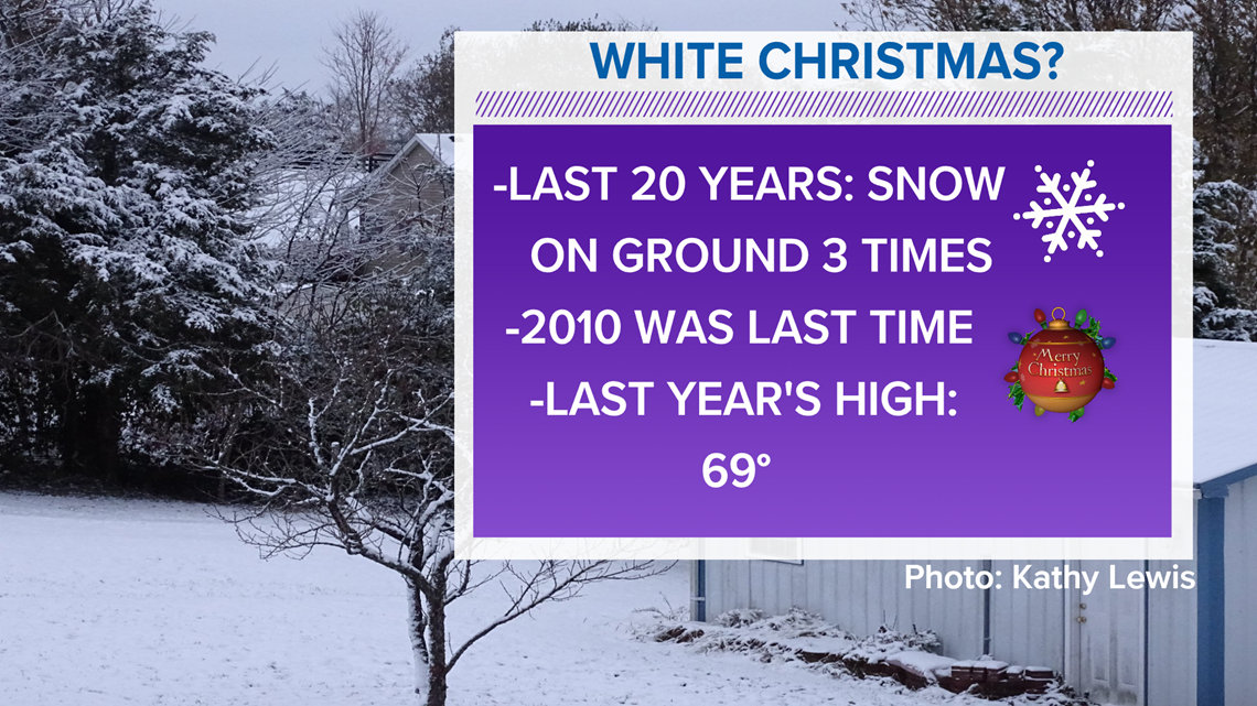
Happy holidays and of course the burning question the last several days (and every year at this time for that matter) is will we have a white Christmas? While it isn’t likely for the majority of our area, there is the potential we could see some festive flakes and a light coating in spots on Christmas Day.
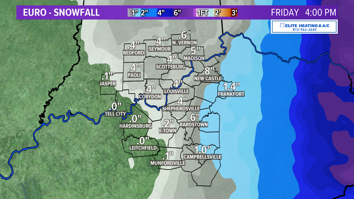
As the main system comes through Wednesday night and into Christmas Eve morning, it is looking more and more like the best moisture will be out of our area before the cold air arrives. The I-75 corridor from Lexington and points east have the best chance of laying some snow on the ground Christmas Eve and with the cold air crashing in, it would hang around into Christmas Day.

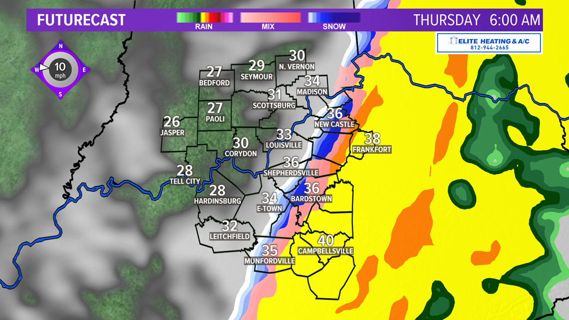

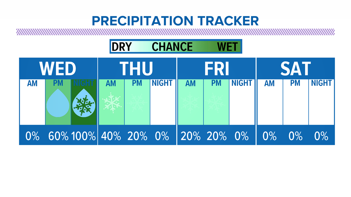
It now looks like our best shot will be from some upper level energy and moisture that should rotate through the region on Christmas Day, so we could totally see a few snowflakes flying around to make it look festive. Keep in mind when temperatures are as cold as they are going to be (teens and 20s), it doesn’t take a bunch of moisture to lay a light coating on the ground. Some of the model data is beginning to pick up on that idea today so that’s definitely promising.

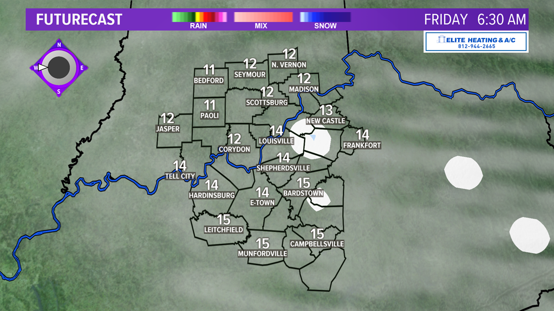

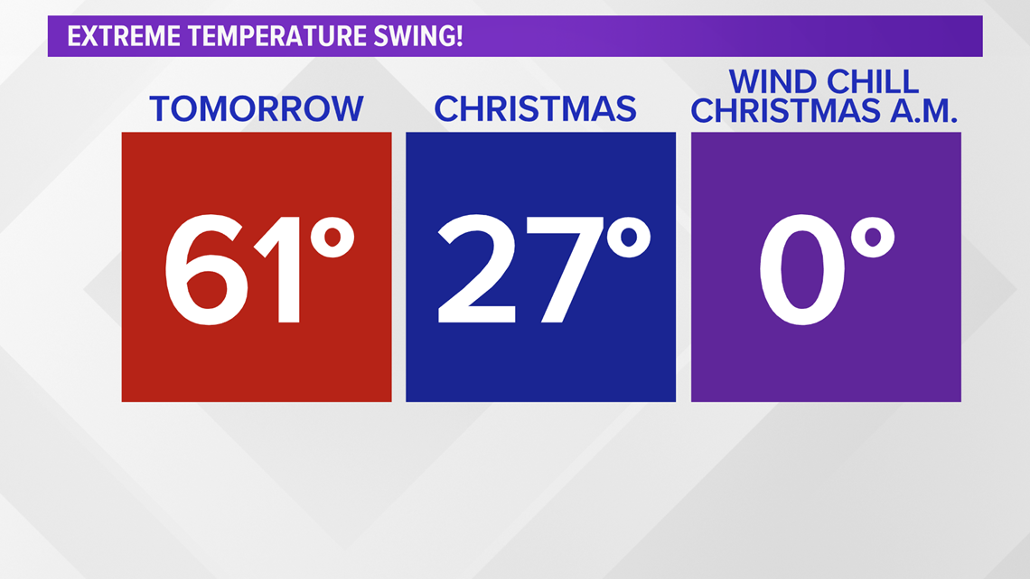
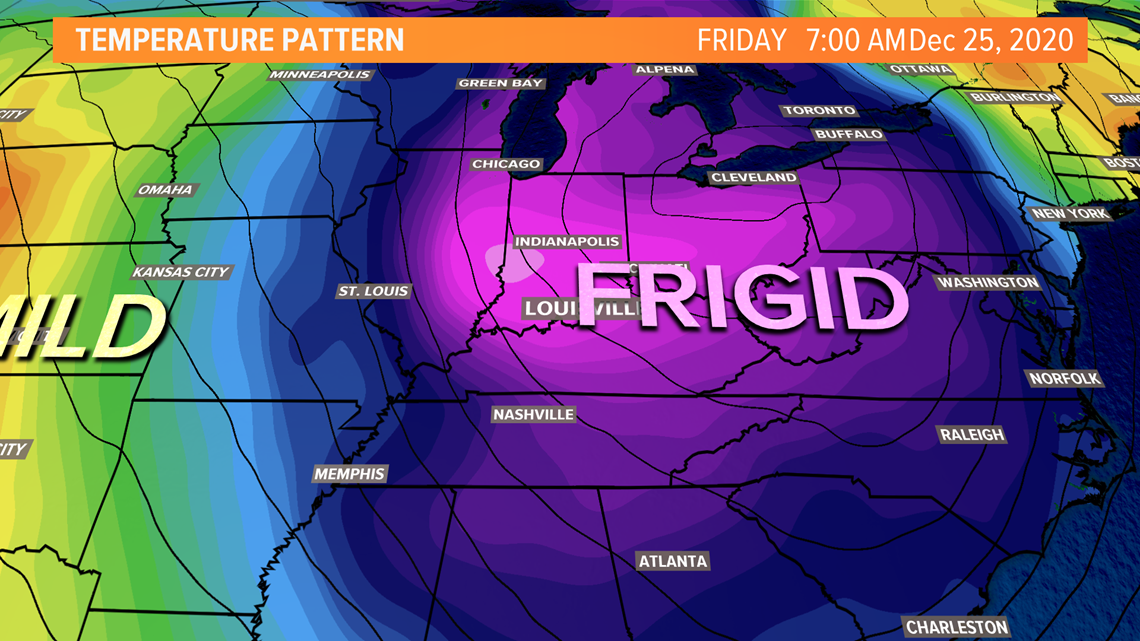
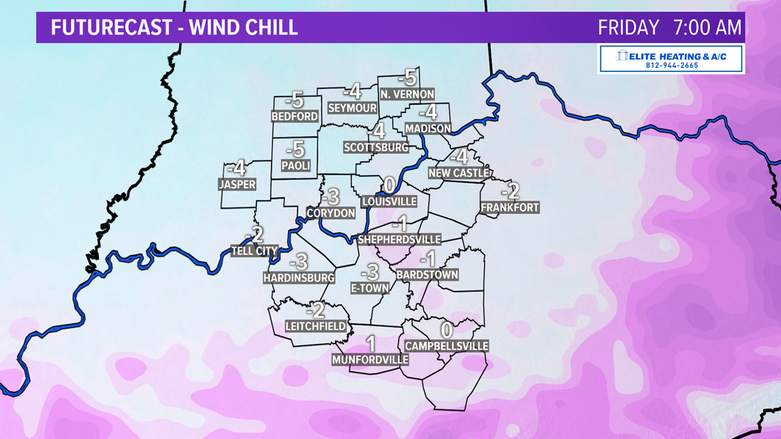
Of course, the other big story is the coldest air of the season arriving for Christmas Eve and Christmas Day. We should wake up Christmas morning with temperatures in the teens and only recover into the mid-20s, especially if we have more clouds around with the snow showers. Adding to the bone chilling cold with be a brisk wind, which could knock our “feel-like” temperatures down into the lower single digits or even below zero for a short spell on Christmas morning. Brrr!


Here’s a look at a few stats relative to a white Christmas here in Louisville over the last 20 years. Stay with the WHAS11 First Alert StormTeam this week for updates.

Meteorologist T.G. Shuck