
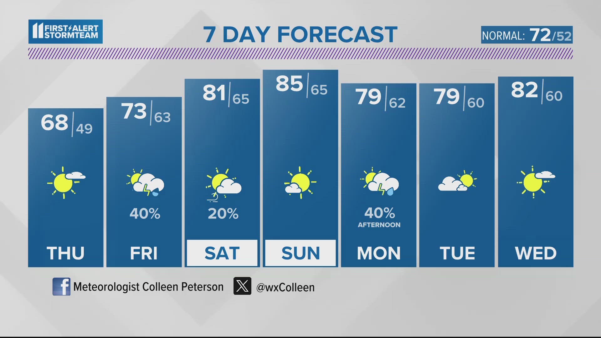
LOUISVILLE, Ky. — Last night's rain was not much but it made for much needed moisture after a fairly dry start to the year. Luckily, April has brought on above normal rainfall to Kentuckiana. As we take you into today and tomorrow there will be no rainfall found anywhere near our area. High temperatures will peak in the middle to upper 60s both afternoons. Today's wind will be light out of the north while tomorrow's breeze will be light out of the east. The only short-term issue will be a rather chilly night tonight! Low temperatures will dip into the upper 30s outside of Louisville with several low 40s found in the city.
There are numerous events going on this weekend with several of them involving the Kentucky Derby Festival. Luckily, our weather forecast is keeping us fairly quiet for the Derby City's busiest time of the year! High temperatures will clock well into the upper 70s and 80s through the weekend with Sunday being the warmest day. The only real chance for isolated showers and storms will come into play late Friday afternoon and evening. Severe weather chances remain very low.
Next week marks the end of April and the week leading into the 150th Kentucky Derby! All signs from our forecast computer models keep us warm leading into the week of Derby. Shower and storm wise, we expect the next round to arrive from the west late in the afternoon Monday and extending into Tuesday morning. Plan on scattered showers and storms at that time.
Download the free WHAS11 app for the latest weather alerts from the First Alert StormTeam. For Apple or Android users.
TODAY: Comfortable with a few passing clouds and a sunny sky. High: 69°. Wind: N 5-15 mph.
TONIGHT: Clear and chilly. Low: 41°. Wind: NE 5-10 mph.
TOMORROW: Sunshine and a few afternoon clouds. High: 68°. Wind: NE 5-10 mph.
LIVE RADAR
Related video
More from the First Alert StormTeam


Follow the First Alert StormTeam on social media.
DOWNLOAD THE WHAS11 APP:
Download the free WHAS11 app for the latest weather alerts from the First Alert StormTeam. For Apple or Android users.
JOIN THE CLOUD WATCHERS FACEBOOK GROUP:
Interested in photography? Join nearly 8,000 residents from Kentucky and southern Indiana and share your weather photos. Click here to join the group!